






Executive Overview
Yellowstone National Park remains an undisputed titan of the American landscape. Spanning the rugged frontiers of Wyoming, Montana, and Idaho, America’s first national park continues to command staggering visitor volume, drawing roughly 4.8 million visitors in 2025 alone. Recognized by U.S. News as the nation’s premier national park for 2026, the 2.2-acre biosphere is a global magnet for naturalists, photographers, and outdoor adventurers. Its hydrothermal features, megafauna populations, and dramatic canyons have cemented its legacy as an ecological masterpiece.
Yet, this gravitational pull often creates a narrow tunnel vision among travelers. Millions of visitors crowd the main park loops, missing the sprawling, equally dramatic ecosystems that unfurl just beyond its official boundaries. The Greater Yellowstone Ecosystem (GYE) and its adjoining territories do not stop at park gates; rather, they bleed outward into lesser-known state parks, national wildlife refuges, volcanic monuments, and hidden basins that offer fraction-of-the-crowd access to raw wilderness.
This investigative travel feature explores the remarkable array of parks and natural attractions situated just outside Yellowstone’s fringes. From a subterranean river vanishing act in Wyoming to lunar-like lava fields in Idaho and a tragic, earthquake-born lake in Montana, these alternate routes deliver profound natural encounters without the vehicular gridlock and congested boardwalks of the national park core.
Detailed Chronology and Geological Evolution of the Periphery
To understand the diversity of the lands surrounding Yellowstone, one must trace the deep geological history that shaped the tri-state border region. The landscape is a textbook of volcanic activity, tectonic displacement, and glacial carving that occurred over millions of years.
Prehistoric Foundations and Volcanic Legacies
Long before human history took root in the Rocky Mountains, the region was an active crucible of terrestrial forces. Approximately 1.3 million years ago, a massive volcanic cataclysm rocked present-day eastern Idaho, expelling immense volumes of pyroclastic material and leaving behind the hard volcanic basalt sheets that define landmarks like Mesa Falls. As these molten flows cooled and hardened, they created the resilient foundations over which the Henry’s Fork of the Snake River would eventually carve its dramatic drops.
Farther west, tectonic rifting and volcanic outpourings over the last 15,000 years forged the surreal topography of the Craters of the Moon National Monument and Preserve. These jagged basaltic lava fields, cinder cones, and subterranean lava tubes were so geologically faithful to extraterrestrial conditions that NASA deployed Apollo astronauts there in 1969 to train for lunar EVA missions.
Tectonic Shifts and Catastrophic Events
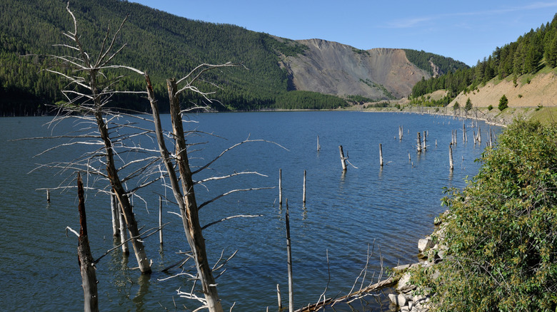
While ancient volcanism shaped much of the regional bedrock, more recent tectonic activity has radically altered human-scale history. A poignant example is Earthquake Lake in Montana. On the night of August 17, 1959, a massive 7.3-magnitude earthquake struck the Hebgen Lake region just north of Yellowstone. The violent tremor triggered a catastrophic mountainside landslide that plummeted into the Madison River canyon, moving millions of tons of rock and soil in seconds.
The landslide formed a natural dam over 200 feet high, completely blocking the river and abruptly giving birth to Earthquake Lake. Today, dead pine trees still jut hauntingly from the water’s surface—a visible, sobering monument to the raw, instantaneous power of tectonic faulting that continues to shape the Greater Yellowstone Ecosystem.
Supporting Context & Metrics: Navigating the Greater Ecosystem
Visitation Pressures and the Shift Toward Perimeter Tourism
The staggering influx of 4.8 million annual visitors to Yellowstone National Park places immense strain on local infrastructure, wildlife corridors, and visitor satisfaction. Traffic jams caused by wildlife sightings ("traffic jams" colloquially known as "bear jams") and packed parking lots at iconic geothermal basins have prompted land management agencies to encourage dispersion into peripheral public lands.
| Attraction | State | Primary Feature | Approximate Distance from Yellowstone Gate | Estimated Annual Crowd Density |
|---|---|---|---|---|
| Sunlight Basin | Wyoming | Alpine meadows, high bridges, gorges | ~30 miles northeast of Cooke City | Extremely Low |
| Boysen State Park | Wyoming | Reservoir recreation, canyon walls | Southeast of Park / Fremont County | Moderate (Regional) |
| Sinks Canyon State Park | Wyoming | Subterranean river, limestone caves | Southeast of Park | Low-Moderate |
| Earthquake Lake | Montana | 1959 landslide lake, interpretive center | 30 minutes northwest of West Yellowstone | Low |
| Red Rock Lakes NWR | Montana | Trumpeter swan sanctuary, wetlands | ~2 hours west of West Yellowstone | Very Low |
| Harriman State Park | Idaho | Historic cattle ranch, fly-fishing waters | South of West Yellowstone | Low-Moderate |
| Mesa Falls | Idaho | Volcanic rock waterfalls (Upper/Lower) | South of West Yellowstone | Moderate |
| Craters of the Moon | Idaho | Lunar lava fields, Dark Sky preserve | Southwest of GYE | Low-Moderate |
Ecological Corridors and Wildlife Conservation
The lands surrounding Yellowstone are not merely scenic backdrops; they serve as critical biological corridors for the GYE’s iconic megafauna.
- Sunlight Basin, Wyoming: Situated in the Absaroka Range, this remote expanse features deep canyons where elk, mule deer, moose, and apex predators such as grizzly bears and black bears roam freely across unfenced public and private lands.
- Red Rock Lakes National Wildlife Refuge, Montana: Encompassing over 60,000 acres of marshlands and prairies in the Centennial Valley, this refuge was established in 1935 specifically to rescue the native trumpeter swan from the brink of extinction. Today, alongside protected waterfowl populations, the refuge supports vital populations of moose, pronghorn, mountain lions, and grizzly bears.
Deep Dive: The Eight Essential Detours
1. Sunlight Basin, Wyoming: Canyons and High-Altitude Vistas
Tucked away in the rugged Absaroka Mountains, Sunlight Basin is widely regarded as one of Wyoming’s best-kept geographic secrets. The area is a tapestry of deep forested canyons, plunging waterfalls, and sweeping alpine meadows.
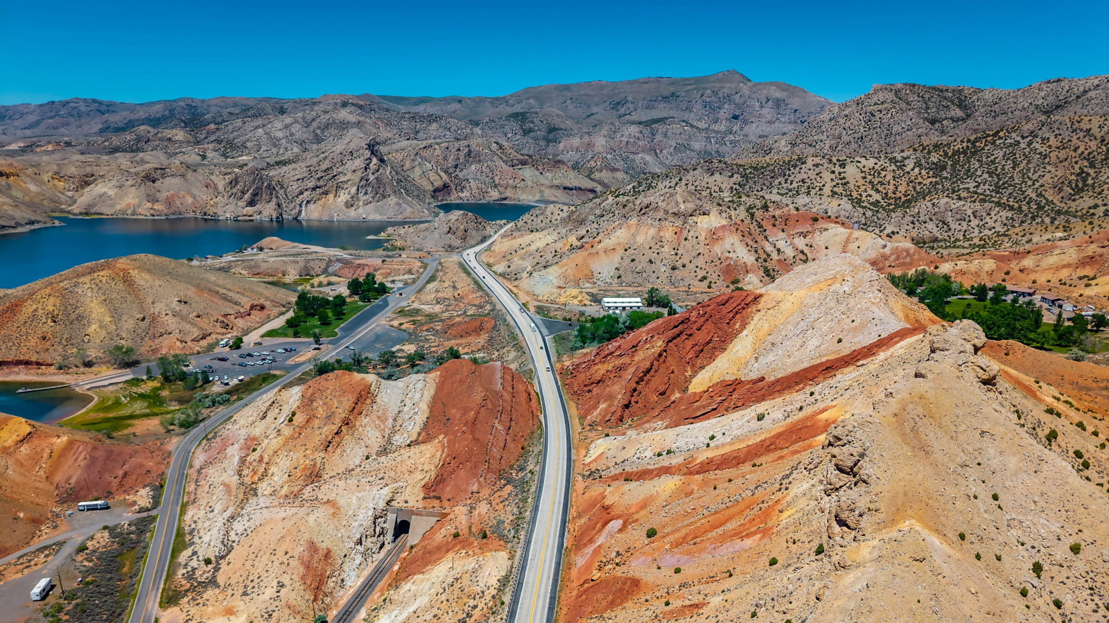
For travelers daring enough to navigate its winding routes, the payoff is immense. The Sunlight Creek Bridge spans the dramatic Sunlight Gorge, holding the title of Wyoming’s highest bridge at 1,200 feet above the canyon floor. A short drive away, the Dead Indian Summit Overlook rewards motorists with an 8,000-foot vantage point, offering panoramic views of the entire basin carved by ancient glaciers. Wildlife watchers frequent the area to spot massive herds of elk and mule deer, while predator researchers monitor robust grizzly populations moving between the Shoshone National Forest and the park proper.
2. Boysen State Park, Wyoming: Water Sports and Canyon Walls
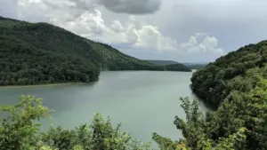
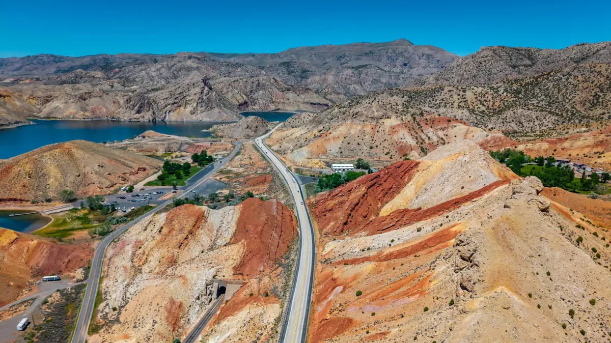
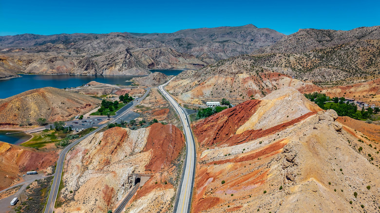
As Wyoming’s largest state park, Boysen State Park spans roughly 35,000 acres in Fremont County, immediately adjacent to the Wind River Indian Reservation. Despite its expansive acreage, the park is remarkably accessible, largely because the man-made Boysen Reservoir covers over half of its total area.
The reservoir provides an aquatic playground for boaters, anglers, and swimmers, framed by sheer limestone canyon walls that date back millions of years. Beyond the water, the park transitions into sagebrush-covered plains and rolling badlands, dotted with developed campgrounds that offer a peaceful respite from the high-altitude chill of the nearby mountains.
3. Sinks Canyon State Park, Wyoming: Nature’s Hydrological Illusion
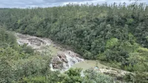
Located along the eastern slope of the Wind River Range near Lander, Sinks Canyon State Park showcases one of hydrology’s most fascinating natural phenomena. Here, the Middle Popo Agie River enters the park as a rushing mountain torrent, only to vanish entirely into a gaping limestone cavern known simply as "The Sinks."
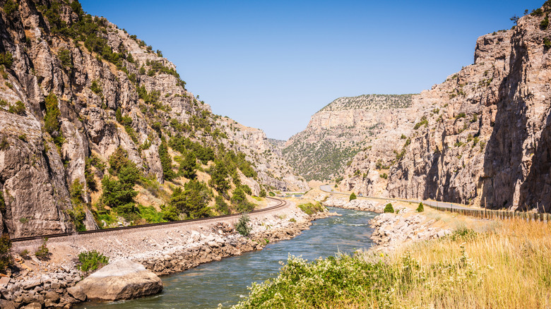
Through a complex subterranean karst plumbing system, the water travels underground for a quarter-mile before reappearing at "The Rise"—a tranquil, crystal-clear pool teeming with massive rainbow trout. Beyond this geological curiosity, the 600-acre park offers world-class rock climbing routes along sheer quartzite cliffs, miles of serene hiking trails, and official Dark Sky designation, making it a premier destination for nocturnal stargazing.
4. Earthquake Lake, Montana: A Monument to Tectonic Power
Lying just 30 miles northwest of West Yellowstone, Earthquake Lake (often called "Quake Lake") tells a dramatic story of sudden, violent geological transformation. Formed during the midnight hours of August 17, 1959, when an earthquake triggered a colossal mountainside collapse, the lake preserves the ghost forest of drowned pine trees whose trunks still pierce the water’s surface.
A dedicated visitor center operated by the U.S. Forest Service offers comprehensive exhibits detailing the seismology and human history of the disaster. Visitors can explore the shoreline via kayak or canoe, absorbing the solemn atmosphere of a landscape permanently scarred by the earth’s restless crust.
5. Red Rock Lakes National Wildlife Refuge, Montana: Sanctuary in the Centennial Valley
For travelers seeking utter solitude, the Red Rock Lakes National Wildlife Refuge offers an untouched wetland ecosystem nestled against the soaring Centennial Mountains. Established in 1935 to save the trumpeter swan—North America’s largest native waterfowl—the refuge has successfully restored the species from a precarious population of fewer than 70 individuals to a thriving regional presence.
Encompassing expansive marshes, willow-choked creeks, and pristine subalpine lakes, the refuge sits roughly two hours west of West Yellowstone. It serves as an undisturbed haven for birdwatchers, botanists, and wildlife photographers who wish to experience the Greater Yellowstone Ecosystem without tour buses or traffic queues.
6. Harriman State Park, Idaho: Historic Ranches and Prime Angling
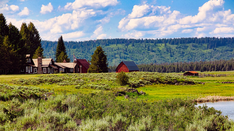
Spanning 11,000 acres within the Silver Creek caldera in Island Park, Idaho, Harriman State Park channels the tranquil beauty of the Yellowstone region without the congestion. The park preserves the historic architecture of the Railroad Ranch, a former summer retreat established by the railroad and copper magnate families, the Harrimans and Guggenheims.
Winding through the heart of the park is an 8-mile stretch of Henry’s Fork of the Snake River, a world-renowned fly-fishing destination. Anglers from across the globe visit these catch-and-release waters to test their skills against wary wild trout, while wildlife enthusiasts spot moose, sandhill cranes, and bald eagles grazing in the verdant meadows.
7. Mesa Falls, Idaho: Volcanic Waterfalls on the Snake River
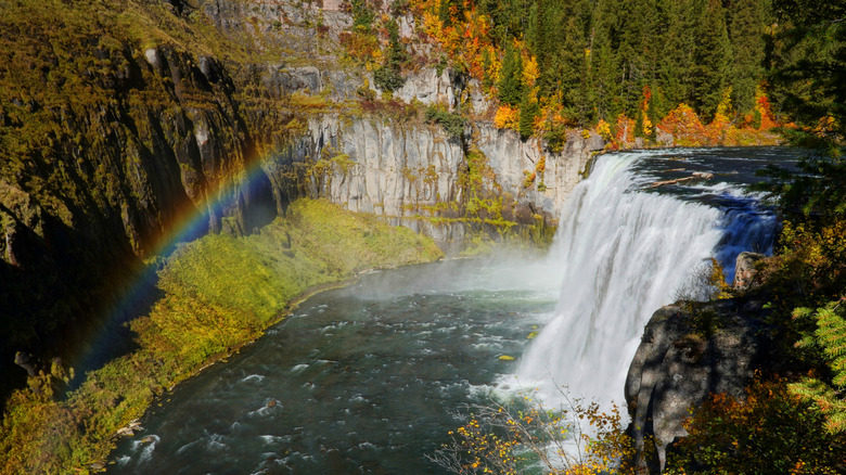
Formed over the remnants of an immense volcanic eruption that occurred 1.3 million years ago, Mesa Falls showcases the raw carving power of the Snake River as it plunges over durable layers of volcanic tuff.
Located along the Mesa Falls Scenic Byway (Idaho Highway 47), the site features two distinct spectacles: Upper Mesa Falls, which drops an impressive 114 feet into a churning mist-filled basin, and Lower Mesa Falls, located a short distance downstream. An accessible boardwalk and interpretive center provide safe, breathtaking viewpoints that rival any waterfall vista found deeper within Yellowstone proper.
8. Craters of the Moon National Monument and Preserve, Idaho: An Extraterrestrial Escape
Completing this regional circuit is Craters of the Moon, a vast ocean of basaltic lava flows that blankets south-central Idaho. Created by a series of volcanic rift eruptions between 15,000 and 2,000 years ago, the landscape features cinder cones, spatter cones, and intricate underground lava tube caves that visitors can explore with proper lighting and permits.
Because its stark, black-rock terrain so closely mimics the lunar surface, the monument served as a geological training ground for NASA astronauts in the late 1960s. By night, its certified Dark Sky status transforms the volcanic horizon into an extraordinary celestial observatory.
Official Statements and Expert Perspectives
Land management and tourism authorities have increasingly emphasized the importance of regional dispersion to protect sensitive habitats inside Yellowstone National Park while supporting sustainable tourism economies in neighboring states.
"The Greater Yellowstone Ecosystem is a vast, interconnected landscape that extends far beyond the park boundaries," notes a regional conservation liaison for the U.S. Forest Service. "When travelers explore state parks, national wildlife refuges, and national monuments in Wyoming, Montana, and Idaho, they alleviate ecological pressure on core bottleneck zones while discovering equally authentic, richly diverse wilderness areas."
Tourism economists echo these sentiments, pointing out that regional diversification spreads economic benefits to rural gateway communities that historically relied solely on short, intense summer spikes in national park visitation.
Future Outlook: Sustainable Exploration on the Horizon
As visitation numbers across America’s public lands remain elevated, the future of travel around Yellowstone National Park lies in dispersal and education. The assumption that world-class wilderness exists solely behind federal park gates is rapidly dissolving.
Travelers are increasingly prioritizing regenerative tourism—seeking out lesser-known state parks, wildlife refuges, and geological monuments where human footprints are lighter and interactions with nature are more intimate. By turning away from the congested core and venturing into Sunlight Basin, Sinks Canyon, Earthquake Lake, and beyond, visitors not only secure a more peaceful and enriching adventure, but actively contribute to the long-term preservation of the broader ecosystem.