





Executive Overview
Framed by the rugged majesty of the Northern Rockies and skyscraping mountain peaks, Montana is a landscape defined by its staggering abundance of fresh water. While colloquially and geographically understood as a landlocked state, the Treasure State boasts a massive aquatic footprint comprising more than 3,223 officially named lakes and reservoirs, alongside countless uncharted subalpine lakes carved by ancient glaciers and millennia of elemental weathering.
For residents and visiting outdoor enthusiasts alike, water is not merely a scenic backdrop; it is the central artery of the regional lifestyle. Whether navigating technical whitewater or stand-up paddleboarding (SUPing) across the soothing, crystal-clear expanses of the western valleys, access to pristine aquatic environments is woven into the cultural fabric of Montana. Crucially, this access is legally protected. Under the Montana State Constitution, all surface waters belong to the state for the use of its people, establishing a guaranteed public right to recreation.
Drawing from years of technical navigation, seasonal meteorological monitoring, and firsthand exploration across the state’s diverse watersheds, this guide provides an authoritative, curated assessment of Montana’s premier lakes for canoeing, stand-up paddleboarding, and flatwater kayaking. Designed for both the novice paddler and the seasoned expeditioner, this report details the distinct geographical, ecological, and regulatory profiles of six standout bodies of water.
Detailed Chronology & Geological Evolution
To truly understand Montana’s aquatic ecosystems, one must examine the geological forces that shaped them. The state’s current geography is the legacy of the Pleistocene epoch, during which massive continental and alpine ice sheets scoured the valleys, leaving behind deep basins, moraines, and polished bedrock.
The evolutionary timeline of Montana’s iconic lakes underscores a dynamic environment:
- Pleistocene Epoch (2.6 million to 11,700 years ago): Glacial advancement and retreat carve out massive depressions such as the Flathead Valley and the structural trench holding Lake McDonald in what is now Glacier National Park. As glaciers recede, they deposit terminal moraines that act as natural dams, trapping glacial meltwater and forming deep, hyper-clear alpine lakes.
- Pre-Settlement Era: Indigenous peoples, including the Kootenai, Salish, and Blackfeet nations, utilize the waterways and surrounding valleys for sustenance, trade, and cultural stewardship. Landmarks such as Wild Horse Island on Flathead Lake serve as historical grazing and sanctuary sites, reflecting a deep, enduring relationship with the local ecosystem.
- August 17, 1959 (The Hebgen Lake Earthquake): A massive 7.3-magnitude earthquake strikes southwestern Montana at 11:37 PM, triggering a catastrophic landslide of 80 million tons of rock and debris along the Madison River. Moving at speeds exceeding 100 miles per hour, the landslide creates a natural dam that rapidly floods the canyon, birthing Earthquake Lake (Quake Lake) and its iconic "ghost forest" of submerged timber within weeks.
- Modern Era (Late 20th Century to Present): Through legislative acts and constitutional protections, Montana codifies public water access rights. Concurrently, state and federal agencies implement rigorous aquatic invasive species (AIS) protocols, including mandatory watercraft inspection stations, to safeguard these vital watersheds from ecological degradation.
Supporting Context & Metrics: The Six Premier Paddling Destinations
1. Flathead Lake: The All-Day Alpine Excursion
- Key Metric: Over 2,000 square miles of surface water (spanning a massive aquatic basin), 185 miles of shoreline, and recognized as the largest natural freshwater lake west of the Mississippi River in the Lower 48.
- Geographical Profile: Tucked into the northwestern corner of the state, Flathead Lake is an immense body of water split ecologically and scenically. The east shore is dramatically framed by the Mission Mountains and fertile cherry orchards; the mountain shade keeps these waters cooler and offers protection from the intense summer sun. The west shore presents panoramic mountain vistas backed by rolling hills.
- Paddling Experience: Ideal for all-day kayak and canoe expeditions, as well as calm-water SUPing during early morning and late evening windows. However, paddlers must respect local meteorology: Montana weather can shift dramatically within minutes, and Flathead is notorious for sudden high winds and choppy, wind-driven waves.
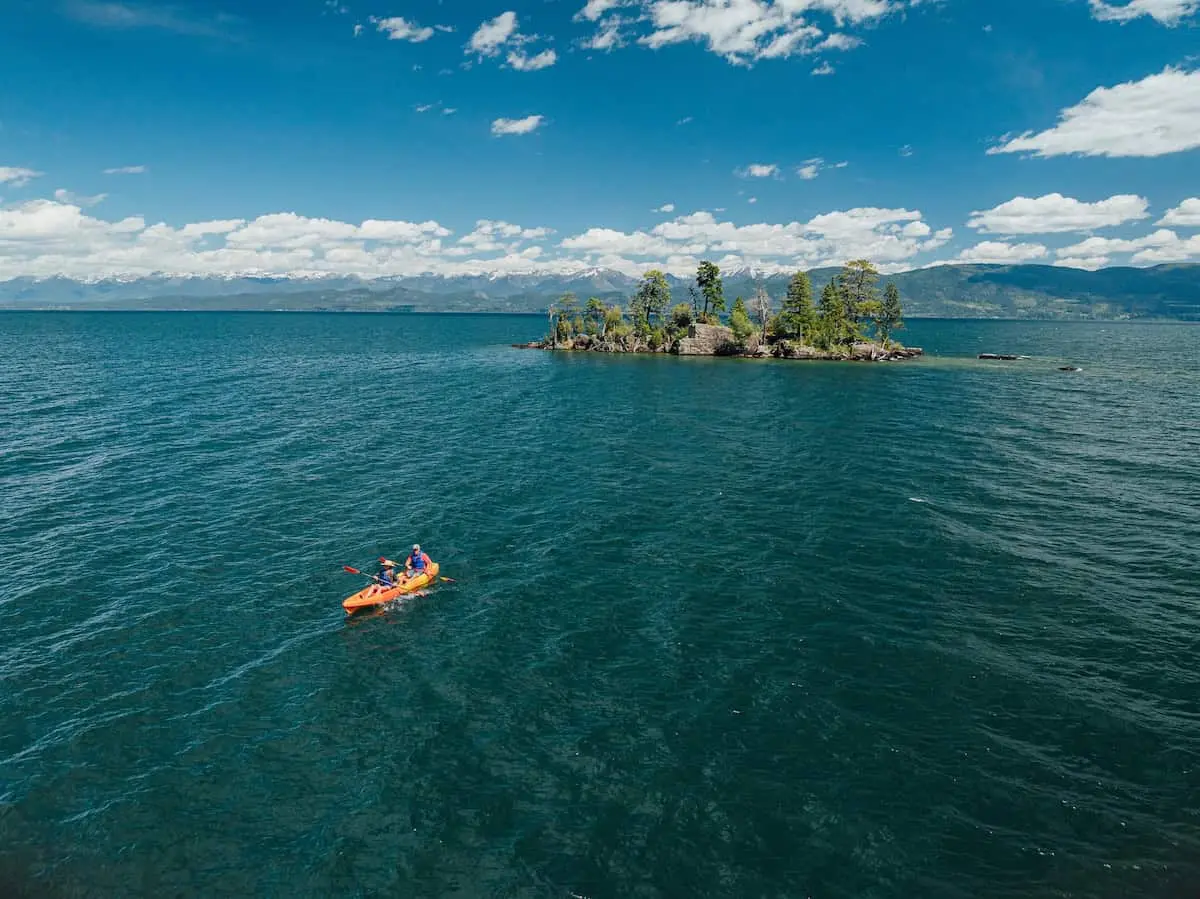
- Highlight Destination: A paddle to Wild Horse Island, a 2,164-acre state park unit. Historically used by the Kootenai and Salish tribes to pasture horses, the island today operates as a protected wildlife sanctuary harboring wild horses, bighorn sheep, mule deer, bald eagles, ospreys, and falcons.
2. Lake McDonald: The Glacial Crown Jewel
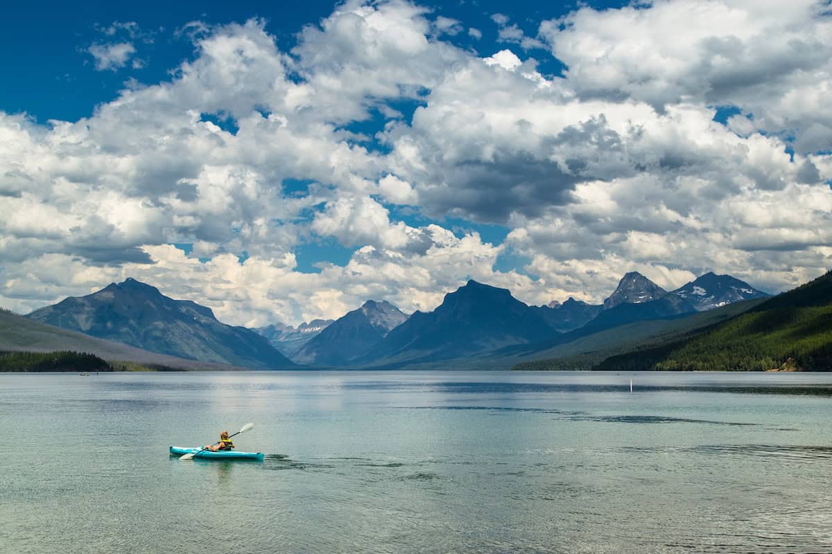
- Key Metric: Stretching across 10 miles of shoreline and plunging to depths exceeding 470 feet, Lake McDonald is the largest lake within Glacier National Park.
- Geographical Profile: Situated immediately adjacent to the West Glacier entrance, Lake McDonald is fed by icy glacial runoff and snowmelt. This ultra-pure water yields staggering underwater visibility of up to 80 feet. Beneath the surface lie smooth argillite pebbles in vibrant shades of green, blue, red, and purple.
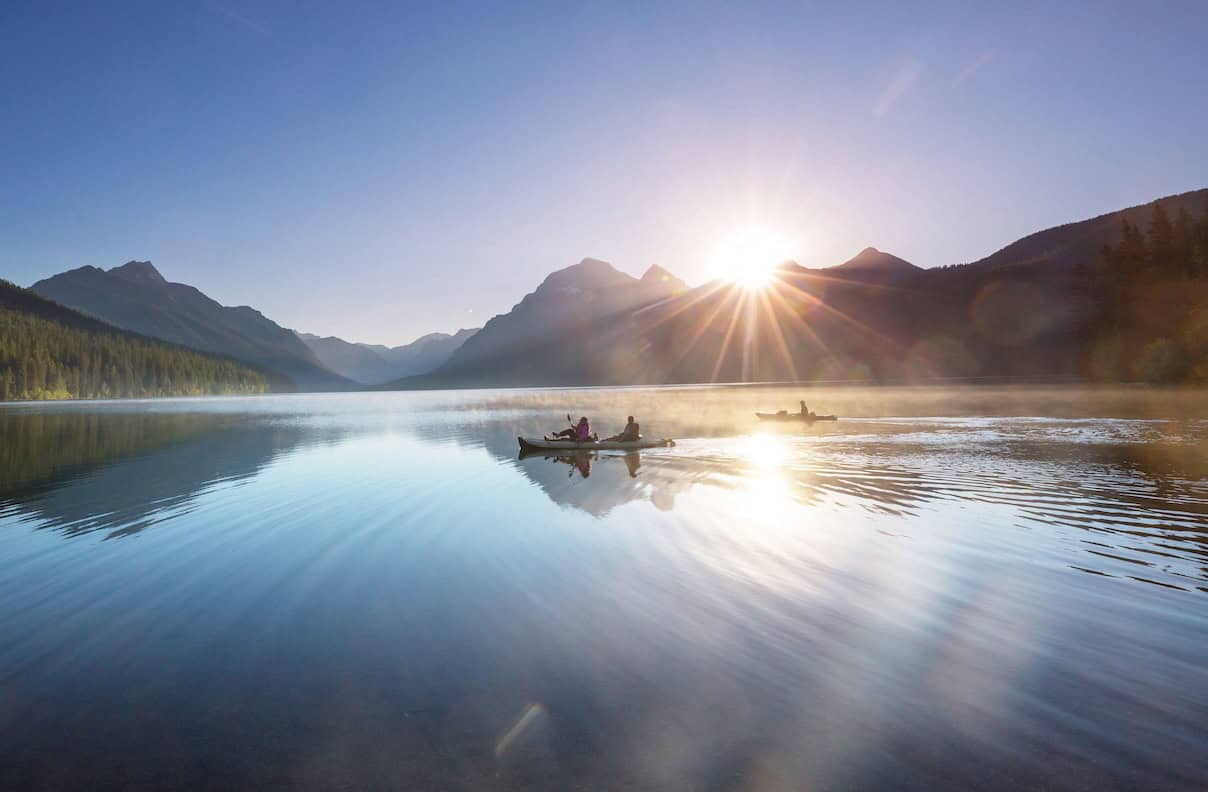
- Paddling Experience: Offers a mirror-like surface on calm days, reflecting the surrounding peaks of Glacier National Park. Early morning excursions provide optimal conditions for spotting local fauna, including bighorn sheep and occasional black or grizzly bears along the tree line.
- Logistics & Infrastructure: Watercraft rentals are available via Apgar Village or the historic Lake McDonald Lodge (constructed in 1913 in the Swiss chalet architectural style). Privately owned vessels must undergo mandatory, free inspections at designated Montana check stations prior to park entry.
3. Whitefish Lake: The Ideal Beginner’s Sanctuary
- Key Metric: Located approximately 40 minutes north of Flathead Lake, nestled at the base of Whitefish Mountain Resort.
- Geographical Profile: Significantly smaller than its southern neighbor, Whitefish Lake is flanked by steep, protective mountains that block prevailing winds, maintaining a remarkably consistent, glassy surface. The lake outflows into the Whitefish River, a lazy 2.5-mile meandering channel flowing directly through the town of Whitefish.
- Paddling Experience: Tailored explicitly for novice paddlers, families, and those seeking low-stress recreational touring. Early morning paddles offer absolute tranquility before motorized boat traffic increases.
- Regulatory Framework: Boat ramps are seasonally locked between October and April. Summer early-morning fishers and launchers must secure an Early Angler Permit for dashboard display. All watercraft—motorized and non-motorized alike—require mandatory AIS inspection prior to launch.
4. Earthquake (Quake Lake): The Seismological Ghost Forest
- Key Metric: Approximately 6 miles long and reaching depths of up to 125 feet along the Madison River valley.
- Geographical Profile: Born out of the catastrophic 1959 earthquake and subsequent massive landslide, Quake Lake stands as a dramatic monument to tectonic power. The rising waters submerged the local timber stands, preserving a haunting, picturesque "ghost forest" of skeletal trees protruding from the surface.
- Paddling Experience: Highly technical and visually striking. Paddlers must navigate carefully, keeping a sharp eye on submerged timber and jagged snags that can easily trap rudders, fins, or puncture inflatable watercraft. Afternoon winds can be fierce and unpredictable; early morning launches are strongly advised.
- Educational Value: Adjacent interpretive exhibits at the Earthquake Lake Visitor Center provide comprehensive scientific data on seismic mechanics and regional tectonic activity.
5. Hyalite Reservoir: The Alpine Trailhead Nexus
- Key Metric: A 206-acre reservoir situated 10 miles up Hyalite Canyon, engineered originally in the 1940s and expanded in 1993.
- Geographical Profile: Framed by dramatic alpine peaks within the Gallatin Mountain Range near Bozeman, Hyalite Reservoir operates under strict no-wake regulations, ensuring flat, tranquil water conditions free from high-speed motorized disruption.
- Paddling Experience: Highly compatible with multi-sport itineraries. Paddlers frequently combine a morning canoe or SUP session on the glassy reservoir with afternoon alpine hiking, such as the accessible 1.1-mile out-and-back trail leading to Palisade Falls.
- Ecological Notes: The reservoir is an established fishery supporting cutthroat trout and Arctic grayling, though anglers must verify catch-and-release restrictions on specific species.
6. Hebgen Lake: The Angler’s Horizon
- Key Metric: Measuring 16 miles long by 4 miles wide, located a mere 10 miles northwest of West Yellowstone.
- Geographical Profile: A large, man-made reservoir offering expansive open-water horizons, situated just 15 minutes from the West Yellowstone park gates.
- Paddling & Angling Synergy: Renowned for world-class fly-fishing populations of large rainbow and brown trout. While mid-summer (July to September) offers warm recreational cruising, the critical window for anglers spans from late May through mid-July during the prolific chironomid insect hatch.
- Amenities: Well-supported by surrounding public campgrounds, including Rainbow Point and Bakers Hole, with sites managed via Recreation.gov.
Official Statements & Regulatory Guidance
The preservation of Montana’s aquatic ecosystems requires strict adherence to state and tribal regulations. Managing agencies emphasize that public access carries a profound responsibility for ecological stewardship.
"Under the Montana Constitution, all surface waters belong to the state for the use of its people, establishing a sacred public trust. However, enjoying this right requires absolute vigilance against aquatic invasive species. Every watercraft—whether a high-end fiberglass kayak or an inflatable paddleboard—must be inspected before entering our pristine watersheds."
— State Wildlife & Fisheries Enforcement Directorate
Furthermore, recreationalists must navigate overlapping jurisdictions. For instance, the southern half of Flathead Lake falls directly within the sovereign boundaries of the Confederated Salish and Kootenai Tribes (CSKT) Flathead Reservation. Visitors utilizing tribal waters are legally mandated to acquire appropriate recreational permits prior to launching.
Future Outlook
As tourism and outdoor recreation rates climb across the Northern Rockies, the management of Montana’s aquatic resources faces complex balancing acts. State agencies, tribal governments, and conservation coalitions are increasingly focusing on sustainable tourism frameworks to protect water quality, manage shoreline congestion, and mitigate the spread of aquatic invasive species (AIS) such as zebra and quagga mussels.
Future management outlooks indicate:
- Expanded Inspection Infrastructure: Increased funding and operational hours for mandatory check stations along major travel corridors (e.g., Highway 287, West Glacier approaches).
- Tribal-State Cooperative Stewardship: Enhanced joint initiatives between the State of Montana and indigenous nations to preserve water quality and cultural heritage sites around shared waterways like Flathead Lake.
- Climate Adaptation Monitoring: Continuous tracking of glacial melt rates impacting alpine lake volumes (such as Lake McDonald) and water temperature shifts affecting native cold-water fisheries like cutthroat trout and Arctic grayling.
By respecting local regulations, wearing properly fitted personal flotation devices (PFDs), monitoring rapidly changing weather patterns, and adhering strictly to Clean, Drain, Dry protocols, paddlers can ensure that Montana’s legendary waterways remain pristine, accessible, and awe-inspiring for generations to come.
For comprehensive statewide clean-boating directives and inspection station maps, consult Clean Drain Dry Montana.