








Executive Overview
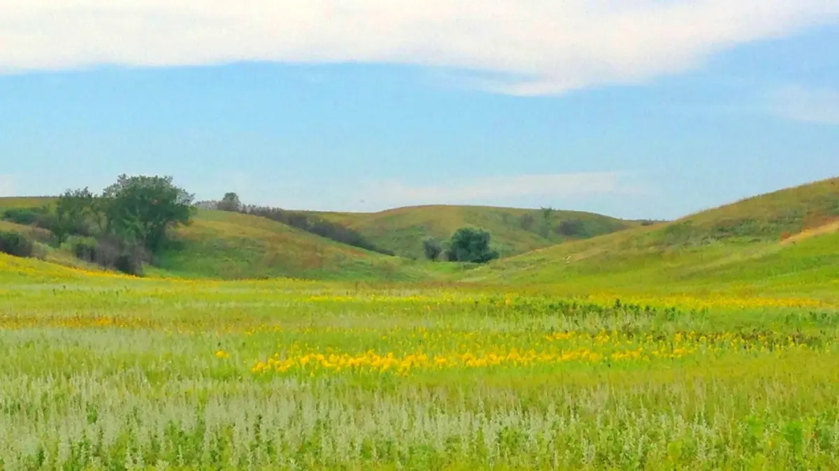
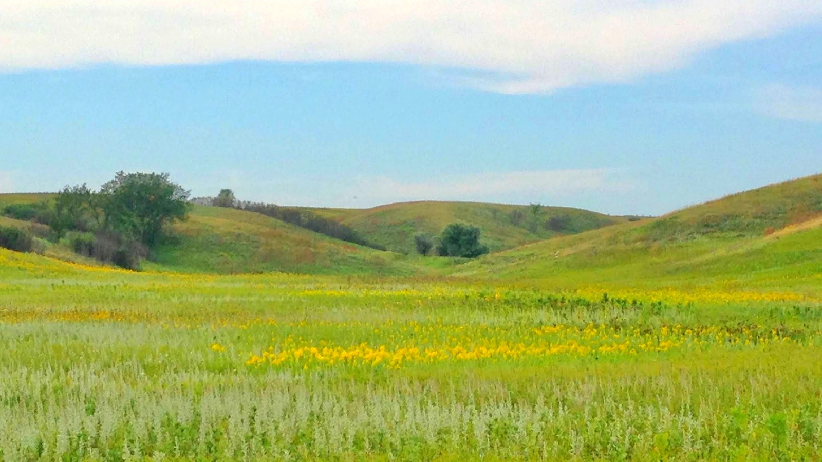
While towering mountain ranges and sprawling coastal beaches frequently dominate the itineraries of modern travelers, a distinct, restorative brand of tranquility exists within the American interior. Far from overcrowded boardwalks and tightly scheduled tourist attractions, the boundless open spaces of the Midwest offer an unfiltered connection to the natural world. Here, prairie grasses undulate endlessly across rolling topography under vast skies, white-tailed deer graze unbothered, and native avian species orchestrate complex courtship rituals in absolute isolation.
Situated a mere two-hour drive west of Fargo, North Dakota, the Arrowwood National Wildlife Refuge serves as a premier destination for this restorative escape. Encompassing nearly 16,000 acres of protected grasslands, sweeping wetlands, and the meandering 14-mile corridor of the James River, this ecological sanctuary provides a critical haven for regional biodiversity. Established in the mid-20th century to safeguard the fragile migratory pathways of North American waterfowl, Arrowwood has evolved into a vital biological crossroads.
Hosting upward of 250 documented bird species, the refuge is celebrated globally for its rich populations of migratory waterfowl, resident sharp-tailed grouse, and diverse prairie fauna. Beyond its ecological significance, Arrowwood offers a rare canvas for low-impact outdoor recreation—spanning wildlife photography, seasonal hunting and fishing, vehicular scenic tours, and remote hiking. As urban populations increasingly seek respite from high-stress environments, Arrowwood National Wildlife Refuge stands out as an authoritative model of wildlife preservation harmonizing seamlessly with passive public access.
Detailed Chronology & Historical Development
The ecological tapestry of Arrowwood National Wildlife Refuge is the product of both ancient geological forces and deliberate mid-century conservation policy. Understanding the modern refuge requires examining the timeline that shaped its landscape and institutional governance.
The Geological Genesis: The Prairie Pothole Region
Long before human intervention, the retreat of the Wisconsin glaciation approximately 10,000 to 12,000 years ago sculpted the physiographic foundation of central North Dakota. As colossal ice sheets melted and receded, they left behind irregular depressions across the landscape. These geological formations, universally recognized as "prairie potholes," span five U.S. states and three Canadian provinces.
Within Arrowwood National Wildlife Refuge, these shallow, glacially carved basins collect seasonal snowmelt and precipitation, giving rise to highly productive temporary, seasonal, and semi-permanent wetlands. According to ecological assessments by the National Wildlife Federation, the broader Prairie Pothole Region functions as the "duck factory" of North America, successfully supporting over 50 percent of the continent’s migratory waterfowl populations. The integration of these glacial wetlands with the rolling upland mixed-grass prairies creates an extraordinarily complex ecosystem capable of sustaining exceptional biodiversity.
Establishment and the Dust Bowl Era (1935)
The formal establishment of Arrowwood National Wildlife Refuge in 1935 did not occur in a vacuum; it was forged during one of the most ecologically and economically devastating periods in modern American history: the Dust Bowl.
As severe agricultural mismanagement and prolonged drought ravaged the Great Plains, federal policymakers recognized the catastrophic toll industrial expansion and intensive farming were taking on native ecosystems—particularly migratory bird populations whose wetland habitats were vanishing at an alarming rate. Under the administration of President Franklin D. Roosevelt, the federal government intensified its acquisition and rehabilitation of marginal agricultural lands to restore them to their native state.
Arrowwood was officially designated to protect and manage a critical bottleneck along the Central Flyway. Conservationists quickly realized that by securing the James River corridor—which feeds three primary lakes (Arrowwood, Jim, and Mud Lakes) and an extensive marsh system—the federal government could secure a vital refueling and breeding station for millions of birds navigating the North American continent.
Expansion and Modern Management Milestones
Throughout the latter half of the 20th century, management strategies at Arrowwood transitioned from basic habitat rescue to active, science-based ecological restoration.
- The 1970s–1980s: Refuge biologists implemented controlled burning regimens and managed grazing programs to mimic the historical ecological impact of North American bison and naturally occurring wildfires. These practices prevented the encroachment of woody vegetation and maintained the open, high-quality grassland structure required by ground-nesting prairie birds.
- The 1990s–2000s: Infrastructure enhancements were introduced to balance surging public interest with strict wildlife protection protocols. The construction of dedicated auto tour routes, elevated observation decks, and specialized photography blinds allowed visitors to experience the refuge deeply without disrupting nesting grounds.
- Present Day: Today, Arrowwood operates under the umbrella of the U.S. Fish and Wildlife Service (USFWS) as part of the overarching National Wildlife Refuge System. Modern priorities emphasize adaptive management in the face of climate variability, invasive species control, and the continuous monitoring of avian health indicators across the Central Flyway.
Supporting Context & Metrics
Evaluating the scale and ecological value of Arrowwood National Wildlife Refuge requires analyzing specific geographic, biological, and infrastructural metrics.
Geographic and Ecological Metrics
- Total Acreage: Spans just under 16,000 acres of protected terrain, encompassing contiguous native mixed-grass prairie, restored grasslands, shrublands, and diverse wetland complexes.
- Hydrological Corridor: Anchored by a 14-mile continuous stretch of the James River, which directly sustains three major water bodies—Arrowwood Lake, Jim Lake, and Mud Lake—alongside expansive marshland habitats.
- Avian Diversity: Over 250 distinct bird species have been formally documented within the refuge boundaries since official record-keeping began, highlighting its role as a premier migratory crossroads.
- Waterfowl Productivity: As a vital component of the Prairie Pothole Region, the refuge contributes directly to the regional metric wherein the broader ecosystem supports more than 50% of North America’s total migratory waterfowl production.
Recreational and Logistical Metrics
- Proximity to Urban Centers: Located approximately two hours (roughly 110 to 120 miles) west of Fargo, North Dakota’s largest metropolitan center, making it an accessible day-trip destination.
- Trail Infrastructure: Features immersive recreational routes, notably the 20-mile out-and-back Historic Fort Totten Trail, which offers a moderately challenging trekking experience through open prairie down to Deputy Marsh.
- Vehicular Access: Includes a dedicated 5.5-mile auto tour route equipped with strategic pull-offs and an elevated observation deck overlooking the James River valley.
- Seasonal Lodging Radius: The nearest full-service municipal accommodations and logistical support hubs are situated 30 minutes north in Carrington and 40 minutes south in Jamestown, the latter of which intersects with Interstate 94.
Official Perspectives & Ecological Management
Management of the refuge is governed by strict federal mandates aimed at preserving biological integrity while facilitating compatible wildlife-dependent recreation.
The U.S. Fish and Wildlife Service Mandate
Federal wildlife managers emphasize that Arrowwood is fundamentally a sanctuary for nature, rather than a conventional recreational park. According to USFWS policy guidelines governing the National Wildlife Refuge System, any human activity permitted within the boundaries—including hunting, fishing, wildlife observation, and environmental education—must undergo rigorous "compatibility determinations."
In official statements regarding refuge management, senior biologists routinely underscore the fragility of ground-nesting bird populations during peak breeding cycles. Unregulated human foot traffic outside of designated trails can inadvertently flush nesting females from their clutches, exposing vulnerable eggs and hatchlings to avian predators and thermal stress. Consequently, strict seasonal closures and access limitations are enforced to protect sensitive species, particularly during the intense spring breeding windows.
Avian Behavioral Insights: The Sharp-Tailed Grouse
Among the primary focal points of scientific study and public fascination at Arrowwood are the resident sharp-tailed grouse (Tympanuchus phasianellus). Ornithological monitoring programs track the annual lekking behaviors of these remarkable birds.
Every spring, male sharp-tailed grouse gather on traditional communal courting grounds known as leks. During these elaborate dawn rituals, the males rapidly stamp their feet, inflate purple air sacs on their necks, erect their tail feathers, and emit low-frequency cooing sounds to establish dominance and attract prospective mates.
Refuge officials actively support wildlife photography and natural history interpretation through the maintenance of specialized, reservation-only photo blinds positioned near active leks. These enclosures allow researchers and wildlife enthusiasts to observe intimate behavioral dynamics without altering natural avian routines.
Future Outlook: Conservation Challenges & Visitor Guidance
As Arrowwood National Wildlife Refuge looks toward the decades ahead, its stewards face complex environmental and logistical realities.
Ecological Challenges on the Horizon
- Climate Variability and Hydrological Shifts: The health of Arrowwood’s wetland complexes depends heavily on seasonal snowpacks and precipitation patterns within the Prairie Pothole Region. Extended drought cycles can cause temporary potholes to dry prematurely, reducing available breeding habitat for waterfowl and altering aquatic food webs along the James River corridor.
- Invasive Plant Species: The ongoing threat of aggressive non-native flora—such as leafy spurge, smooth brome, and Canada thistle—undermines native prairie biodiversity. Refuge staff continuously deploy integrated pest management strategies, combining targeted biological controls, managed grazing, and controlled burns to protect native plant communities.
- Surrounding Land-Use Pressures: The conversion of adjacent native grasslands into intensive row-crop agriculture fragments the broader ecosystem. Maintaining wildlife corridors that connect Arrowwood to surrounding state and federal conservation easements is vital to ensuring that resident and migratory species maintain genetic diversity and safe movement pathways.
Navigating Your Visit: Practical Recommendations
For travelers planning an excursion to this North Dakota sanctuary, strategic preparation ensures both a rewarding experience and minimal environmental impact:
- Timing Your Trip: For optimal birdwatching and dramatic wildlife photography, target peak windows in April (to witness the sharp-tailed grouse courtship dances and early waterfowl migration) or October (to experience the massive influx of southward-migrating ducks, geese, and cranes).
- Exploration Options: Visitors pressed for time can utilize the 5.5-mile auto tour route, which provides sweeping vistas of the James River from the comfort of a vehicle. Those seeking physical engagement can hike segments of the Historic Fort Totten Trail, keeping in mind that weather conditions can change rapidly across the open plains.
- Winter Recreation: The refuge remains open year-round. During the colder months, ice fishing is permitted on Arrowwood, Jim, and Mud Lakes. However, travelers should note that the operation of snowmobiles and all-terrain vehicles (ATVs) is strictly prohibited across all refuge lands to safeguard resting wildlife.
- Accommodations and Extended Itineraries: Because lodging options directly adjacent to the refuge are limited, visitors typically base themselves in Carrington to the north or Jamestown to the south. A stop in Jamestown provides access to essential amenities, historical diversions—such as the famous World’s Largest Buffalo Monument—and convenient access to Interstate 94, completing a well-rounded journey through North Dakota’s scenic heartland.