








Executive Overview
At first glance, the landscape of Indiana is frequently dismissed as a homogenous expanse of flat Midwestern farmland and modest, rolling hills. However, beneath this agricultural veneer lies a dramatic geological secret. Located less than an hour and a half west of Indianapolis, Turkey Run State Park shatters all preconceived notions of Indiana’s topography. Featuring moss-covered gorges, towering sandstone ravines, old-growth forests, and vibrant wildflower carpets flanking rushing waterways, this park earns its moniker as the "Grand Canyon of the Midwest."
While a drive in through the surrounding cornfields might fool the uninitiated, deep within the park’s protected borders lie breathtaking stone hollows carved by ancient glacial meltwaters and millennia of erosion. Managed by the Indiana Department of Natural Resources (DNR), Turkey Run is widely considered the crown jewel of the state’s park system. Its intricate network of numbered nature trails ranges from leisurely historical strolls to rugged climbs requiring vertical ladders and nimble footing.
To experience the park fully, visitors must traverse a pedestrian-only suspension bridge over the scenic Sugar Creek. Because the park’s trails intricately intersect, planning an itinerary can be daunting. Drawing from comprehensive visitor reviews, ecological data, and firsthand exploration, this guide breaks down the seven most scenic nature trails in Turkey Run State Park. Whether you are seeking high-adrenaline ladder climbs, peaceful photography spots, or deep dives into Midwestern pioneer history, these seven trails offer an unforgettable experience across every season of the year.
Detailed Chronology & Historical Context: Preserving the Wilderness
The breathtaking landscapes of Turkey Run are not merely natural wonders; they are the result of a deliberate, hard-fought conservation movement that birthed Indiana’s modern state park system. Understanding the historical framework of the park adds a profound layer of appreciation when hiking trails that weave past historic structures and memorials.
The Dawn of Indiana State Parks (1916)
In the early 20th century, rapid industrialization and unchecked timber harvesting threatened to obliterate Indiana’s most precious natural sanctuaries. Enter Colonel Richard Lieber, a German-born conservationist widely recognized as the "father of Indiana’s state parks." Lieber worked tirelessly to raise public funds, build grassroots support, and lobby the state legislature to purchase and protect endangered wilderness areas.
While McCormick’s Creek officially opened as Indiana’s oldest state park in 1916, Turkey Run quickly followed suit later that same year, secured largely through the efforts of conservationists who recognized the urgent need to protect its ancient forests from commercial lumber companies. Colonel Lieber’s dedication to the park was so absolute that, upon his passing, he requested his final resting place be within the borders of Turkey Run State Park, cementing an eternal bond between the man and the land.
Architectural and Cultural Milestones
As visitors navigate the trails today, they encounter structures that bear silent witness to the region’s pioneer past. The Narrows Covered Bridge, constructed in 1882 by J.J. Daniels, stands as a masterclass in 19th-century engineering, spanning Sugar Creek and serving as an aesthetic anchor for the park’s eastern trailheads. Nearby, historical homesteads like the Lusk Home and remnants of early industrial ventures—such as historical coal mines—provide hikers with a tangible connection to the settlers who first carved out a living in these rugged river valleys.
The Magnificent Seven: A Deep Dive into Turkey Run’s Premier Trails
Trail 3: Ice Box, Bear Hollow, Rocky Hollow, and Wedge Rock
- Distance: 1.7 miles
- Difficulty: Very Rugged
- Key Highlights: Bear Hollow, Rocky Hollow, Ice Box ravines, and the iconic vertical ladder climbs.
If there is a singular trail that encapsulates why Turkey Run is dubbed the "Grand Canyon of the Midwest," it is Trail 3. Though modest in length at 1.7 miles, this loop packs an immense punch, guiding hikers through some of the park’s most dramatic sandstone canyons.
The undisputed hallmark—and the source of equal parts excitement and anxiety for visitors—is the series of vertical ladders found within Bear Hollow. Climbers must descend and ascend these wooden ladders to navigate the narrow, vertical clefts of the canyon walls. Reviewers consistently praise the route as "amazing fun," though it requires caution. Because of its rugged topography, hikers should anticipate navigating through mud and occasionally walking directly through running creek water, particularly following periods of heavy Midwestern rainfall.
Trail 2: Gypsy Gulch and Box Canyon
- Distance: 1.0 mile
- Difficulty: Rugged
- Key Highlights: Towering cliff edges, narrow canyon passes, and hyper-vibrant summer forest canopies.
Stretching just 1 mile, Trail 2 hugs the precipitous edges of cliff lines and plunges deep into the heart of Gypsy Gulch and Box Canyon. In the summer months, the trail guides hikers along a tight, winding path enveloped by an outrageously green, dense forest canopy that filters sunlight into emerald hues.
Conversely, winter visits offer an entirely different aesthetic: massive icicles cling precariously to the sandstone overhangs, creating a frozen labyrinth. Regardless of the season, portions of this trail are notoriously slick. Proper footwear—such as sturdy hiking boots—is non-negotiable, and carrying trekking poles or a sturdy wooden walking stick is strongly advised to minimize the risk of slips on wet rock surfaces.
Trail 1: Sunset Point, Goose Rock, and Narrows Covered Bridge
- Distance: 3.0 miles
- Difficulty: Moderate
- Key Highlights: Historic Narrows Covered Bridge, sweeping cliffside vistas at Sunset Point, and old-growth sycamore and walnut trees.
Affectionately known by park rangers as the park’s "big-tree trail," Trail 1 unfurls along the southern banks of Sugar Creek. Spanning 3 miles, this route offers a stark contrast to the tight, claustrophobic canyons of Trails 2 and 3, trading vertical ladders for sprawling arboreal views and historical landmarks.

The trail serves as a connective tissue between two of the park’s most photographed destinations located at its opposite terminals. On the eastern end stands the magnificent Narrows Covered Bridge of 1882, casting mirror-like reflections onto the glassy surface of Sugar Creek. On the western end, hikers reach Sunset Point, a meticulously positioned cliffside vantage point engineered to offer panoramic, unobstructed views of the river valley below as the sun dips beneath the horizon.
Trail 4: Punch Bowl, Lusk Home, Narrows, and Coal Mine
- Distance: 2.0 miles
- Difficulty: Moderately Rugged
- Key Highlights: The tranquil Punch Bowl waterfall, historical Lusk Home, and early mining remnants.
For those looking to seamlessly blend natural geological wonders with pioneer history, Trail 4 is the definitive choice. This 2-mile loop leads hikers past the historic Lusk Home and early coal mine sites near the Narrows Covered Bridge. While interior access to the historic structures is restricted, informative plaques provide rich context regarding the pioneers who once inhabited the region.
Continuing along the loop brings hikers to the Punch Bowl, a geological marvel where a low, cascading waterfall drops gently into a circular pool. Over millennia, the swirling water has carved out a smooth, amphitheater-like hollow in the surrounding sandstone, making it a premier photography destination within the park.
Trail 5: The 140 Steps
- Distance: 0.7 miles (excluding connector trails)
- Difficulty: Rugged
- Key Highlights: Spring wildflower blooms, water-level canyon approaches, and the infamous 140-step staircase.
Measuring just 0.7 miles, Trail 5 packs a tremendous physical workout into a short distance. In the spring, the wooded floor of this trail erupts into a vibrant carpet of native wildflowers, most notably delicate bluebells that blanket the damp soil.
The trail is infamous across Indiana for its grueling staircase of 140 steps. Savvy hikers often recommend tackling this loop in a clockwise direction, which converts the grueling climb into a downward descent, depositing hikers neatly at the junction where Trail 3 drops into Bear Hollow. Because reaching Trail 5 requires crossing the central suspension bridge and hiking a portion of Trail 3, visitors should factor in additional mileage when calculating their total trek.
Trail 9: Boulder Canyon and Falls Canyon
- Distance: 1.0 mile
- Difficulty: Extremely Rugged
- Key Highlights: Virgin timber stands, Boulder Canyon, Falls Canyon, and winter ice waterfalls.
The official Indiana DNR trail guide describes Trail 9 with a blunt and accurate warning: "The best trail to see virgin wood is also the most rugged. Be careful." Spanning 1 mile, this path is not for the faint of heart.

To access Trail 9, hikers must cross the Sugar Creek suspension bridge, turn left, and navigate segments of Trails 3 and 5. Once reached, the trail rewards efforts with untouched, old-growth forest ecosystems that represent what Indiana looked like before European settlement. Boulder Canyon and Falls Canyon present massive rock formations and jumbled boulders that hikers must scramble over to reach the upper ridge. In the dead of winter, Boulder Canyon transforms into a wonderland featuring a towering frozen waterfall that draws dedicated nature photographers from across the Midwest.
Trail 11: Lieber Memorial and Log Church
- Distance: 0.5 miles
- Difficulty: Easy
- Key Highlights: Lieber Memorial, historic Log Church, and gentle woodland strolls.
For history buffs, conservationists, and visitors seeking a low-impact walk, Trail 11 offers a peaceful respite. Originating near the historic Turkey Run Inn, this gentle 0.5-mile trail winds through quiet woods leading directly to the Lieber Memorial, honoring Colonel Richard Lieber.
Along the path, hikers pass a reconstructed historic log church that vividly highlights the rich cultural and architectural heritage of early Parke County settlers. It serves as a contemplative space to reflect on the preservation efforts that saved this wilderness from destruction.
Supporting Context, Logistics & Metrics
Navigating a rugged park like Turkey Run requires careful logistical planning. Below is a comprehensive data reference table to assist hikers in planning their daily itineraries based on distance, difficulty, and primary features.
| Trail Number | Distance (Miles) | Difficulty Level | Primary Geographical / Historical Features |
|---|---|---|---|
| Trail 1 | 3.0 | Moderate | Narrows Covered Bridge, Sunset Point, old-growth sycamores |
| Trail 2 | 1.0 | Rugged | Gypsy Gulch, Box Canyon, cliff edges, winter icicles |
| Trail 3 | 1.7 | Very Rugged | Bear Hollow, Rocky Hollow, Ice Box, vertical ladders |
| Trail 4 | 2.0 | Moderately Rugged | Punch Bowl waterfall, Lusk Home, historic coal mine |
| Trail 5 | 0.7 | Rugged | The 140 Steps, spring bluebells, ravine approaches |
| Trail 9 | 1.0 | Extremely Rugged | Virgin timber, Boulder Canyon, Falls Canyon, ice falls |
| Trail 11 | 0.5 | Easy | Lieber Memorial, historic Log Church, Turkey Run Inn |
Practical Tips for Visitors
- Footwear & Gear: Given the prevalence of mud, slick sandstone, and uneven terrain, waterproof hiking boots with aggressive tread are essential. Trekking poles provide vital stability, though travelers flying in should review current TSA guidelines regarding the transport of outdoor gear in carry-on luggage.
- Parking Logistics: The main parking lot adjacent to the park’s nature center provides the most direct access to the iconic suspension bridge crossing Sugar Creek. However, visitors looking to target specific trails (such as Trail 1 or Trail 11) can utilize auxiliary parking lots scattered throughout the park perimeter.
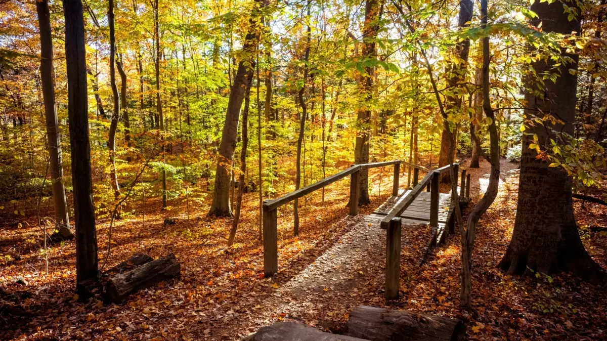
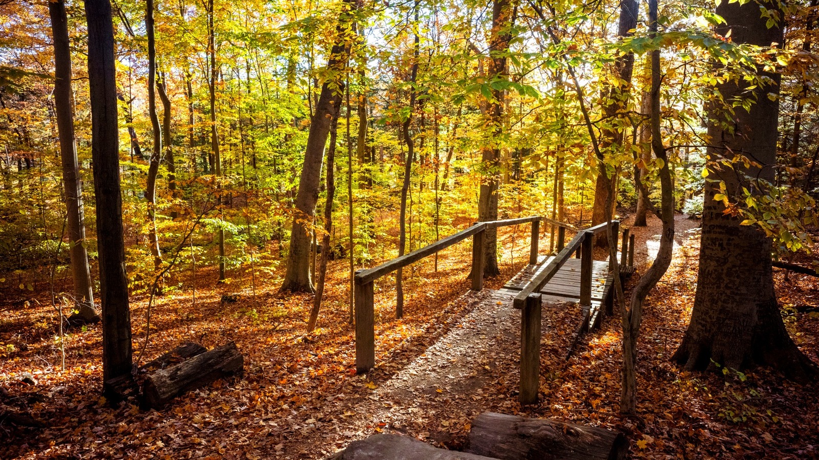
- Seasonal Variations: Turkey Run offers a radically different experience depending on the season. Spring brings rushing creeks and wildflower carpets; summer delivers lush, emerald forest canopies; autumn showcases fiery Midwestern foliage; and winter reveals frozen canyon waterfalls and unobstructed geological formations.
Official Statements and Conservation Outlook
Park management and state conservation authorities continue to emphasize the delicate balance between public recreation and environmental preservation within Turkey Run State Park.
In recent updates regarding park infrastructure, the Indiana Department of Natural Resources emphasized the ongoing commitment to maintaining historical structures—such as the 1882 Narrows Covered Bridge—while ensuring that high-traffic rugged trails like Trail 3 receive regular safety maintenance on their wooden ladder systems.

"Turkey Run State Park represents an irreplaceable ecological and historical anchor for the state of Indiana," notes the Indiana DNR in park management publications. "Our primary mandate is to provide world-class outdoor recreation while strictly safeguarding the ancient canyons, virgin timber stands, and pioneer heritage sites for generations to come. Visitors play a crucial role in this mission by practicing ‘Leave No Trace’ principles, staying on designated paths, and respecting the fragile sandstone ecosystems."
Future Outlook
Looking ahead, Turkey Run State Park faces the dual challenge of managing an increasing volume of outdoor enthusiasts while protecting sensitive natural habitats from erosion and overcrowding. Future infrastructure initiatives by the state aim to upgrade visitor center educational exhibits, expand sustainable parking solutions to minimize habitat fragmentation, and enhance trail marking systems to improve hiker safety on rugged routes like Trails 3 and 9.
As urban centers across the Midwest continue to expand, sanctuaries like Turkey Run serve as vital green lungs and living museums. By respecting the park’s rugged topography, adhering to safety guidelines, and embracing both its natural beauty and pioneering history, visitors ensure that the "Grand Canyon of the Midwest" remains an awe-inspiring escape for decades to come.