







Executive Overview
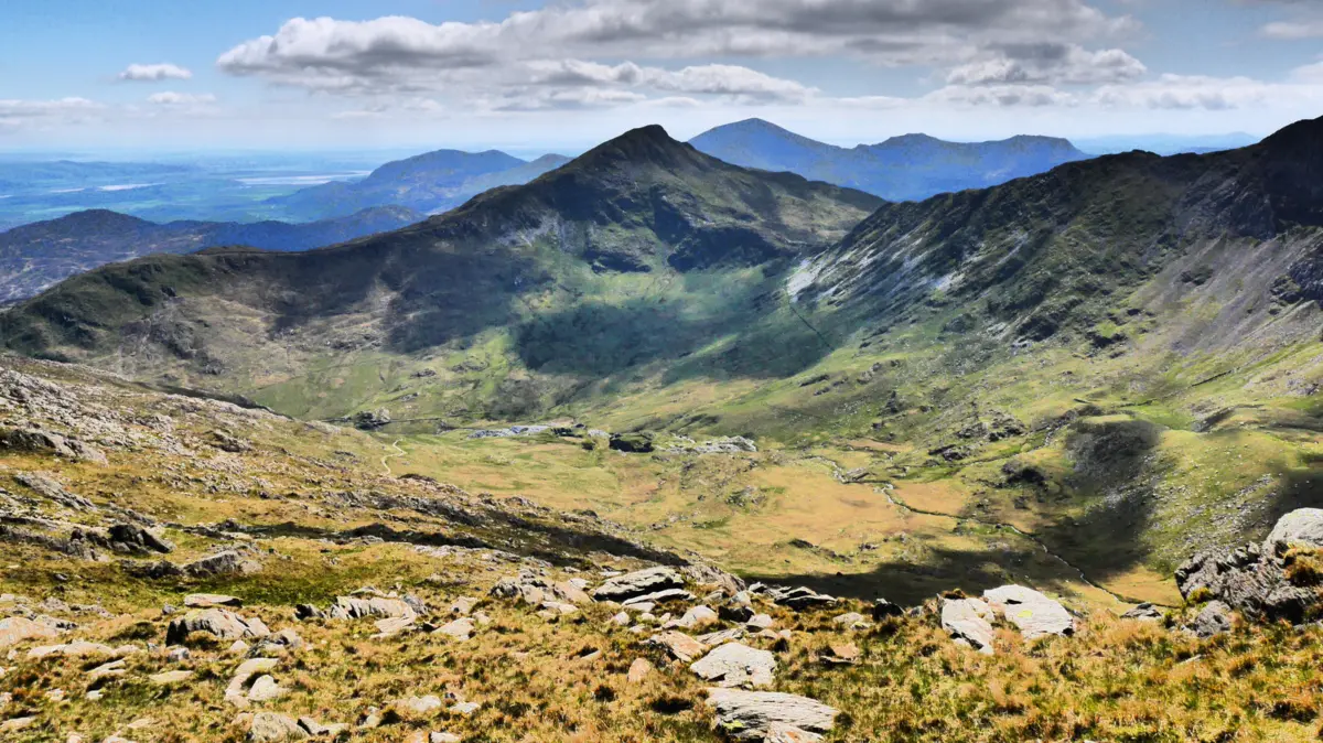
Stretching across 526,720 acres of rugged topography from Conwy in the north to Aberdyfi in the south, Eryri National Park—historically and internationally recognized as Snowdonia—stands as the crown jewel of Welsh conservation, natural beauty, and historical heritage. As the largest national park in Wales, Eryri welcomes nearly 4 million visitors annually. It offers a rare, dramatic convergence of alpine environments, glacial valleys, cascading waterfalls, 74 miles of sweeping coastline, and pristine sandy beaches.
While the park’s silhouette is heavily defined by its nine majestic mountain ranges and the towering bulk of Yr Wyddfa (Snowdon)—the highest peak in Wales—Eryri is far more than a mountaineer’s paradise. Beneath its jagged skyline lie historic, slate-mined communities, ancient copper deposits, and formidable medieval fortresses built by kings and princes. This in-depth dispatch examines the geographical diversity, infrastructural developments, historical milestones, and future conservation imperatives that shape Eryri National Park today.
Detailed Chronology: From Ancient Strongholds to Modern Conservation
To truly understand Eryri, one must trace its evolution through deep geological time, medieval military architecture, and the modern designation of protected wilderness.
The Medieval Era and Strategic Fortifications (13th Century)
The valleys and coastal promontories of Eryri have served as geopolitical flashpoints for centuries. During the 13th century, the region became a chessboard for native Welsh princes and English monarchs.
- Castell Dolwyddelan (c. 1210–1240): Erected by Llywelyn the Great (Llywelyn ab Iorwerth), this strategic stronghold was designed to safeguard vital mountain passes and project native Welsh authority over the interior uplands.
- The Edwardian Conquest (1283 onward): Following the defeat of the last native princes, King Edward I commissioned a ring of formidable stone castles around the periphery of Eryri to subjugate the Welsh population. Among these, Harlech Castle, perched on a rocky coastal precipice overlooking Cardigan Bay, became an engineering marvel and the site of historical sieges—most notably a grueling seven-year standoff during the Wars of the Roses.
Industrial Revolution and the Slate Age (18th–19th Centuries)
Centuries later, the quiet valleys of Eryri transformed into the industrial engine of the British Empire. The extraction of slate reshaped entire mountainsides, carving out deep quarries that employed thousands of Welsh laborers. Communities like Llanberis and the surrounding slate-mining towns became globally significant exporters of roofing materials. Today, these industrial scars have been repurposed; former slate quarries now host high-octane adventure tourism hubs, such as underground zip lines and subterranean trampolining complexes.
Park Designation and Evolution (1951–Present)
Recognizing the urgent need to protect this fragile landscape from unchecked industrialization and urban sprawl, Eryri was officially designated as a National Park in 1951—the first in Wales and third in the United Kingdom. In recent years, a significant cultural shift occurred when the park officially dropped its anglicized name, "Snowdonia," in favor of its native Welsh moniker, Eryri (meaning "The Highlands" or, traditionally associated with eagles), honoring the linguistic and cultural heritage of the region.
Supporting Context & Metrics: By the Numbers
Understanding the sheer scale of Eryri requires analyzing the quantitative data that drives its tourism economy, environmental management, and recreational infrastructure:

- Total Land Area: 526,720 acres (spanning roughly 9 percent of the total landmass of Wales).
- Annual Visitation: Approximately 4 million visitors per year, generating substantial economic activity for local hospitality, guiding services, and rural enterprises.
- Trail Network: 1,497 miles of public footpaths, bridleways, and designated walking routes catering to all skill levels.
- Coastline: 74 miles of protected marine and coastal border, incorporating sections of the internationally acclaimed Wales Coast Path.
- Peak Elevation: Yr Wyddfa (Snowdon) stands at 3,560 feet (1,085 meters) above sea level, attracting over 600,000 summit seekers annually during peak seasonal windows.
- Mountain Ranges: Nine distinct mountain ranges encompassing 28 summits over 2,000 feet (often referred to as the "Welsh 3000s" when factoring in adjacent peaks).
Geographic & Recreational Breakdown
1. The Alpine Core and Mountaineering Hubs
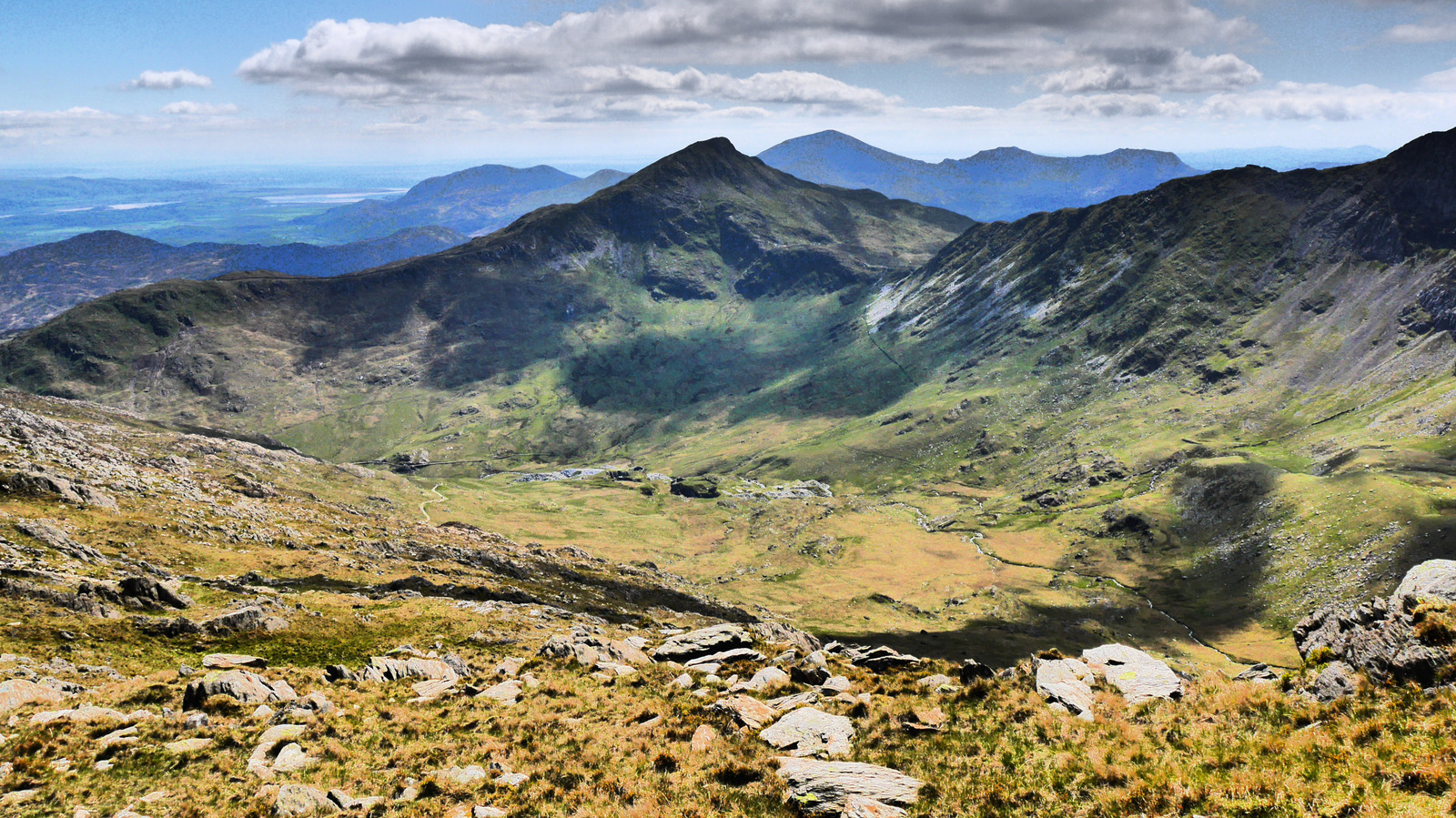
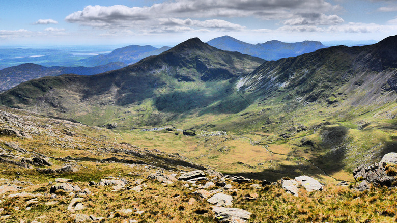
The uplands of Eryri are characterized by glaciated cwms (cirques), razor-sharp ridges like Crib Goch, and roaring waterfalls.
- Yr Wyddfa (Snowdon): While experienced hikers tackle routes like the Miners’ Track, Pyg Track, or Watkin Path, visitors seeking a more relaxed ascent can board the historic Snowdon Mountain Railway, which has chugged its way to the summit since 1896. On exceptionally clear days, the summit rewards climbers with views stretching across the Irish Sea to Ireland.
- Charming Basecamps: Villages such as Beddgelert (famed for its scenic riverside walks and the poignant legend of Gelert the faithful hound), Llanberis (gateway to Llyn Padarn and Dolbadarn Castle), and Betws-y-Coed (the historic "gateway to the forest") offer idyllic stone-built cottages, traditional Welsh pubs, and immediate access to trailheads.
2. Coastal Contrasts: Beaches and Marine Wildlife
Paradoxically, some of Eryri’s most breathtaking escapes sit at sea level where the mountains meet the sea.
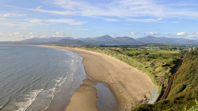
- Morfa Harlech: Voted among the most picturesque beaches in Wales, this 4-mile stretch of pristine white sand features a dynamic, nationally protected dune system. Cardigan Bay’s coastal waters frequently host pods of bottlenose dolphins, grey seals, and harbor porpoises.
- Morfa Dyffryn Beach: Located further south, this expansive golden shore is flanked by towering sand dunes and offers sweeping vistas of the Llyn Peninsula and Tremadog Bay. (Note: The northern section is legally designated as a naturist beach).
3. Architectural Marvels: Castles and Strongholds
Eryri’s built heritage is inextricably linked to its dramatic geography.
- Harlech Castle: A UNESCO World Heritage Site featuring innovative concentric defense architecture. Visitors cross a modern floating footbridge to enter the ruined inner ward, where battlements frame a striking contrast between the blue waters of Cardigan Bay and the dark peaks of the interior mountains.
- Dolbadarn Castle: Situated in Llanberis, this 13th-century Welsh tower is completely free to enter. Climbing to the top of its surviving round fortification offers panoramic 360-degree views of Llyn Padarn and the surrounding oak woodlands.
- Castell Dolwyddelan: Perched on a dramatic rocky outcrop, this fortress requires a brief 15-minute uphill hike from the valley floor. Its isolated setting emphasizes the defensive calculations made by Llywelyn the Great over 800 years ago.
Official Statements and Conservation Perspectives
As visitor numbers swell toward the 4-million mark, managing the delicate balance between tourism, local community needs, and environmental preservation has become a central focus for park authorities.
Park management and local councils have repeatedly emphasized the importance of sustainable tourism. In official planning updates, representatives from the Eryri National Park Authority (Údurdod Parc Cenedlaethol Eryri) have stressed:
"Our primary mission is to protect the natural beauty, wildlife, and cultural heritage of Eryri while providing opportunities for the public to understand and enjoy its unique qualities. Sustainable access is critical. We urge all visitors to respect local agricultural communities, park responsibly, adhere to the Countryside Code, and support local Welsh businesses that keep these rural economies vibrant."
Environmental groups have also highlighted the importance of path restoration projects. Heavy foot traffic on fragile alpine flora—such as the Snowdon lily (Lloydia serotina)—requires continuous volunteer and professional conservation efforts to prevent soil erosion and habitat degradation along popular routes like the Pyg and Miners’ tracks.
Future Outlook: Sustainable Tourism and Cultural Preservation
Looking ahead, Eryri National Park faces both opportunities and mounting challenges. Climate change adaptation, carbon reduction within the park’s transport networks, and managing vehicular congestion at honeypot sites like Pen-y-Pass remain top priorities for regional planners.
Initiatives to promote public transportation—such as enhanced seasonal bus networks connecting coastal towns to mountain trailheads—are currently being expanded to reduce the park’s carbon footprint. Furthermore, the successful transition to using the native name Eryri signals a broader cultural renaissance, ensuring that visitors engage not just with the physical landscape, but with the living Welsh language, folklore, and traditions that have animated these mountains for millennia.
Whether one seeks the adrenaline of soaring over disused slate quarries, the tranquility of a remote sandy beach overlooking Cardigan Bay, or the historical resonance of a medieval fortress clinging to a slate cliff, Eryri remains an incomparable European sanctuary—an enduring wilderness where mountain and ocean meet.