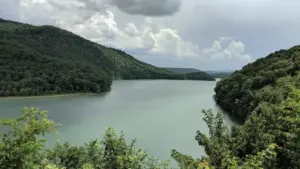
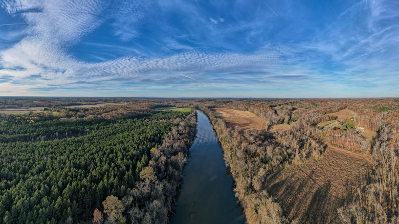
Tucked safely away from the bustling thoroughfares that connect North Carolina’s metropolitan hubs, Yadkin River Park in Linwood, North Carolina, stands as a masterclass in modern ecological preservation meeting historical stewardship. Situated less than an hour’s drive from the economic and cultural epicenters of Greensboro and Charlotte, this newly developed public sanctuary spans the northern terminus of High Rock Lake—the state’s second-largest body of water—offering an integrated escape for anglers, paddlers, historians, and hikers alike.
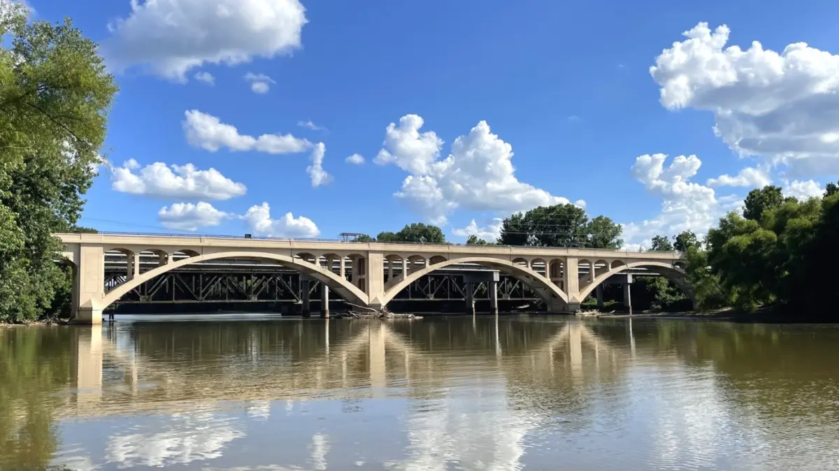
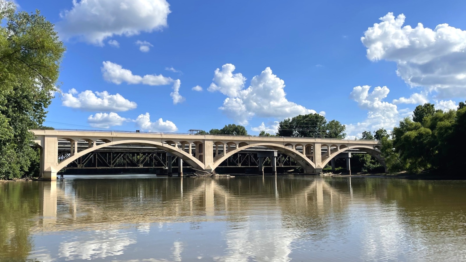
Far more than a standard recreational green space, Yadkin River Park functions as an open-air archive. Its 1.25 miles of meticulously maintained gravel trails wind directly past the physical remnants of a strategic Civil War-era fortification, traverse grounds once scoured by the legendary American frontiersman Daniel Boone, and cross over the architectural crown jewel of the area: the 1,300-foot-long, arched Wil-Cox Bridge.
As municipal authorities and conservation groups continue to invest heavily in its amenities—ranging from modern dog parks and environmental centers to specialized cyclist support stations—Yadkin River Park has transitioned from a localized geographic secret into a regional destination. It successfully bridges the gap between North Carolina’s rich, turbulent past and its modern, eco-conscious recreational future, providing a vital anchor for the 163-mile Yadkin River State Trail.
To fully appreciate the spatial layout and cultural weight of Yadkin River Park, one must peel back centuries of human settlement, conflict, and industrial evolution along the riverbanks of Davidson County.
1. Indigenous Roots and Frontier Explorations
Long before European settlers mapped the Piedmont region, the fertile river valleys surrounding the Yadkin River were inhabited by Native American tribes who utilized the winding waterways for trade, seasonal hunting, and agriculture. Thousands of years of indigenous history remain embedded in the soil and riverbed. By the mid-18th century, the territory caught the attention of pioneering figures expanding the American frontier. Notably, American frontiersman Daniel Boone frequently utilized the area as a hunting ground, drawn by the dense woodlands and abundant wildlife flanking the river.
2. Revolutionary Skirmishes and Civil War Fortifications
The strategic geographic positioning of the Yadkin River crossings made it an inevitable theater of military operations during major American conflicts. During the Revolutionary War, the region witnessed localized skirmishes as colonial and British forces vied for control of vital transit corridors. Decades later, the American Civil War left an indelible mark on the landscape. A strategic Confederate fort was established near the river crossing to protect vital supply and communication lines—earthworks and structural footprints that modern visitors can still observe firsthand while hiking the park’s eastern loop.
3. The Ferry Era and the First Bridge (1800–1924)
As agrarian and commercial interests expanded across North Carolina, the need for reliable river crossings became paramount. In the early 1800s, an organized ferry service operated at the site, ferrying passengers, livestock, and wagons across the swift currents of the Yadkin.
The era of manual river crossings changed forever in 1818 with the completion of the area’s very first bridge. While that early wooden and stone structure succumbed to the elements and time, resilient engineering remains visible today: during low-water periods or via watercraft, modern boaters can still spot the original stone foundations rising from the riverbed as a testament to early 19th-century American infrastructure.
4. The Architectural Rise of the Wil-Cox Bridge (1924)
The definitive architectural centerpiece of today’s park materialized in 1924 with the construction of the Wil-Cox Bridge. Featuring a series of distinctive structural concrete arches, the bridge was engineered to handle the burgeoning automobile traffic of the 20th century.
For decades, the Wil-Cox Bridge carried the weight of regional transit until it was eventually decommissioned for vehicular traffic and designated exclusively for pedestrians and cyclists. Today, meticulously preserved, the bridge serves as the structural spine of the park, linking Davidson County directly to the historic railway town of Spencer across the river.
Supporting Context & Metrics
Understanding the operational capacity and geographic impact of Yadkin River Park requires a close look at the physical metrics, ecological reach, and recreational infrastructure that define the site today.
Geographic and Navigational Metrics
Proximity to Urban Centers: Located precisely in Linwood, NC (Davidson County), the park sits approximately 45 miles southwest of Greensboro and roughly 50 miles northeast of Charlotte, making it an accessible day-trip destination for a combined metropolitan population exceeding two million residents.
Trail Systems: The park features 1.25 miles of dedicated, multi-use gravel trails designed for hikers, walkers, and cyclists, looping through dense woodlands and historic defensive earthworks.
The Wil-Cox Span: The historic pedestrian bridge spans an impressive length of approximately 1,300 feet, offering unobstructed panoramic views of the water and elevated rest zones equipped with covered benches.
The Yadkin River State Trail: The park’s waters form a critical nexus along this 163-mile designated paddle trail, which features a total of 17 public access points winding down the western expanse of North Carolina.
Recreational Infrastructure and Amenities
York Hill River Access: The premier launch point for watercraft. It boasts a heavy-duty concrete boat ramp tailored for motorboats, paired with a specialized gentle slope designed for canoes and kayaks.
Fisheries and Aquatic Species: Positioned at the northern edge of High Rock Lake—North Carolina’s second-largest lake—the park provides prime aquatic access. Anglers routinely target largemouth bass, striped bass, crappie, and exceptionally large specimen catfish. Shoreline fishing is augmented by strategic firepits designed to extend the fishing season into colder autumn and winter months.
Park Amenities for Diverse Visitors: Recent capital developments have introduced a sprawling, modern playground for families, comprehensive picnic facilities, and an environmental education center.
Specialized Infrastructure: To accommodate modern outdoor enthusiasts, the park features a dedicated dog park segregated securely into large- and small-dog play areas (complete with waste stations), as well as cyclist service stations equipped with automated air pumps and basic multi-tool bike repair mounts.
Official Statements and Conservation Vision
The successful transformation of the Yadkin River corridor from an underutilized historical site into a premier public park is the result of sustained collaboration between municipal planners, state agencies, and environmental advocacy groups such as the Yadkin Riverkeeper.
In foundational assessments provided by the Yadkin Riverkeeper organization, leadership emphasized the delicate balance required to honor the past while opening the space to modern outdoor enthusiasts:
"Yadkin River Park in Davidson County serves as a vital bridge connecting the past, present, and future. The land holds the footprints of Native Americans, revolutionary soldiers, and frontiersmen like Daniel Boone. Preserving these narratives while providing sustainable public access to High Rock Lake and the Yadkin River ensures that future generations develop both a respect for our state’s heritage and a profound stewardship for our natural waterways."
Local municipal planners and Davidson County economic development boards have consistently echoed these sentiments, noting that the park functions as a regional economic catalyst. By bridging rural conservation with nearby urban tourism markets—such as Greensboro’s thriving arts district and Spencer’s historic North Carolina Transportation Museum—the park acts as a connective tissue for heritage tourism in the Piedmont Triad.
Future Outlook
As outdoor recreation continues to surge in post-pandemic North Carolina, the future trajectory of Yadkin River Park focuses on sustainable expansion, enhanced ecological monitoring, and deeper integration with surrounding regional trail networks.
1. Expanded Trail Connectivity
Current municipal proposals explore the feasibility of extending the park’s trail networks further along the Davidson County shoreline, potentially linking the park’s pedestrian paths into a broader regional greenway system. This would allow cyclists to traverse continuously from Linwood into neighboring historic districts without interacting with heavy automotive traffic.
2. Environmental Education and Conservation Initiatives
With the establishment of the park’s new environmental center, future educational programming will scale up significantly. Local school districts and conservation groups plan to launch water quality monitoring programs, guided botanical hikes, and historical interpretation tours. These initiatives aim to transform the park into an outdoor classroom for regional youth, emphasizing watershed protection and the preservation of the Yadkin River basin.
3. Infrastructure Hardening and Visitor Management
Given the rising popularity of the York Hill River Access area during peak spring and summer fishing and boating seasons, park authorities are reviewing traffic flow, parking expansions, and shoreline erosion control measures. Balancing high visitor volume with the delicate ecology of High Rock Lake remains a top priority, ensuring that the park’s natural quietude and pristine aquatic habitats endure for decades to come.
Through careful planning, profound historical reverence, and robust community engagement, Yadkin River Park remains a shining blueprint for how modern North Carolina can honor its storied past while inviting the public to step directly into nature.