







Executive Overview
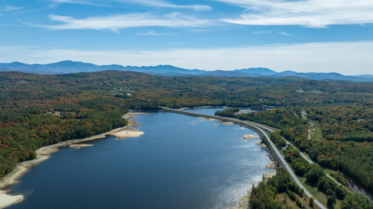
Nestled within the rugged terrain of the Upper Connecticut River Valley, framed by the majestic silhouettes of New Hampshire’s White Mountains to the east and Vermont’s Green Mountains to the west, lies Moore Reservoir. As New Hampshire’s largest artificial lake, this sprawling 3,500-acre aquatic playground shatters the conventional image of the Granite State’s waterfronts. While New Hampshire is globally celebrated for its nearly 1,000 glacial swimming holes, pristine ponds, and natural lakes, Moore Reservoir offers a dramatically different maritime experience—one forged through mid-century industrial ambition and shaped by the powerful flow of New England’s longest river.
Stretching 11 miles along the borderlands of Littleton, New Hampshire, and Waterford, Vermont, Moore Reservoir is much more than a scenic backdrop. It is a premier year-round sanctuary for anglers, a haven for motorized and non-motorized watercraft enthusiasts, and an engineering landmark that underpins regional energy infrastructure. With nearly 30 miles of rugged, heavily forested shoreline, depths reaching 120 feet, and rich fisheries stocked annually, the reservoir has quietly evolved into one of the Northeast’s best-kept outdoor recreation secrets.
This comprehensive report examines the multifaceted identity of Moore Reservoir. We explore its origins in New England’s hydroelectric boom, outline its extensive boating and fishing infrastructure, analyze interstate regulatory frameworks, and highlight the vibrant tourism ecosystems of the surrounding mountain communities that make this destination an unmissable stop for travelers.
Detailed Chronology: From Wild River to Industrial Powerhouse
To fully appreciate the serene waters and sweeping mountain vistas of Moore Reservoir today, one must look back nearly a century to understand the monumental landscape transformation that created it. The story of Moore Reservoir is fundamentally intertwined with the history of the Connecticut River, a vital 400-mile artery that originates near the Canadian border, carves a path between Vermont and New Hampshire, flows through Massachusetts and Connecticut, and ultimately empties into Long Island Sound.
The Pre-Dam Era and the Call for Clean Energy
Before the mid-20th century, the stretch of the Connecticut River flowing between Littleton, New Hampshire, and Waterford, Vermont, was characterized by roaring rapids, dynamic seasonal flooding, and a wild, untamed ecosystem. However, as New England entered the post-Depression era and industrial electrification accelerated, utility planners recognized the immense hydroelectric potential harbored within the river’s northern gradients.
In the 1930s, the New England Power Company initiated planning for what would become one of the most ambitious civil engineering projects in the region’s history. The goal was twofold: harness the kinetic energy of the Connecticut River to generate reliable, large-scale electrical power, and regulate downstream flow to mitigate seasonal flood risks that routinely threatened valley communities.
Construction of the Samuel C. Moore Dam
The centerpiece of this grand vision was the construction of the Samuel C. Moore Dam. Initiated prior to the outbreak of World War II, the project faced unprecedented logistical hurdles, material shortages, and labor constraints throughout the 1940s. Despite these setbacks, construction pushed forward across two decades.
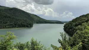
When the dam was finally completed and brought fully online, it established the largest hydroelectric plant in New England. The impoundment of the dam transformed the landscape overnight. As the concrete barrier held back the rushing waters of the Connecticut River, the basin filled slowly over a period of months, drowning low-lying riverbanks and timberlands to form an 11-mile-long, deep-water basin.
Named in honor of Samuel C. Moore—a pioneering utility executive instrumental in the region’s electrical development—the reservoir permanently altered the ecology and geography of the borderlands. What was once a narrow, fast-moving river channel became a vast inland sea, balancing industrial utility with rugged natural beauty. Today, the facility operates under modern energy management protocols, continuing to supply clean, renewable power to the regional grid while sustaining a thriving recreational ecosystem along its shores.
Supporting Context & Metrics: Geography, Infrastructure, and Accessibility
Moore Reservoir is defined by impressive physical metrics and a robust network of public access points designed to accommodate thousands of outdoor enthusiasts each year. Understanding the layout, depth profiles, and access logistics of the reservoir is essential for a safe and rewarding visit.
Key Physical and Geographical Metrics
- Total Surface Area: Approximately 3,500 acres, making it the largest man-made body of water in the state of New Hampshire.
- Length: 11 miles of continuous navigable waters stretching along the Connecticut River basin.
- Maximum Depth: Reaches depths of up to 120 feet near the dam structure, creating deep, cold-water thermal layers favored by game fish.
- Shoreline Length: Nearly 30 miles of heavily forested, undeveloped shoreline bordered by private and conserved public lands.
- Elevation & Mountain Views: Flanked by the White Mountains (New Hampshire) to the east and the Green Mountains (Vermont) to the west, providing panoramic vistas from virtually every angle on the water.
Boating Infrastructure and Public Access Points
Navigating Moore Reservoir is remarkably straightforward, thanks to a well-maintained network of public boat launches, picnic areas, and parking facilities distributed along its length.
- The Moore Dam Visitor Center & Launch: Located immediately adjacent to the Samuel C. Moore Dam, this primary access hub offers exceptional amenities for visitors. It features free trailer parking, modern public restrooms, and scenic picnic sites. It serves as an ideal staging ground for powerboats, pontoons, and larger trailered watercraft.
- Pattenville Picnic Area: Situated a short distance away, this secondary site provides a concrete boat ramp paired with an expanded barbecue and recreation area. Outfitted with built-in grills and stone fireplaces, it is a favorite gathering spot for families looking to combine a day on the water with a lakeside cookout.
- Dodge Hill Boat Ramp: Positioned further north, Dodge Hill offers streamlined access to the upper middle sections of the reservoir. Its proximity to local outfitters makes it a prime departure point for paddlers and kayakers.
- North Littleton Picnic Area: Located at the northern terminus of the reservoir system, this site delivers sweeping panoramic views across the lake’s forested northern banks toward the distant mountain ranges. It features dedicated car-top boat access, making it exceptionally popular for non-motorized recreation.
Navigational Guidelines and Water Safety
Because Moore Reservoir is fundamentally an operational hydroelectric impoundment, water levels fluctuate significantly depending on power generation schedules, seasonal snowmelt, and upstream rainfall. Boaters must exercise constant vigilance regarding submerged hazards, shifting sandbars, and variable shorelines.
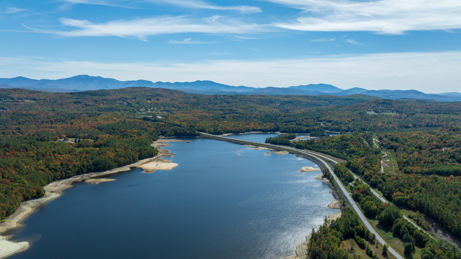
Furthermore, New Hampshire state marine laws strictly regulate vessel speeds. All watercraft must operate at a strict "no-wake" speed when traveling within close proximity to the shoreline, docks, moored vessels, swim areas, and fellow water sports participants. Once clear of the safety zones and out in the open expanses of the reservoir, operators can cruise freely, though caution regarding floating debris and sudden depth drops remains paramount.
Official Statements & Expert Perspectives: Recreation and Conservation
The transformation of an industrial hydroelectric asset into a premier recreational destination has required careful coordination among utility operators, state wildlife agencies, and local tourism advocates.
Balancing Energy Production and Public Recreation
Representatives from Great River Hydro and local energy stakeholders emphasize that public access and environmental stewardship are core tenets of modern dam management. "The primary mandate of the Samuel C. Moore Dam is the generation of reliable hydroelectric power and regional flood control," notes a regional facilities manager. "However, we recognize that the resulting reservoir has become an irreplaceable ecological and recreational jewel for New Hampshire and Vermont. Our goal is to manage water levels transparently while maintaining safe, open public access to the shoreline and launch facilities."
Fisheries Management and Conservation
The New Hampshire Fish and Game Department places significant emphasis on maintaining the ecological health of the reservoir. Through sustained stocking programs and rigorous monitoring, the state ensures that Moore Reservoir remains a premier sportfishing destination.
Fisheries biologists note that the reservoir’s diverse bathymetry—ranging from shallow, weed-lined bays to deep, 120-foot glacial pockets—creates an ideal habitat for both warm-water and cold-water species. "The annual stocking of rainbow trout, combined with robust, self-sustaining populations of smallmouth bass and chain pickerel, provides anglers with a world-class multi-species fishery," explains a state fisheries coordinator. "Add in the growing winter ice-fishing interest for northern pike, and you have a body of water that demands attention 365 days a year."
Future Outlook: Sustainable Tourism and Regional Growth
As travelers increasingly seek out off-the-beaten-path destinations that combine outdoor adventure with authentic small-town charm, Moore Reservoir and its surrounding communities are poised for thoughtful, sustainable growth.
Expanding Non-Motorized Sports and Guided Ecotourism
While powerboating and jet-skiing remain popular, recent years have witnessed an explosive surge in non-motorized water sports. Kayaking, canoeing, and stand-up paddleboarding (SUP) have captured the imagination of eco-tourists eager to explore the quiet coves and winding inlets of the reservoir at a slower pace.
Local enterprises, such as North Country Kayak located near the Dodge Hill Boat Ramp, are leading this charge by offering comprehensive equipment rentals and specialized guided tours. Their sunset paddles and autumn foliage excursions offer visitors an immersive way to experience the brilliant seasonal transformations of the White and Green Mountains reflected on the glass-like surface of the lake. Similarly, outfitters like White Mountain Anglers provide expert-led drift boat excursions, opening up the river’s technical channels to novice and veteran anglers alike.
Strategic Gateway Communities
The future vitality of Moore Reservoir is deeply connected to the economic and cultural health of its neighboring towns:
- Littleton, New Hampshire: Located just a 10-minute drive from the reservoir, Littleton has successfully branded itself as a premier mountain hub. Featuring a vibrant, historic downtown filled with independent boutiques, craft breweries, and diverse dining options, Littleton acts as the primary staging and supply center for visitors heading to the water.
- Waterford, Vermont: Situated directly across the Connecticut River, Waterford offers a peaceful, pastoral contrast characterized by classic New England architecture, historic covered bridges, and a cozy, tight-knit mountain village atmosphere.
Accessibility and Transportation Hubs
Reaching this northern New England sanctuary is remarkably convenient for travelers across the Northeast. Moore Reservoir is situated just 70 miles north of Lebanon Municipal Airport (LEB), which offers daily nonstop commercial flights connecting passengers to Boston and the New York metropolitan area via Westchester County (White Plains). For travelers arriving from further afield, the Patrick Leahy Burlington International Airport (BTV) in Vermont is located less than 100 miles to the west, offering expanded flight options across major national carriers.
Conclusion
Moore Reservoir stands as a testament to the harmonious coexistence of heavy industry and pristine natural beauty. What began as a bold engineering endeavor in the 1930s has matured into New Hampshire’s largest artificial lake—a dynamic, multi-use playground that rivals the state’s natural glacial lakes. Whether you are casting a line for trophy trout in the shadow of the White Mountains, navigating calm morning waters by kayak, or exploring the vibrant culture of nearby Littleton and Waterford, Moore Reservoir offers an authentic, uncrowded New England experience that continues to captivate the adventurous spirit.