



Executive Overview
On Wednesday, September 3, a catastrophic maritime collision in the Sea of Marmara, just off the coast of Istanbul, resulted in the rapid sinking of a Turkish-flagged commercial cargo vessel. The incident has left ten crew members missing, triggering a massive, multi-agency search and rescue (SAR) operation coordinated by Turkish authorities.
According to official reports from the state-owned Anadolu Agency, the vessel sank within approximately 11 minutes of colliding with another Turkish-flagged commercial ship. While the second vessel sustained no critical damage and remains safely anchored off the coastal district of Silivri, the fate of the sunken ship’s crew remains unknown.
+----------------------------------------------------------------------+
|                      COLLISION SUMMARY MATRIX                        |
+----------------------+-----------------------------------------------+
| Date of Incident     | Wednesday, September 3                        |
| Location             | Sea of Marmara, off Silivri (Istanbul)        |
| Vessel Types Involved| Two Turkish-flagged commercial cargo vessels  |
| Sinking Timeline     | Approximately 11 minutes post-collision       |
| Missing Personnel    | 10 Crew Members                               |
| Status of Vessel 2   | Undamaged; Anchored off Silivri               |
+----------------------+-----------------------------------------------+
This maritime disaster has once again trained a global spotlight on the congested waterways surrounding Istanbul—a critical geopolitical and commercial bottleneck connecting the Black Sea to the Mediterranean. As search operations enter a critical phase, investigators are working to reconstruct the final moments leading up to the crash, focusing on potential navigational errors, communication failures, and mechanical anomalies.
Detailed Chronology of the Collision and Sinking
The Pre-Collision Environment
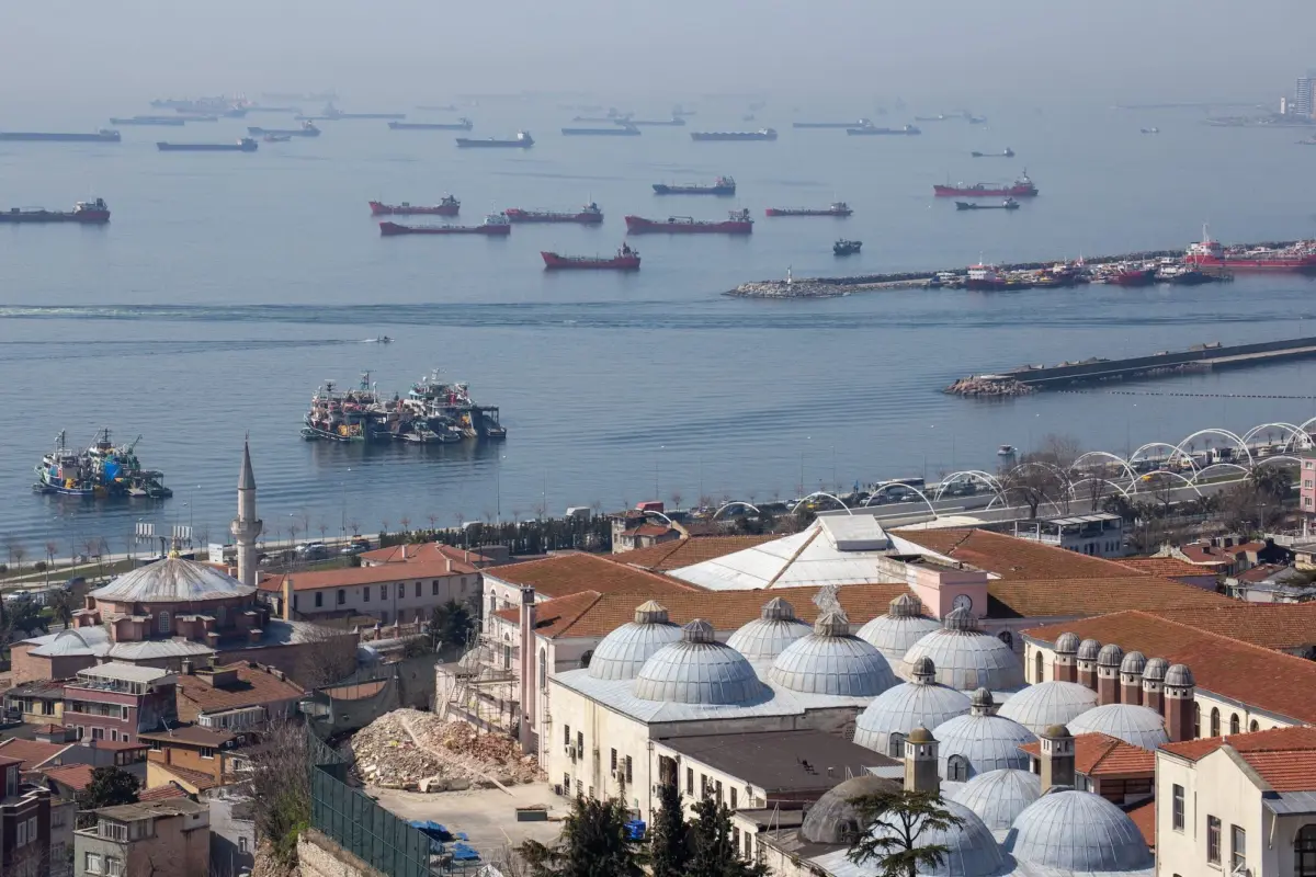
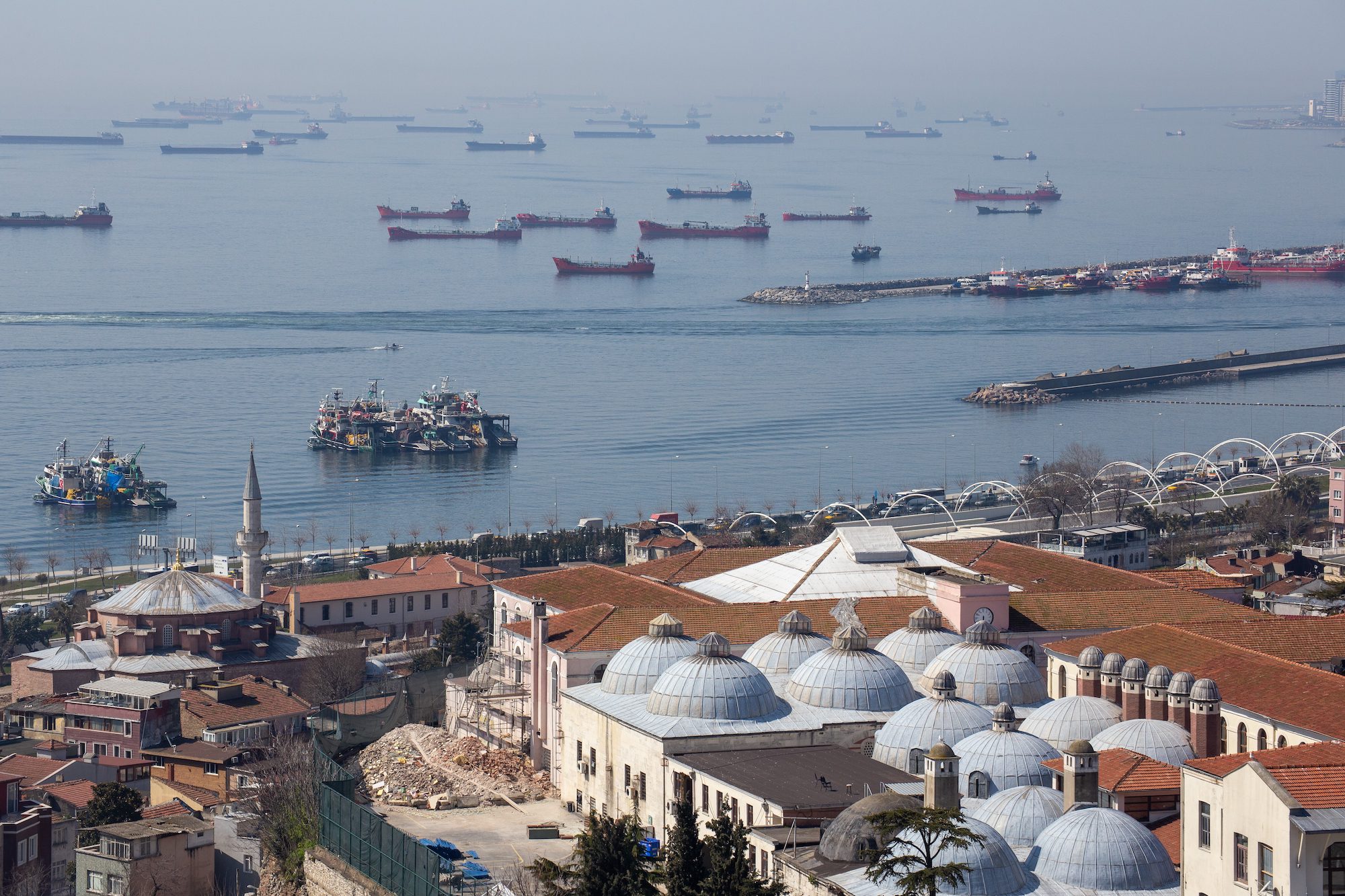
On the afternoon of Wednesday, September 3, both Turkish-flagged commercial vessels were transiting the Sea of Marmara, a vital body of water that acts as an inland sea entirely within the borders of Turkey. The area off Silivri, situated on the European side of the Istanbul province, serves as a key transit corridor and temporary anchorage zone for ships waiting to enter the highly regulated Bosporus Strait.
The weather conditions, traffic density, and exact navigational paths of both vessels at the time of the incident are currently under official review. However, preliminary tracking data indicates that both ships were operating in a relatively high-traffic sector of the Marmara shipping lanes.
                      [ SILIVRI ANCHORAGE ]
                               |
                               | (Safe Anchorage)
                               v
  [ VESSEL 2 ] ------------> [ COLLISION ZONE ] <------------ [ VESSEL 1 ]
  (Undamaged)                     |                           (Sank in 11 Mins)
                                  |
                                  v
                       [ 10 CREW MEMBERS MISSING ]
The Impact and the Fatal 11 Minutes
The collision occurred with high impact, causing immediate and severe structural damage to one of the vessels. The compromised ship, carrying ten crew members, experienced rapid hull breach and catastrophic flooding.
In the maritime shipping industry, an 11-minute sinking window is considered extremely short. This indicates that the vessel likely suffered:
- A major breach below the waterline, compromising multiple watertight compartments simultaneously.
- A rapid loss of reserve buoyancy, leading to progressive flooding.
- A sudden stability failure, potentially exacerbated by the shifting of dry bulk cargo or the free surface effect of water rushing into the hold.
Because the vessel sank so quickly, the crew had an incredibly narrow window to muster, don life jackets, deploy life rafts, or send out an organized Mayday distress signal. It is highly probable that the crew was forced into the water under chaotic and violent conditions.
Immediate Emergency Mobilization
Following the collision, the second vessel, which emerged from the impact structurally sound and fully operational, immediately initiated emergency protocols. The captain of the undamaged vessel brought the ship to a halt and reported the incident to the Turkish Coast Guard Command (Sahil Güvenlik Komutanlığı) and the Vessel Traffic Services (VTS).
The undamaged vessel was subsequently ordered to drop anchor off Silivri to remain available for physical inspection, crew interviews, and the retrieval of voyage data recorder (VDR) information.
Supporting Context and Maritime Metrics
The Strategic Congestion of Turkish Waterways
The Sea of Marmara is one of the most heavily trafficked maritime corridors in the world. It serves as the southern approach to the Bosporus Strait and the northern approach to the Dardanelles Strait. Collectively known as the Turkish Straits, these waterways handle:
- Over 40,000 vessel transits annually.
- Significant volumes of hazardous cargo, including crude oil, chemical products, and liquefied natural gas (LNG).
- Large-scale dry bulk transport, particularly grain shipments from Ukraine and Russia, and industrial steel and coal.
+----------------------------------------------------------------------+
|                 ANNUAL TRAFFIC PROFILE: TURKISH STRAITS             |
+----------------------------------------------------------------------+
| Annual Vessel Transits     | ~40,000+ vessels                        |
| Primary Cargo Types        | Crude Oil, Chemicals, Grain, Dry Bulk   |
| Key Navigational Hazards   | Narrow channels, blind turns, currents  |
+----------------------------------------------------------------------+
The high density of transiting commercial vessels, combined with local passenger ferry routes, fishing vessels, and pleasure craft, makes the Sea of Marmara a high-risk zone for maritime collisions. Despite the implementation of sophisticated Vessel Traffic Services (VTS) and strict Traffic Separation Schemes (TSS), the margin for navigational error remains razor-thin.
Technical Analysis of Rapid Vessel Sinkings
When a commercial cargo ship sinks in under 15 minutes, maritime investigators look closely at structural design and cargo characteristics.
               +----------------------------------------+
               |  CAUSAL FACTORS FOR RAPID SINKINGS     |
               +-------------------+--------------------+
               | Hull Breach       | Direct impact below water line  |
               | Bulkhead Failure  | Progressive flooding of holds   |
               | Cargo Shift       | Instability and rapid capsizing |
+-------------------+--------------------+- Bulkhead Integrity: If the transverse bulkheads—designed to isolate flooding to a single compartment—fail or are breached directly during a collision, progressive flooding will occur. If two or more major holds flood rapidly, most medium-sized cargo vessels will lose stability and sink.
- Cargo Liquefaction or Shifting: If the vessel was carrying dry bulk cargo (such as grain, minerals, or sand), a sudden ingress of water can cause the cargo to shift or liquefy. This dramatically alters the vessel’s center of gravity, causing a sudden, unrecoverable list and subsequent capsizing.
- Entrapment Risks: In rapid sinking scenarios, crew members who are off-duty in the accommodation spaces or working deep within the engine room face extreme difficulty escaping to the open decks, especially if the vessel develops a severe list within the first few minutes of impact.
Search, Rescue, and Recovery Operations
Deployment of Multi-Agency Assets
By Thursday, September 4, Turkish authorities had scaled up the search and rescue operation to an extraordinary level. The coordination involves a joint effort between the Turkish Coast Guard, the Turkish Navy, the Disaster and Emergency Management Authority (AFAD), and local marine police.
+----------------------------------------------------------------------+
|                       SEARCH & RESCUE DEPLOYMENT                     |
+----------------------+-----------------------------------------------+
| Surface Vessels      | 18 (Coast Guard, Navy, Marine Police)         |
| Rotary Aircraft      | 5 Helicopters (equipped with thermal imaging) |
| Fixed-Wing Aircraft  | 1 Maritime Patrol Aircraft                    |
| Unmanned Aerial      | 2 Drones (UAVs)                               |
| Deep-Sea Assets      | 1 Naval Vessel with sonar & underwater gear   |
+----------------------+-----------------------------------------------+
Anadolu Agency confirmed the deployment of a highly sophisticated array of assets:
- 18 Surface Vessels: These include fast rescue boats, offshore patrol vessels, and tugs equipped with searchlights and medical bays.
- Air Support: Five helicopters and one fixed-wing aircraft are conducting systematic search grids. The aerial assets are utilizing thermal imaging and infrared cameras to locate heat signatures in the water.
- Unmanned Aerial Vehicles (UAVs): Two drones are being utilized to provide continuous, high-altitude aerial surveillance of the search sectors, allowing coordinators to analyze surface debris patterns in real-time.
- Underwater Search Capabilities: A specialized Turkish Navy vessel equipped with side-scan sonar and remotely operated vehicles (ROVs) has been deployed to locate the wreck on the seabed. Locating the hull is a top priority, as investigators must determine if any crew members became trapped inside the vessel when it went down.
Environmental Factors Influencing the Search
The Sea of Marmara features complex, dual-layered current systems. A fresher, less dense surface current flows southwards from the Black Sea, while a highly saline, denser undercurrent flows northwards from the Mediterranean.
This dual-current dynamic complicates search operations significantly:
- Drift Vector Modeling: Search coordinators must use complex computer modeling to calculate where survivors or debris might drift. A survivor on the surface will drift according to wind and surface currents, while underwater debris or trapped liferafts could be influenced by deeper current layers.
- Water Temperature and Survival Windows: While summer water temperatures in the Sea of Marmara are relatively mild, prolonged exposure still presents a severe risk of hypothermia, exhaustion, and dehydration. The first 36 to 48 hours are widely recognized by SAR professionals as the critical window for finding survivors alive.
Official Statements and Investigative Focus
Statements from Turkish Authorities
The Turkish Ministry of Transport and Infrastructure, alongside the Governorship of Istanbul, has issued statements confirming that all available state resources have been mobilized.
"Our priority is the preservation of human life. Every available asset from our Coast Guard, Navy, and AFAD is currently deployed in the Sea of Marmara. We are leaving no stone unturned in our efforts to locate the ten missing crew members," an official spokesperson stated.
The Ministry also confirmed that the judicial and administrative investigations into the cause of the accident have been initiated.
The Scope of the Investigation
The Marine Accident Investigation Board (under the Ministry of Transport and Infrastructure) has assumed responsibility for determining the root cause of the collision. The investigation will focus on several critical areas:
                  +-----------------------------------+
                  |      INVESTIGATIVE PROTOCOLS      |
                  +-----------------+-----------------+
                  | VDR Retrieval   | Extract audio and radar data    |
                  | VTS Logs        | Analyze shore-based tracking    |
                  | Crew Interviews | Question survivors and watch-keepers|
                  | COLREGs Audit   | Evaluate right-of-way adherence |
+-----------------+-----------------+- Analysis of Voyage Data Recorders (VDR): Investigators will attempt to recover the VDR (often referred to as the maritime "black box") from both the sunken vessel (once located) and the anchored, undamaged vessel. The VDR contains critical data, including bridge audio recordings, VHF radio communications, radar targets, rudder commands, and engine settings.
- Vessel Traffic Services (VTS) Tracking: Shore-based radar and Automatic Identification System (AIS) data recorded by the Istanbul VTS will be analyzed. This data will provide an exact, second-by-second reconstruction of the vessels’ speeds, headings, and relative positions leading up to the impact.
- Compliance with COLREGs: Investigators will assess which vessel had the right of way under the International Regulations for Preventing Collisions at Sea (COLREGs). Specifically, they will examine:
- Rule 5 (Look-out): Did both vessels maintain a proper visual and radar look-out?
- Rule 7 (Risk of Collision): Did either vessel fail to recognize the developing risk of collision in a timely manner?
- Rule 15 & 16 (Crossing Situations & Action by Give-way Vessel): If it was a crossing situation, did the vessel designated as the "give-way" ship take early and substantial action to keep well clear?
- Human Factors and Fatigue: The work schedules, rest hours, and qualifications of the watch-keeping officers on both vessels will be audited to determine if fatigue, distraction, or lack of training played a role in the disaster.
Future Outlook and Systemic Safety Reforms
Potential Environmental Impact
Beyond the immediate humanitarian crisis, the sinking of a commercial cargo ship presents localized environmental risks. Depending on the vessel’s size and propulsion system, it likely carried significant quantities of heavy fuel oil (HFO) or marine gas oil (MGO), along with lubricating oils and hydraulic fluids.
If the fuel tanks were ruptured during the collision or subsequent sinking, there is a risk of an oil spill in the sensitive marine ecosystem of the Sea of Marmara. Environmental monitoring vessels are on standby to deploy containment booms and skimmers if any surface sheen or major oil leakage is detected above the wreck site.
The Call for Enhanced Traffic Management
This tragic event is expected to reignite debates regarding maritime transit safety regulations in Turkish waters. Over the years, Turkey has progressively tightened transit rules, encouraging the use of maritime pilots and implementing strict scheduling to prevent congestion.
However, many maritime safety experts argue that more robust measures are required, including:
- Mandatory Pilotage: Extending mandatory pilotage to a wider class of vessels transiting the Sea of Marmara, not just those transiting the narrow straits.
- Enhanced VTS Intervention: Empowering Vessel Traffic Services operators to take a more active, prescriptive role in directing vessels when a risk of collision is detected on shore-based radar.
- Stricter Enforcement of Speed Limits: Implementing tighter speed restrictions in designated high-density zones off major anchorages like Silivri.
Conclusion
As the search and rescue operations continue off the coast of Istanbul, the immediate focus remains entirely on finding the ten missing mariners. The deployment of advanced naval sonar, aerial drones, and a fleet of rescue vessels demonstrates the scale of Turkey’s response to this maritime emergency.
Once the rescue phase concludes, the focus will shift to a rigorous, transparent investigation. The findings of this inquiry will be vital not only for providing closure to the families of the crew but also for implementing the systemic reforms necessary to prevent such a swift and devastating loss of life from occurring again in these highly contested waters.