




Executive Overview
For generations, travelers traversing the Mid-Atlantic have grown accustomed to a specific aesthetic when it comes to inland bodies of water. Whether natural ponds or sprawling man-made reservoirs, Virginia’s lakes typically share a distinct visual signature. Deep green waters, darkened by decades of decaying leaf litter, rich sediment, and organic runoff, often take on a tea-like brownish hue. Dense canopies of hardwoods frame long stretches of sandy shoreline where, on blistering summer weekends, families gather by the dozens to claim their patches of sand and sun. Iconic destinations like Smith Mountain Lake epitomize this familiar, bustling Appalachian water-recreation scene.
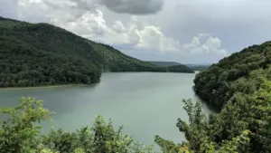
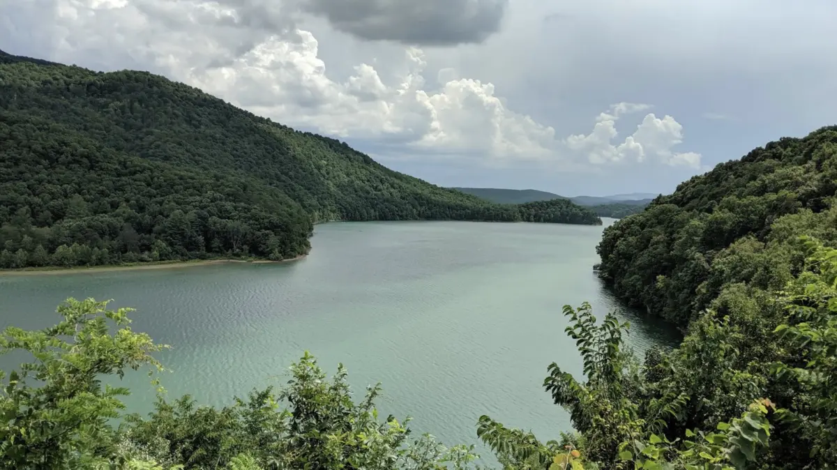
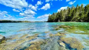
Yet, nestled deep within the rugged fold of the Allegheny Mountains, a striking anomaly defies this regional expectation. Lake Moomaw—straddling the border of Bath and Alleghany counties in western Virginia—looks less like a typical mid-Atlantic reservoir and more like a remote, tropical mountain hideaway. Boasting astonishingly clear, vivid blue-green waters and an extraordinary depth of visibility, the lake is framed by 43 miles of entirely undeveloped, heavily forested shoreline.
Formed by the damming of the Jackson River, this aquatic masterpiece combines dramatic canyon topography with pristine water quality. Far removed from the commercial congestion and roaring boat docks of Virginia’s more heavily developed recreational hubs, Lake Moomaw offers a rare blend of untamed wilderness and world-class outdoor recreation. From its status as the Commonwealth’s only recognized "two-story" fishery to its proximity to centuries-old mineral springs, Lake Moomaw stands as a premier destination for anglers, boaters, hikers, and travelers seeking profound solitude.
Detailed Chronology: From Wild River Canyon to Engineered Reservoir
To truly understand the unique ecology and topography of Lake Moomaw, one must look backward through time to examine the geological and engineering forces that shaped the landscape.
Long before the waters pooled against the concrete face of the Gathright Dam, the region was defined by the relentless, carving power of the Jackson River. For millennia, the river cut a deep, winding canyon through the dense sedimentary rock of the Allegheny Highlands. The steep valley walls, towering hemlock forests, and narrow floodplains created a remote riverine ecosystem accessible only to wildlife, indigenous peoples, and later, early European settlers and loggers.
The Genesis of the Gathright Project
The turning point for the valley arrived in the mid-20th century. Recognizing the need for downstream flood control, water quality management, and enhanced regional recreation, the United States Army Corps of Engineers proposed the Gathright Dam project. Authorized by the Flood Control Act of 1946, construction plans aimed to harness the volatile flows of the Jackson River.
Construction of the Gathright Dam officially began in the 1970s. The massive earth-and-rockfill dam was engineered to block the narrow canyon, gradually allowing the Jackson River to back up and flood the surrounding valleys, hollows, and tributary mouths. As the basin filled, it submerged old homesteads, timber roads, and remnants of logging camps, permanently altering the human geography of the valley while giving birth to a massive aquatic ecosystem.

Naming the Lake
Upon completion of the reservoir project, the newly formed body of water was officially named Lake Moomaw. The designation honored the late Benjamin C. Moomaw Jr., a fierce champion of the region’s economic development, conservation, and tourism potential. Moomaw had spent decades advocating for the infrastructure and preservation of the Alleghany Highlands, making the naming of the lake a fitting tribute to a man who envisioned the region’s potential as a premier outdoor destination.
In the decades following its impoundment, the U.S. Forest Service—specifically operating within the bounds of the George Washington and Jefferson National Forests—assumed stewardship of the surrounding lands. By strictly limiting shoreline development, managing timber harvests, and constructing thoughtful recreational access points, federal land managers preserved the pristine, wild aesthetic that defines Lake Moomaw today.
Supporting Context & Metrics: Geography, Ecology, and Infrastructure
To appreciate Lake Moomaw fully, one must examine the hard metrics and ecological realities that set it apart from its regional counterparts.
Geographical Isolation and Access
Situated entirely within the George Washington and Jefferson National Forests, Lake Moomaw lies tightly wedged between Bath and Alleghany counties, with its western shores hugging the Virginia-West Virginia border. This remote placement shields the lake from suburban encroachment.
- Proximity to Urban Centers: The nearest commercial hubs with major domestic airports are Roanoke and Charlottesville, both located roughly 100 miles away.
- Local Amenities: The closest town, Hot Springs, sits approximately 15 miles to the east, offering sparse commercial amenities, including local grocery options and historic village shops.
- Shoreline Development: Unlike Smith Mountain Lake, which is ringed by sprawling residential subdivisions, private docks, and commercial marinas, Lake Moomaw boasts 43 miles of completely undeveloped shoreline. The tree line meets the water’s edge in an uninterrupted sweep of green.
Hydrological and Limnological Marvels
The primary reason for Lake Moomaw’s striking visual clarity lies in its origins as a deep river canyon. Because the basin is deep, steep-walled, and fed by clean mountain tributaries, it lacks the shallow, marshy edges that typically churn up organic sediments.
Furthermore, Lake Moomaw is officially classified by wildlife management agencies as Virginia’s only true two-story fishery. This limnological designation means the lake thermal-stratifies in a way that creates two distinct habitable zones for aquatic life:
- The Warmwater Upper Layer: Well-oxygenated and sunlit during the summer months, providing ideal habitat for warm-water species.
- The Coldwater Lower Layer: Deep, highly oxygenated, and cool year-round, sustained by regulated water releases and deep-water dynamics from the Gathright Dam.
Fisheries Management and Angling Dynamics
Because of its unique two-story stratification, Lake Moomaw has earned a legendary reputation among regional and national anglers. The aquatic food web is robust, supported by both native and stocked species:
- Native Populations: Smallmouth bass and rock bass, originally native to the free-flowing Jackson River, thrive in the rocky, clear-water environments along the submerged ledges.
- Stocked Gamefish: State wildlife agencies regularly augment the ecosystem with largemouth bass, channel catfish, and redear sunfish.
- Trout Fishery: The cold lower tier of the lake sustains thriving populations of trout. While anglers must adhere to strict conservation regulations—such as a daily limit of two trout per person—the lake offers a unique regulatory advantage: no specialized trout license or National Forest Stamp is required to fish for trout within the boundaries of Lake Moomaw.
Official Statements & Management Frameworks
The stewardship of Lake Moomaw involves a complex, cooperative framework between federal agencies, state wildlife managers, and local tourism authorities. Because the lake and its surrounding watershed sit squarely within the George Washington and Jefferson National Forests, federal oversight prioritizes ecological integrity, watershed protection, and sustainable public recreation.
U.S. Forest Service Oversight
The United States Department of Agriculture (USDA) Forest Service manages the recreation areas, campgrounds, and boat launches that ring the lake. Representatives from the Warm Springs Ranger District emphasize that the primary directive of management is balancing public access with absolute habitat preservation.
"Lake Moomaw represents a delicate balance between outdoor recreation and wilderness conservation," notes a regional U.S. Forest Service management overview for the George Washington and Jefferson National Forests. "Our objective is to provide high-quality camping, boating, and trail access without compromising the pristine forest canopy and water quality that make this area a sanctuary."
Virginia Department of Wildlife Resources (DWR)
The fisheries and game management protocols at Lake Moomaw are overseen by the Virginia Department of Wildlife Resources. Biologists monitor water temperatures, dissolved oxygen levels, and fish creel limits to ensure the two-story fishery remains sustainable.
In official biological assessments, DWR fisheries biologists highlight the lake’s unusual capacity to support trophy-sized smallmouth bass and cold-water salmonids side-by-side. Strict creel limits and seasonal monitoring ensure that the angling pressure does not degrade the self-sustaining and stocked fish populations.
Future Outlook: Preservation vs. Public Access in the Allegheny Highlands
As outdoor tourism surges across the Mid-Atlantic, destinations like Lake Moomaw face a delicate future. The tension between preserving a pristine, quiet mountain sanctuary and accommodating a growing public thirst for nature-based travel will define the coming decades.
Infrastructure and Recreational Upgrades
Looking forward, land managers are focusing on sustainable infrastructure updates rather than massive commercial expansions. Campgrounds at facilities such as Bolar Mountain Recreation Area and the primitive sites scattered along the perimeter are undergoing continuous maintenance to prevent shoreline erosion and manage human waste runoff. Upgrades to boat ramps at Bolar Flat Marina ensure that modern watercraft can be launched efficiently without degrading the surrounding clay and gravel banks.
Conservation Challenges
The primary threat to Lake Moomaw’s exceptional water clarity and ecological health is non-point source pollution from the broader watershed. As development edges closer to the upper reaches of the Jackson River basin, monitoring agricultural runoff, stormwater management, and soil stabilization becomes paramount. Forest Service ecologists continue to work alongside watershed protection groups to maintain forested buffer zones along all inflowing streams.
Ecotourism and Economic Sustainability
For the nearby communities of Hot Springs, Warm Springs, and Covington, Lake Moomaw serves as an indispensable economic anchor. While towns like Hot Springs lean heavily on luxury visitors drawn to the historic Omni Homestead Resort and the ancient Warm Springs Pools, the broader region increasingly captures adventure travelers, hikers, and anglers.
The future outlook for Lake Moomaw remains bright, provided conservation policies hold firm. By resisting the temptation of commercial over-development—no hotels line its shores, no jet-ski rental shacks deface its coves, and no neon signs pierce the mountain night—Lake Moomaw promises to remain a rare, enduring sanctuary. It stands as a protected portal to an older, wilder Virginia, where the blue-green waters mirror the endless green canopy of the ancient Alleghenies for generations yet unborn.