



Executive Overview
To the millions of Americans who visit its shores each year, the ocean is a place of recreation, solace, and untamed beauty. For the broader public, it is an invisible highway carrying the cargo that populates retail shelves, the source of seafood on restaurant menus, and a monumental engine driving weather patterns across the continent. Yet, beneath the rolling waves and coastal horizons lies a sophisticated, high-tech nervous system working continuously to monitor, measure, and decode the marine environment: the United States Integrated Ocean Observing System (IOOS).
Managed under the broader umbrella of the National Oceanic and Atmospheric Administration (NOAA), IOOS is a cooperative partnership consisting of federal agencies, academic institutions, state and local governments, and 11 regional associations. Operating through an intricate web of underwater gliders, surface buoys, high-frequency radar networks, and coastal water-level stations, IOOS provides critical, real-time data about the nation’s oceans, coasts, and the Great Lakes.
Despite its vital role in modern American society, IOOS largely functions in the background. Most citizens remain unaware that every accurate hurricane track, safe maritime shipping route, and successful coastal search-and-rescue operation relies fundamentally on the data streams generated by this system. Today, however, this foundational pillar of American infrastructure faces a profound threat. Amid shifting federal budget priorities and potential funding cuts, the continued viability of IOOS—and the broader suite of NOAA scientific services—hangs in the balance. As environmental pressures mount, experts warn that compromising our ability to observe the ocean is tantamount to navigating a turbulent future blindfolded.
Detailed Chronology: The Evolution and Current Crucible of Ocean Observing
The establishment of America’s integrated ocean observation network did not happen overnight; it is the culmination of decades of scientific collaboration, technological breakthroughs, and legislative foresight designed to unify fractured marine data collection efforts.
- Late 20th Century (The Fragmented Era): For decades, federal agencies, academic laboratories, and state entities collected marine data in isolated silos. Fisheries monitored stocks, the Navy tracked tactical underwater acoustics, and academic institutions studied localized currents. There was no unified framework to synthesize these disparate data points into actionable intelligence for public use or emergency response.
- The 2000s (Legislative Mandate and Integration): Recognizing the economic and security vulnerabilities of lacking a centralized ocean monitoring system, Congress moved to establish a national framework. The Integrated Coastal and Ocean Observation System (ICOOS) Act formally authorized IOOS, tasking NOAA with bridging federal and regional observation networks to create a cohesive national asset.
- The 2010s (Technological Expansion): This decade saw the rapid deployment of autonomous technology. Traditional fixed buoys were augmented by mobile underwater gliders capable of traversing vast ocean depths, profiling water columns, and transmitting real-time telemetry via satellite. High-frequency radar systems were erected along coastlines to map surface currents continuously, drastically improving the precision of spill response and search-and-rescue modeling.
- The 2020s (Climate Acceleration and the Current Crisis): As global climate anomalies accelerated—highlighted by severe marine heatwaves, intensifying hurricane seasons, and shifting precipitation cycles—the demand for high-resolution ocean data surged. Concurrently, budgetary pressures in Washington began to target federal science agencies.
- Fall/Winter 2026–2027 (The El Niño Crucible): Meteorological indicators point toward a greater than 90% probability of a very strong El Niño event developing in the tropical Pacific. This macro-climatic shift directly interacts with unusually warm coastal waters along the U.S. West Coast. IOOS regional systems are currently deployed at the frontlines, tracking how deep-ocean thermal energy translates into coastal hazards. Yet, precisely when this heightened observational demand peaks, the federal funding supporting these systems faces unprecedented legislative jeopardy.
Supporting Context & Metrics: The Economic and Societal Footprint of IOOS
To understand the true value of the Integrated Ocean Observing System, one must examine its impact as a piece of critical public infrastructure. Just as roads facilitate vehicular traffic and electrical grids transmit power, IOOS transmits information—data that directly shields the U.S. economy from catastrophic disruption.
Maritime Commerce and the Supply Chain
The American economy relies heavily on maritime transport. Cargo vessels carrying automobiles, electronics, agricultural goods, and apparel navigate complex harbors and narrow channels daily. Safe navigation is a game of millimeters and knots. Under keel clearance calculations, tidal phase predictions, and real-time surface current data provided by IOOS prevent groundings, collisions, and supply chain bottlenecks. A single major shipping channel closure caused by poor environmental forecasting can cost the national economy millions of dollars per hour.
Search and Rescue Operations
When a vessel capsizes or a swimmer is swept out to sea by a rip current, the United States Coast Guard is deployed. However, finding a person in a dynamic, shifting ocean environment is notoriously difficult. Search-and-rescue mission coordinators rely on IOOS near-real-time surface-current data to run predictive drift models. By narrowing the search zone from hundreds of square miles down to manageable perimeters, these observations directly save human lives.
Fisheries and Aquaculture
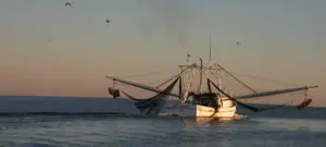
Commercial and recreational fishing industries depend on stable marine ecosystems. Fishermen utilize ocean temperature and salinity data to locate target species efficiently, reducing fuel consumption and operational costs. Furthermore, aquaculture operators rely on early warnings regarding harmful algal blooms (HABs) and hypoxic (low-oxygen) zones to protect harvests from massive die-offs, safeguarding both public health and commercial revenue.
Extreme Weather and Coastal Resilience
While NOAA satellites track major weather systems from above, IOOS stations on the water measure the thermodynamic energy fueling them from below. During hurricane season, data from coastal and deep-water buoys feeds directly into forecast models, giving emergency managers the precise intelligence needed to order timely evacuations and position emergency response assets.
Official Statements & Expert Perspectives
The threat facing America’s ocean observing infrastructure has mobilized conservation groups, former government officials, and marine scientists who view the current budgetary climate with grave concern.
Rachel Brittin, former NOAA Deputy Director of External Affairs and a leading voice in climate and ocean communications with over 25 years of experience, underscores the irreplaceable nature of continuous marine data:
"The ocean never stops changing. We can’t afford to stop watching. When long-running observations end, some of what disappears cannot simply be recovered by turning a sensor back on several years later. Continuous records allow scientists to distinguish short-term shifts from long-term changes and recognize trends that become visible only over decades."
Environmental advocates and institutional partners echo these concerns, pointing out that cutting scientific budgets does not eliminate the underlying environmental risks. Ocean Conservancy, a leading voice in marine advocacy, has issued stark warnings regarding the vulnerability of NOAA appropriations in the upcoming federal budget cycles:
"Cutting ocean observations does not make the hazards disappear. Hurricanes will still cross the ocean. Coastal waters will still flood. Harmful algal blooms will still occur. Ships will still enter ports, fishermen will still head to sea, and people will still need rescuing from the water. We will simply know less about what is happening and have less information to prepare us."
Experts emphasize that dismantling or downsizing these observing networks creates blind spots that ripple outward, affecting inland agricultural sectors, coastal real estate markets, municipal water planning, and national security alike.
Future Outlook: Navigating the Road Ahead
As the United States faces an increasingly volatile environmental landscape marked by extreme weather, sea-level rise, and unpredictable oceanic anomalies like the developing 2026–2027 El Niño, the imperative for robust data collection has never been more acute.
The decisions made by lawmakers during the upcoming Fiscal Year appropriations process will determine whether America maintains its leadership in ocean science or relinquishes its observational capabilities. Reversing investments in IOOS and related NOAA programs would inflict self-harm upon an economy deeply intertwined with the marine environment.
Protecting this vital infrastructure requires a concerted mobilization of policymakers, commercial maritime stakeholders, coastal communities, and engaged citizens. By communicating to elected officials that ocean intelligence is non-negotiable public infrastructure, the public can help ensure that the silent sentinels of the sea remain on watch—securing safer coasts, a more resilient economy, and an informed nation for decades to come.