










Executive Overview
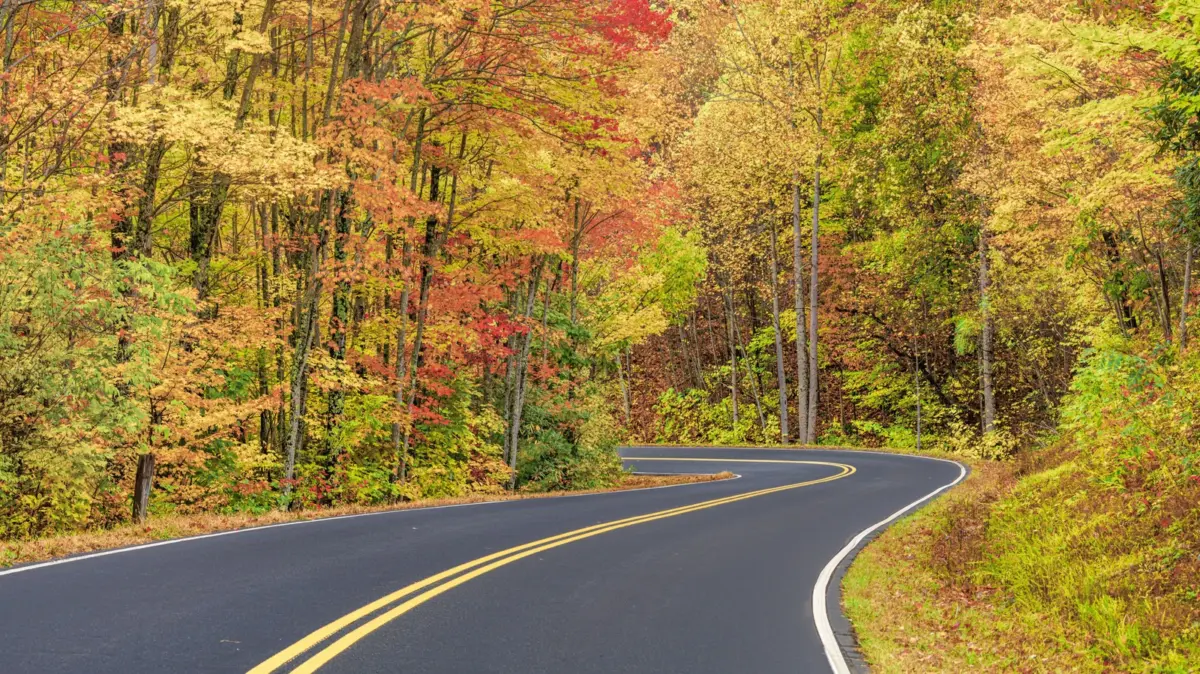
Spanning over 800 square miles of pristine, ancient wilderness across the border of North Carolina and Tennessee, the Great Smoky Mountains National Park stands as America’s most visited national park. Named for the iconic, smoke-like blue fog that perpetually embraces its rolling peaks and deep valleys, this UNESCO World Heritage Site protects one of the world’s most biologically diverse temperate deciduous forests. While millions of visitors hike its legendary trails—such as a celebrated section of the Appalachian Trail—the park also functions as a premier sanctuary for auto-touring enthusiasts.
With 384 miles of meticulously maintained scenic roadways designed largely to keep travel speeds at a leisurely 35 miles per hour or less, the park invites motorists to slow down, disconnect, and immerse themselves in a landscape that has inspired generations of songwriters, poets, and travelers. From the historic, wildlife-rich expanses of Cades Cove to the rugged, high-elevation sweeping vistas of Newfound Gap Road, and from subterranean tunnels on the "Road to Nowhere" to the bone-rattling 4×4 tracks of Parson Branch Road, the park offers an astonishing variety of driving experiences.
This comprehensive journalistic report details the absolute best scenic drives within the Great Smoky Mountains National Park, providing travelers with the historical context, logistical parameters, and geographical insights necessary to curate an unforgettable American road trip.
Detailed Chronology & Historical Evolution of the Park’s Roadways
The roads that weave through the Great Smoky Mountains today are not merely functional paths; they are historical artifacts that trace the complex human footprint of the Appalachian region. Understanding how these routes came to be adds a profound layer of depth to any modern road trip.
Pre-Park Era and Early Settlement
Long before the establishment of the national park in the 1930s, the valleys of the Smokies—most notably Cades Cove and Cataloochee—supported vibrant Appalachian farming communities. Dirt tracks, wagon trails, and logging paths crisscrossed the rugged terrain. Families carved out homesteads, erecting wooden cabins, gristmills, churches, and schoolhouses. Routes like Rich Mountain Road and the paths through Cataloochee were the lifelines of these isolated settlements, connecting families to markets and neighboring communities through grueling mountain passes.
The Civilian Conservation Corps (CCC) and Park Infrastructure
The true genesis of the modern scenic drive in the Great Smokies began with the creation of the national park. Spurred by conservationists, local business leaders, and presidential initiatives, the federal government began acquiring private timberlands and abandoned farms. During the Great Depression, the Civilian Conservation Corps (CCC) and the Public Works Administration deployed thousands of young men to the mountains.
Operating under grueling conditions, these workers hand-cut, graded, and paved many of the park’s foundational arteries, including sections of Newfound Gap Road. Their labor transformed an impenetrable wilderness into an accessible national treasure, balancing the desire for visitor access with the imperative of landscape preservation.

Mid-Century Infrastructure and Modern Realities
As automobile ownership surged in post-World War II America, park visitation skyrocketed. Pavement replaced gravel on major corridors like U.S. 441, and ambitious infrastructure projects—such as the abortive Lakeview Drive ("Road to Nowhere")—attempted to compensate communities displaced by the creation of Fontana Lake. Today, the management of these roadways represents a delicate balancing act. The National Park Service must maintain historic alignments, protect sensitive flora and fauna habitats, and manage millions of vehicles annually while keeping iconic drives safe, accessible, and evocative of a bygone era.
The Master Routes: Detailed Breakdown of the Smokies’ Premier Drives
1. Newfound Gap Road (U.S. 441): The High-Altitude Spine
Stretching 33 miles one-way between Gatlinburg, Tennessee, and Cherokee, North Carolina, Newfound Gap Road is the ultimate paved corridor of the Great Smoky Mountains.
- Geographic Profile: The route climbs steadily from lower elevations, traversing an extraordinary botanical transition. Drivers journey from hardwood forests into dense pine-oak stands, ultimately ascending into damp, cool spruce-fir forests reminiscent of Canadian ecosystems. The road reaches its zenith at Newfound Gap, sitting at an elevation of 5,046 feet.
- Key Highlights: Countless paved pullouts and parking areas offer sprawling mountain vistas. From Newfound Gap, motorists can access Kuwohi Road (formerly Clingmans Dome Road), a steep spur leading to an observation tower perched at 6,643 feet—the highest point in Tennessee.
- Driving Experience: Completely paved and heavily trafficked, this route requires attentiveness, particularly due to rapid weather shifts at higher elevations where fog, ice, and sudden temperature drops are common.
2. Cades Cove Loop Road: History and Wildlife in a Mountain Basin
The 11-mile, one-way Cades Cove Loop Road is arguably the most famous and heavily visited auto-tour in the entire park system.

- Geographic Profile: A wide, verdant valley ringed by towering mountain ridges, Cades Cove is a structural limestone window where ancient rock layers have been eroded to reveal younger formations.
- Key Highlights: The loop is a living history museum. Motorists pass preserved 19th-century structures, including primitive Baptist churches, cantilever barns, historic homesteads, and tranquil cemeteries. Furthermore, the cove is premier wildlife territory; early morning and late evening drives frequently yield sightings of white-tailed deer, wild turkeys, coyotes, and black bears.
- Operational Nuances: Because of its immense popularity, traffic can crawl. To mitigate congestion and promote non-motorized recreation, the National Park Service closes the loop to motor vehicles every Wednesday from May through September, reserving the pavement exclusively for pedestrians and cyclists.
3. Roaring Fork Motor Nature Trail: A Submerged Forest Experience
Located just outside bustling Gatlinburg, the Roaring Fork Motor Nature Trail offers an intimate encounter with the park’s dense interior forests and rushing waters.
- Geographic Profile: This one-way, narrow loop road winds along the roaring waters of the Roaring Fork stream, enveloped by a dense canopy of old-growth trees and lush undergrowth.
- Key Highlights: The route features rushing mountain streams, cascading waterfalls (such as Grotto Falls and Rainbow Falls trailheads nearby), and preserved historic structures like the Noah "Bud" Ogle cabin.
- Driving Experience: The road is tightly winding and heavily canopied, creating a moody, enchanting atmosphere. Trailers and large motorhomes are strictly prohibited due to tight turns and low clearances.
4. Rich Mountain Road: The Quiet Alternative to the Cove
For motorists seeking to escape the bumper-to-bumper traffic of Cades Cove, Rich Mountain Road serves as a serene, under-the-radar alternative.
- Geographic Profile: A 7-mile, one-way gravel road that branches off the Cades Cove Loop Road, climbing steeply up the flank of Rich Mountain.
- Key Highlights: The route offers tranquil drives past mountain streams, fern-carpeted forest floors, and culminates in a magnificent elevated overlook peering down over the entirety of Cades Cove and the Primitive Baptist Church.
- Operational Constraints: Rich Mountain Road is strictly seasonal, open only from April through mid-November. Due to its steep, unpaved, and narrow profile, vehicles exceeding 25 feet in length and any vehicles towing trailers are banned.
5. Cataloochee Valley Scenic Drive: Elk, History, and Remote Isolation
Tucked away in the rugged, southeastern section of the park in North Carolina, Cataloochee Valley rewards adventurous drivers willing to venture off the beaten path.
- Geographic Profile: Accessed via a remote 26-mile roundtrip journey involving gravel roads (Cove Creek Road and Cataloochee Entrance Road), this isolated valley was once home to a thriving mountain community of over 1,200 residents.
- Key Highlights: Visitors can explore remarkably preserved early 20th-century frame houses, a historic schoolhouse, and two churches. Moreover, Cataloochee is the primary release and viewing site for the park’s reintroduced elk population; drivers frequently spot majestic bull elk grazing peacefully in the misty meadows.
- Driving Experience: The approach features narrow, unpaved shelf roads with steep drop-offs and no guardrails, requiring steady nerves and a respectful driving pace.
6. Lakeview Drive (The Road to Nowhere): A Monument to Unfulfilled Promises
Lakeview Drive stands as one of the most uniquely contextualized roads in the National Park system, blending striking natural beauty with political history.
- Geographic Profile: Stretching 8 miles westward from Bryson City, North Carolina, the paved road hugs the northern shore of Fontana Lake before terminating abruptly at a massive concrete tunnel.
- Historical Context: In the 1940s, the federal government acquired thousands of acres of private land along the Little Tennessee River to construct Fontana Dam and Fontana Lake, inundating the old Everett Street Road. The government promised displaced residents a replacement shoreline highway. Construction began, but environmental concerns and engineering disputes halted the project permanently after a single tunnel was bored.
- Key Highlights: Today, the "Road to Nowhere" offers sweeping overlooks of the shimmering sapphire waters of Fontana Lake, deep green valleys, and the distant crests of the Appalachian chain. Hikers also use the tunnel terminus as a gateway into remote backcountry trails.
7. Little River Gorge Road: Serenity Along the Water
Following the natural contours of the Little River, this paved corridor offers an idyllic and accessible driving experience close to the park’s main visitor hubs.

- Geographic Profile: An 18-mile paved route winding between Gatlinburg and Tremont, closely tracking the rushing waters of the Little River.
- Key Highlights: The drive is defined by serene river scenes, boulder-strewn rapids, overhanging rhododendrons, and quiet picnic spots. Wildlife viewing is exceptional here; black bears are frequently spotted foraging along the riverbanks.
8. Little Greenbrier Road: A Woodland Shortcut
Measuring just one mile in length, Little Greenbrier Road is a quiet gravel passage located roughly 20 minutes from Gatlinburg.
- Geographic Profile: A narrow, tree-shaded ribbon of gravel connecting Metcalf Bottoms to the historic Walker Sisters Place.
- Key Highlights: While brief, the drive explodes with colorful wildflowers in the spring and early summer. It serves as the primary vehicular access point for hikers seeking the historic Little Brier Gap trail or Laurel Falls. Large vehicles and towed trailers are strictly prohibited.
9. Parson Branch Road: The Ultimate Off-Pavement Challenge
Reserved strictly for high-clearance four-wheel-drive enthusiasts, Parson Branch Road is frequently cited by automotive adventurers as the most challenging and atmospheric drive in the Smokies.
- Geographic Profile: An 8-mile, one-way gravel track originating near the end of the Cades Cove Loop Road, descending precariously through steep, densely forested terrain.
- Driving Experience: Characterized by multiple unbridged water crossings, sharp switchbacks, and a haunting, cathedral-like silence beneath deep forest canopies, this road demands respect. Following years of storm-related closures and extensive treefall, it has reopened, requiring drivers to exercise extreme caution and verify current road conditions before departure.
Supporting Context & Operational Metrics
To ensure a seamless road trip experience within the Great Smoky Mountains National Park, travelers must be cognizant of critical operational metrics, regulations, and environmental factors:
- Speed Limits & Safety: To protect wildlife and accommodate heavy tourist foot traffic, park speed limits rarely exceed 35 mph and drop significantly lower on secondary gravel roads. Drivers should utilize lower gear ratios when descending steep mountain passes (such as Newfound Gap Road) to prevent catastrophic brake overheating.
- Seasonal Closures: High-elevation routes (like Kuwohi Road) and seasonal gravel paths (such as Rich Mountain Road and Parson Branch Road) are subject to winter closures due to ice, heavy snow, and hazardous road conditions. Always consult the National Park Service’s official road status alerts prior to departure.
- Vehicle Restrictions: Oversized vehicles, commercial buses, and any vehicle towing a trailer are strictly prohibited on narrow, historic byways such as Rich Mountain Road, Roaring Fork Motor Nature Trail, and Little Greenbrier Road.
- Wildlife Etiquette: The park is home to a dense population of black bears and, in designated areas like Cataloochee, reintroduced elk. Federal regulations mandate maintaining a minimum distance of 50 yards (150 feet) from bears and elk at all times. Feeding or approaching wildlife is both illegal and dangerous.
Future Outlook and Conservation Challenges
As the Great Smoky Mountains National Park approaches its centennial milestones, park administrators face complex challenges in managing the tension between increasing visitation and rigorous ecological preservation.
With annual visitor numbers consistently hovering near or above 14 million, vehicular congestion on iconic arteries like Newfound Gap Road and Cades Cove Loop Road has strained parking infrastructure and increased carbon emissions within a protected biosphere. In response, park management is increasingly exploring innovative traffic management strategies, including expanded parking fee programs (such as the mandatory Park It Forward parking tag system introduced in recent years), enhanced visitor education initiatives, and the potential piloting of shuttle services in high-impact zones.

Concurrently, climate change and invasive species—such as the hemlock woolly adelgid devastating native hemlock trees—are altering the visual and botanical tapestry of the forests framing these scenic drives. Despite these pressures, the fundamental mission of the park’s roadways remains steadfast: to provide a contemplative, awe-inspiring passage through a timeless landscape. Whether navigated from the leather seat of a modern touring car, the window of a camper van, or the handlebars of a bicycle, the scenic drives of the Great Smoky Mountains continue to offer a profound communion with the American wilderness.