








Executive Overview
The global maritime shipping industry is facing an invisible operational crisis. As modern merchant vessels grow larger and global supply chains become more tightly wound, the safety of crew, vessels, and billions of dollars in cargo remains tethered to legacy weather forecasting methods. A groundbreaking whitepaper released by ocean data platform Sofar Ocean, titled "The Maritime Weather Forecast Gap Is an Operational Risk," exposes a critical vulnerability in traditional marine meteorology: the industry’s dangerous over-reliance on wave height as the primary metric for assessing sea-state safety.
While standard marine forecasts reliably predict how high waves will be, they frequently fail to resolve complex wave characteristics—specifically wave period and direction. When these variables align unfavorably with a vessel’s unique dimensions, speed, loading condition, and heading, they can trigger catastrophic dynamic phenomena such as parametric and synchronous rolling. The results are often disastrous, leading to severe structural damage, lost shipping containers, and compromised crew safety, even in seas that do not appear outwardly extreme.
This forecasting gap has been severely exacerbated by recent geopolitical shifts. With Houthi rebel attacks in the Red Sea forcing hundreds of vessels to bypass the Suez Canal, commercial shipping has rerouted around the Cape of Good Hope. This detour exposes vessels to some of the most volatile and poorly monitored ocean environments on Earth. Consequently, marine insurers have reported a sharp spike in heavy-weather hull and cargo claims, underscoring the urgent need for a paradigm shift in maritime weather intelligence.
By analyzing recent maritime accidents, including the December 2025 cargo loss incident involving the refrigerated vessel Baltic Klipper, alongside historical container-loss disasters, this investigative report details the mechanics of the maritime weather forecast gap, examines its financial and environmental toll, and charts a course toward a data-driven future for ocean routing.
Detailed Chronology
To understand the systemic nature of the forecast gap, we must analyze the anatomy of recent and historical maritime incidents where standard meteorological forecasts failed to predict hazardous vessel motions.
+-----------------------------------------------------------------------------+
|                          NOTABLE MARITIME INCIDENTS                          |
+------------------------------------+----------------------------------------+
| Incident / Vessel                  | Primary Meteorological Driver          |
+------------------------------------+----------------------------------------+
| Baltic Klipper (Dec 2025)          | Long-period swell (>15s) missed by     |
|                                    | standard forecasts; wave height normal |
+------------------------------------+----------------------------------------+
| CMA CGM G. Washington (2017)       | Resonant rolling in heavy seas; wave   |
|                                    | direction/period misunderstood         |
+------------------------------------+----------------------------------------+
| Svendborg Maersk (2014)            | Extreme parametric rolling in Bay of   |
|                                    | Biscay; high-energy wave spectra gap   |
+------------------------------------+----------------------------------------+
Case Study 1: The Baltic Klipper Incident (December 2025)
In December 2025, the refrigerated cargo vessel Baltic Klipper was transiting off the Isle of Wight, England, carrying high-value temperature-sensitive cargo. Meteorological reports for the English Channel on the day of the incident indicated manageable, non-extreme wave heights. Standard weather routing systems gave the vessel a green light.
However, as the vessel entered the area, it encountered a powerful, long-period swell exceeding 15 seconds. This long-period wave energy, which had traveled across the Atlantic Ocean, was not aligned with local wind patterns. Because standard forecast models failed to accurately resolve this long-period swell, the crew was caught unprepared. The ship experienced violent, rapid rolling, causing a significant portion of its cargo to shift and slide overboard into the English Channel.
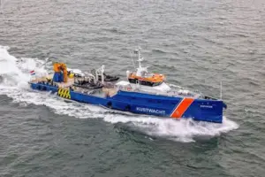
While standard government and commercial forecasts failed to identify the danger, Sofar Ocean’s proprietary forecast model had captured the risk. By utilizing direct, in-situ wave measurements from its global network of drifting ocean buoys, Sofar detected the long-period swell earlier in its propagation path across the Atlantic. This real-time data allowed Sofar to identify the precise threat to the Baltic Klipper more than 48 hours before the incident occurred.
Case Study 2: CMA CGM G. Washington (2017)
The vulnerability of modern container ships to unpredicted wave dynamics is further illustrated by the 2017 incident involving the ultra-large container ship CMA CGM G. Washington in the North Pacific. While transiting in heavy weather, the vessel began rolling violently, reaching heel angles exceeding 20 degrees. The motion caused the collapse of several container bays, resulting in 137 containers being lost overboard and another 85 damaged.
Subsequent investigations revealed that while the general storm system was well-known and tracked by the crew, the standard weather routing software failed to describe the specific wave characteristics—specifically the wave period and direction relative to the ship’s speed and heading—that initiated parametric rolling. The crew had adjusted their course to mitigate wave height, unknowingly placing the ship in a hazardous head-sea condition that triggered resonance.
Case Study 3: Svendborg Maersk (2014)
One of the most severe container-loss incidents in maritime history occurred in February 2014, when the Svendborg Maersk encountered severe weather in the Bay of Biscay. The vessel was subjected to extreme rolling, estimated to have reached 30 to 40 degrees. The violent motion resulted in the loss of over 500 containers overboard, with hundreds more severely damaged.
The weather systems in the Bay of Biscay were well-documented in advance, and the crew expected rough seas. However, the critical gap was the lack of precise data regarding the wave energy spectrum. The ship encountered a complex, "crossed" sea state where wind waves and a heavy swell met at an angle, creating short, steep waves that matched the natural roll period of the heavily laden container ship. The legacy forecast products utilized by the fleet routing office could not resolve these overlapping wave systems, leaving the master without the critical insights needed to alter course in time.
Supporting Context & Metrics
The Physics of Vessel Motion: Why Wave Height Deceives
To understand why standard forecasts fail, one must examine the hydrodynamic forces acting on a ship. A vessel at sea is subjected to six degrees of freedom: translation (surge, sway, heave) and rotation (roll, pitch, yaw). Among these, roll is the most dangerous to cargo stability and structural integrity.
Standard marine forecasts rely heavily on Significant Wave Height ($H_s$), which represents the average height of the highest one-third of waves. While $H_s$ is a useful metric for general sea-state severity, it is mathematically blind to the distribution of wave energy.
Standard Forecast Focus:
[Wave Height Only] ----> Ignores Wave Period & Direction ----> Risk of Parametric Rolling

Advanced Sensor Focus:
[Full Wave Field (Height + Period + Direction)] ----> Resolves Wave Energy ----> Safe Routing
Two distinct sea states can share an identical significant wave height of 4 meters, yet present entirely different operational realities:
- Sea State A: Created by local, short-period wind waves (period of 6 seconds). The waves are steep and choppy, but their short duration prevents the vessel from building up rolling momentum.
- Sea State B: Dominated by a distant, long-period swell (period of 16 seconds). The waves appear gentle and rounded, but their long period matches the natural resonant roll period of a large container ship or reefer. This triggers synchronous rolling or, if sailing in head or following seas, parametric rolling—a phenomenon where rolling angles accelerate exponentially within a few wave cycles, quickly exceeding safe limits.
Without precise, real-time data on wave period ($T_p$) and wave direction ($theta$), weather routing algorithms are forced to make assumptions. When these assumptions are wrong, ships are routed directly into invisible zones of resonance.
The Geopolitical Multiplier: The Cape of Good Hope Rerouting
The operational risk posed by the maritime forecast gap has escalated due to geopolitical instability. Following continuous attacks on commercial shipping in the Red Sea corridor, a vast majority of ocean carriers have abandoned the Suez Canal route, opting instead for the lengthy detour around the Cape of Good Hope.
                     Suez Canal Route (Disrupted)
                       /
               Mediterranean Sea            Red Sea (High Risk)
                                             /
                    Cape of Good Hope Route (Detour)
                       /
            Exposure to Southern Ocean     Extreme Swells & Claims Spike
This detour has fundamentally altered the risk profile of global shipping:
- Exposure to Harsh Environments: The waters off South Africa and the Southern Ocean are notorious for some of the most violent sea states on earth, characterized by strong currents (such as the Agulhas Current) interacting with massive, long-period swells propagating from the Antarctic.
- Spike in Claims: In September 2025, the International Union of Marine Insurance (IUMI) reported that heavy-weather cargo and hull claims had "spiked" globally. This surge was directly linked to the Red Sea rerouting, as vessels designed for calmer transit routes were forced to navigate weather-exposed southern latitudes.
- Rise in Hull Damage: The Nordic Association of Marine Insurers (Cefor) also documented a significant rise in heavy-weather hull claims. Cefor highlighted that vessels transiting these high-exposure routes suffer from reduced operational visibility, as legacy forecasting infrastructure (such as coastal radar and wave buoy networks) is virtually non-existent in vast stretches of the South Atlantic and Indian Oceans.
The Observation Deficit
The root cause of the forecasting gap is a lack of physical data. Numerical weather prediction (NWP) models, such as those run by NOAA or the European Centre for Medium-Range Weather Forecasts (ECMWF), rely heavily on satellite altimetry to estimate wave heights across the open ocean.
However, satellites only provide snapshots of the ocean surface and struggle to accurately resolve wave period and direction, especially in complex, multi-directional sea states. Traditional mooring buoys, which collect highly accurate in-situ wave data, are almost exclusively deployed close to the coastlines of North America and Europe. The open oceans—where international cargo vessels spend the majority of their transits—remain data deserts.
Official Statements
The findings detailed in the Sofar Ocean whitepaper have sparked intense discussion among maritime safety experts, weather routing specialists, and marine underwriters.
Jessica Topal, Senior Routing Specialist at Sofar Ocean, emphasized that the maritime industry must move beyond its historic focus on wave height to truly mitigate risk:
"Wave height is only part of what we look at when assessing risk. The timing and direction of the waves, together with the vessel’s heading and speed, determine how the ship will actually respond. Two sea states with the same wave height can create very different conditions onboard. If we do not account for the full wave spectrum, we are sending ships out with a massive blind spot."
Underwriters have also expressed alarm over the rising financial toll of heavy-weather incidents. Representatives from the International Union of Marine Insurance (IUMI) noted during their fall conference that the industry is seeing a convergence of negative factors:
"The forced rerouting of vessels around the Cape of Good Hope has exposed fleets to severe ocean environments that are historically under-monitored. The subsequent spike in heavy-weather hull and cargo claims is a direct symptom of this exposure. Shipowners can no longer rely on standard, generalized forecasts when navigating these high-risk transit zones."
Furthermore, safety investigators analyzing cargo loss incidents have pointed out that existing Safety Management Systems (SMS) onboard vessels are often deficient because they rely on subjective assessments of sea conditions by the crew, rather than objective, sensor-derived wave data.
Future Outlook
To close the maritime weather forecast gap and protect global supply chains, the shipping industry must transition from static, model-derived weather routing to dynamic, observation-led voyage optimization.
1. Scaling In-Situ Ocean Sensor Networks
The only way to improve the accuracy of wave period and direction forecasts is to dramatically increase the volume of real-time, in-situ ocean observations. Distributed sensor networks, such as Sofar Ocean’s global fleet of Spotter buoys, are bridging this gap. These compact, solar-powered smart buoys drift across the open ocean, constantly measuring wave height, period, direction, and wind. By assimilation of this real-time data into numerical wave models, forecast errors for wave period and direction can be reduced by up to 50%, providing routing coordinators with the high-fidelity data needed to avoid resonant conditions.
[Real-Time Spotter Buoys] ---> [Data Assimilation into NWP Models] ---> [50% Reduction in Forecast Error] ---> [Dynamic Route Optimization]2. Integration of Vessel-Specific Hydrodynamic Modeling
Future weather routing software must move away from "one-size-fits-all" hazard alerts. Instead, routing platforms must integrate the physical characteristics of individual vessels, including:
- Natural Roll Period: Calculated dynamically based on the vessel’s current metacentric height (GM) and draft.
- Vessel-Wave Response Amplitude Operators (RAOs): Numerical models that predict how a specific hull design will pitch, roll, and heave when subjected to waves of varying periods and directions.
- Dynamic Speed and Heading Adjustments: Real-time routing engines that calculate safe operational envelopes, advising masters on exact speed reductions or minor heading changes required to break the cycle of parametric resonance.
3. Regulatory and Insurance Pressures
As the financial and environmental costs of container losses continue to climb, regulatory bodies like the International Maritime Organization (IMO) and marine insurers are likely to mandate stricter guidelines. The IMO has already issued revised guidance on preventing parametric rolling (such as MSC.1/Circ.1627), but these are currently non-mandatory.
In the coming years, marine underwriters may begin conditioning hull and machinery coverage on the use of advanced weather routing services that utilize real-time, in-situ ocean data. Ships equipped with onboard decision support systems that actively monitor and predict resonant rolling will likely benefit from preferential premium rates, transforming weather intelligence from an operational luxury into a regulatory and financial necessity.
Ultimately, the lesson of the Baltic Klipper and similar incidents is clear: the oceans are not getting any calmer, and shipping routes are not getting any simpler. To protect lives, vessels, and cargo in an increasingly volatile world, the maritime industry must close the forecast gap, looking beyond the simple height of the waves to understand the true, complex nature of the sea.