










Executive Overview
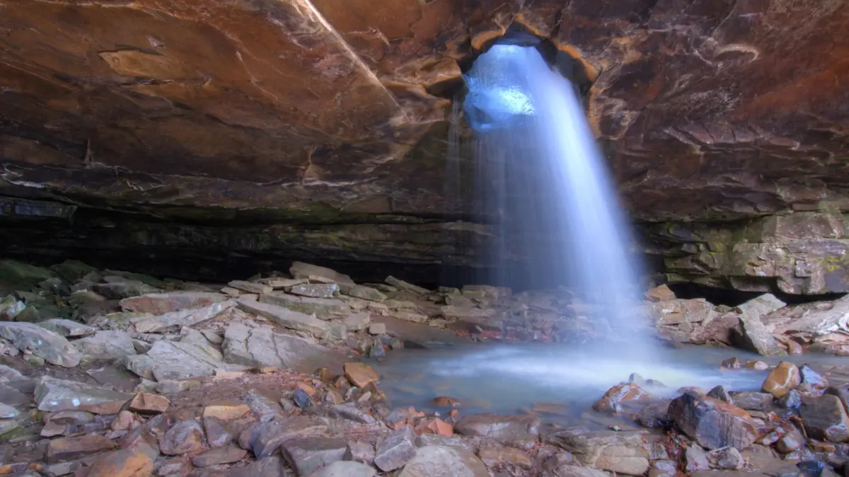
Tucked deep within the rugged, undulating terrain of the Ozark-St. Francis National Forest in northwestern Arkansas lies one of the most geographically fascinating and visually stunning natural spectacles in the American interior: the Glory Hole Waterfall Trail. While the Ozark Mountains are virtually saturated with seasonal and year-round cascades, few match the unique hydrological and geological eccentricity of Glory Hole Falls. Spanning a modest yet challenging out-and-back route of just over two miles, this hidden gem delivers an unforgettable backcountry experience, culminating in a jaw-dropping natural phenomenon where a stream plunges some 30 feet through a solid rock ceiling into a sandstone grotto below.
Referred to affectionately by outdoor enthusiasts as one of the state’s most recognizable natural landmarks—and playfully dubbed by internet communities as the "worst named waterfall in America"—Glory Hole Falls is a masterclass in erosion and geological patience. Over millennia, the relentless flow of water carved a massive, circular opening directly through the roof of an overhanging rock shelter, creating a portal through which cascading water pours like an inverted fountain.
Despite its growing renown among hikers, photographers, and weekend explorers, the trail retains an authentic, uncommercialized backcountry character. There are no paved walkways, visitor centers, gift shops, or modern restrooms at the trailhead; instead, visitors are greeted by a humble roadside pull-off, dense pine and hardwood forests, and a rugged trail that demands respect. As outdoor tourism continues to surge across Arkansas, understanding the logistics, seasonal dynamics, ecological nuances, and safety considerations of the Glory Hole Waterfall Trail has never been more critical for adventurous travelers seeking a genuine immersion in America’s untamed wilderness.
Detailed Chronology: A Geological Evolution and Modern Trail History
Formative Millennia: The Creation of the Grotto
To truly appreciate the Glory Hole Waterfall Trail, one must look far beyond human history to the geological forces that forged the landscape. Millions of years ago, the region that is now northwestern Arkansas was submerged under shallow ancient seas, laying down thick layers of sedimentary rock, specifically the sandstone, limestone, and shale that make up the Ozark Plateau.
As tectonic forces uplifted the region, rivers and streams began cutting through the plateau, creating deep V-shaped valleys, dramatic bluffs, and intricate cave systems. Glory Hole Falls—historically fed by an unnamed tributary of Dismal Creek—offers a textbook example of stream piracy and headward erosion. Over countless centuries, a meandering stream looped back upon itself across a narrow neck of a ridge, driving water directly over an underlying, softer layer of rock protected by a harder sandstone capstone.
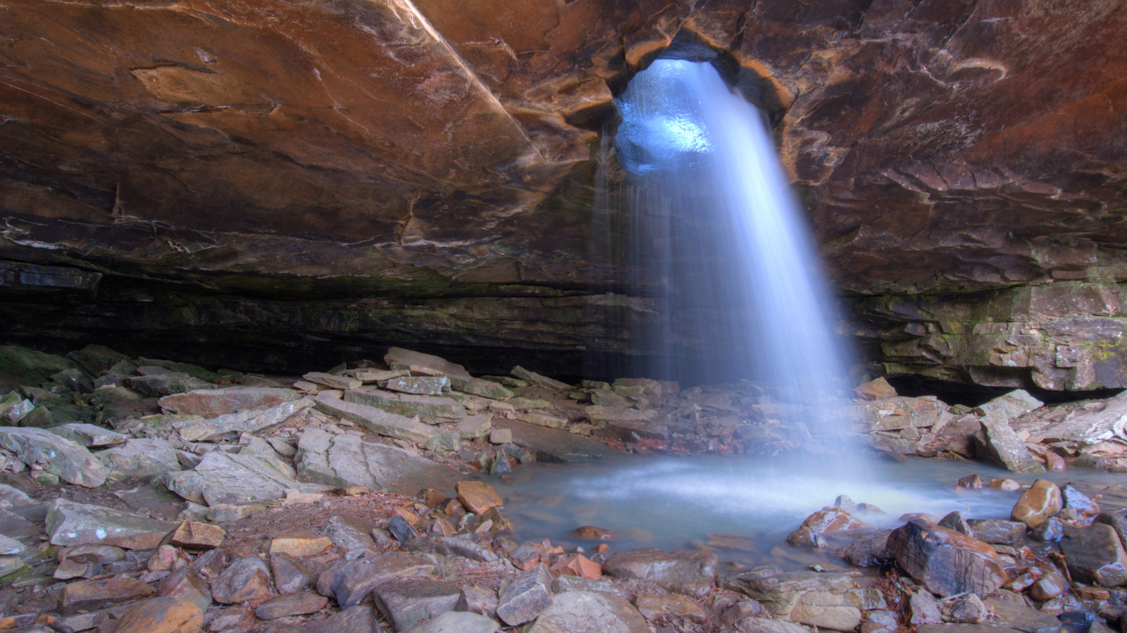
Instead of merely sliding over the edge of a traditional cliff face, the plunging water concentrated its erosive power into a concentrated vortex, boring straight through the thin roof of a massive rock shelter. This rare geological anomaly created the signature "glory hole"—a natural skylight through which water drains before pooling in the sheltered grotto below.
Discovery and the Advent of Modern Recreation
For generations, the waterfall remained a well-guarded secret known primarily to local loggers, hunters, and native Ozark residents. Long before the establishment of the national forest system, the rugged topography of the Dismal Creek Special Interest Area kept casual travelers at bay.
With the formal designation of the Ozark-St. Francis National Forests in the 20th century, the federal government began protecting these watersheds, though infrastructure development prioritized timber management and basic fire access over recreational trail systems. Consequently, Glory Hole Falls developed organically through word-of-mouth among regional hiking clubs and backpacking enthusiasts.
As digital mapping tools, hiking apps like AllTrails, and social media platforms democratized geographic information in the 21st century, the trail transformed from an obscure local legend into a bucket-list destination for nature lovers nationwide. Despite this influx of digital visibility, the trail’s physical infrastructure has remained intentionally rustic, preserving its raw backcountry appeal while challenging land managers to balance conservation with surging visitor numbers.
Supporting Context & Metrics: Navigating the Numbers and Geography
Understanding the physical parameters of the Glory Hole Waterfall Trail is essential for planning a safe and rewarding excursion. Below is a detailed breakdown of the trail’s core metrics, geographical coordinates, and logistical benchmarks:
| Parameter | Metric / Detail |
|---|---|
| Total Trail Distance | Approximately 1.8 to 2.2 miles out-and-back |
| Elevation Gain | Roughly 475 to 500 feet |
| Trail Difficulty Rating | Moderate (AllTrails) to Fairly Difficult (Arkansas State Parks) |
| Average Completion Time | 1 to 2 hours |
| Primary Geographic Feature | 30-foot plunge waterfall through a sandstone grotto ceiling |
| Surrounding Landmass | Ozark-St. Francis National Forest (over 1 million acres) |
| Nearest Communities | Jasper, AR (approx. 45-minute drive); Springfield, MO (approx. 2.5-hour drive) |
| Trailhead Location | Just off Highway 16, within the Dismal Creek Special Interest Area |
| User Ratings | 4.7 out of 5 stars (averaged across major hiking review platforms) |
The Trailhead and Approach
Located just off Arkansas Highway 16, the trailhead can present an initial navigational hurdle for first-time visitors. There are no grand entrance arches, paved parking lots, or prominent signboards. Instead, travelers must rely on precise GPS coordinates or look closely for a modest gravel pull-off on the side of the highway.
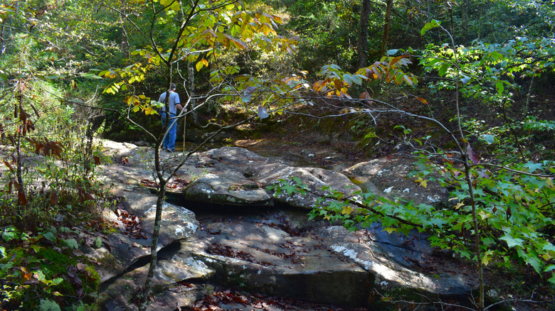
From the moment hikers step off the roadside, the trail immediately plunges into a dense canopy of mixed pine and hardwood forests. The first half of the hike is characterized by a steady, undulating descent toward the stream bed, crossing minor feeder creeks and navigating rocky terrain framed by ancient moss-covered boulders and exposed tree roots. Because the hike to the waterfall is predominantly downhill, returning to the trailhead requires a sustained, sometimes grueling uphill climb on tired legs—a factor that surprises many unprepared visitors who underestimate the return journey’s 500-foot elevation gain.
Official Statements and Expert Perspectives
Land management agencies, outdoor conservationists, and seasoned hikers all offer critical insights into experiencing the Glory Hole Waterfall Trail responsibly. Because the area operates under a primitive backcountry model, official communication emphasizes self-reliance, safety, and environmental stewardship.
Representatives from Arkansas State Parks have frequently highlighted the site as a premier example of the state’s diverse geological heritage, categorizing the route as "fairly difficult" primarily due to the steep return climb and uneven, rock-strewn path. State conservation officials emphasize that visitors must exercise extreme caution near the cliff edges:
"The beauty of the Ozarks lies in its wild, untamed nature. When visitors venture to formations like Glory Hole Falls, they are stepping into an environment devoid of guardrails and artificial safety barriers. Respect for the sheer drops, slick sandstone surfaces, and rapidly changing weather conditions is paramount to ensuring a safe trip."
Experienced wilderness guides and community reviewers on platforms like AllTrails and Google Maps echo these sentiments, consistently awarding the trail a stellar 4.7-star rating while offering practical warnings about seasonal variances. One prominent trail reviewer noted:
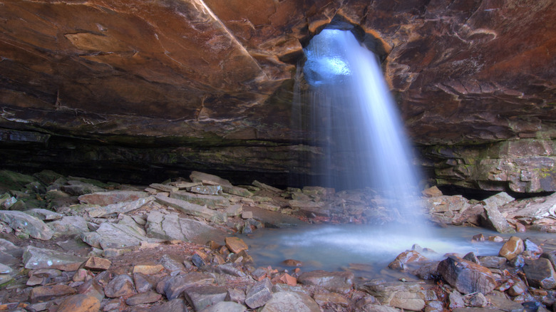
"The waterfall can range from a majestic, roaring torrent after heavy spring rains to a gentle, weeping mist during dry summer months. Regardless of the water volume, the architecture of the grotto itself—the way the light filters through the hole in the cliff ceiling—makes the journey entirely worthwhile every single time."
Additionally, local search-and-rescue organizations frequently remind the public that cell phone service in the remote hollows of the Ozark-St. Francis National Forest is notoriously unreliable. Officials urge hikers to download offline maps, carry physical compasses or GPS units, and inform a trusted third party of their itinerary before setting out into the backcountry.
Future Outlook: Balancing Tourism, Conservation, and Access
As ecotourism continues to expand across the American South, natural treasures like the Glory Hole Waterfall Trail face a delicate balancing act between public accessibility and ecological preservation. The surge in popularity driven by digital media has introduced thousands of new visitors to northwestern Arkansas, bringing both economic vitality to nearby gateway communities like Jasper and mounting environmental pressure on fragile forest ecosystems.
Environmental Stewardship and Leave No Trace Principles
The immediate area surrounding the waterfall is ecologically sensitive. The damp microclimate of the sandstone grotto supports specialized mosses, ferns, and amphibian populations that are easily disrupted by foot traffic outside designated paths. Littering, soil compaction from unauthorized social trails, and erosion along the steep creek banks pose ongoing challenges for the U.S. Forest Service, which manages the land with limited resources.
In response, regional conservation groups are increasingly advocating for enhanced "Leave No Trace" education. Future outlooks suggest that land managers may need to implement formal visitor management strategies—such as designated parking areas, clearer trailhead demarcation, and structured volunteer maintenance programs—to prevent trail degradation without stripping away the authentic wilderness experience that draws travelers to the Ozarks in the first place.
The Four-Season Appeal
Looking ahead, the seasonal appeal of the Glory Hole Waterfall Trail ensures its status as a year-round destination. While spring remains the peak season for roaring water volumes and vibrant wildflower blooms, winter has rapidly gained favor among landscape photographers and solitude seekers. During freezing winter snaps, the cascading water often freezes in mid-air, forming colossal ice columns that resemble giant, frozen chandeliers hanging from the grotto’s stone ceiling. Coupled with bare deciduous trees that open up sweeping panoramic views of the surrounding valleys, the colder months offer an entirely distinct, ethereal perspective of the Ozarks.
Whether visited during the lush green explosion of April, the blazing amber canopy of October, or the frosty stillness of January, the Glory Hole Waterfall Trail stands as a testament to the quiet majesty of the American national forest system—a rugged, unfiltered sanctuary where water, stone, and time intersect in breathtaking fashion.