


Executive Overview
Curaçao stands as one of the premier jewels of the southern Caribbean. Famed for its dramatic natural landscapes, favorable geographic positioning south of the traditional hurricane belt, and a rich, vibrant culture that marries Dutch colonial heritage with Caribbean warmth, the island has evolved into a premier cruise destination. Offering an eclectic mix of pristine white-sand beaches, UNESCO World Heritage-listed architecture, and dynamic culinary traditions, Curaçao delivers an exceptional dual experience of effortless relaxation and deep historical exploration for travelers.
At the heart of this maritime hub is the Curaçao Cruise Port, situated in the historic capital city of Willemstad. The port acts as the primary gateway to the island’s diverse attractions, seamlessly accommodating some of the largest cruise ships afloat alongside intimate luxury liners. To ensure a seamless embarkation and disembarkation experience, this comprehensive guide examines the port’s infrastructure, terminal layouts, logistical operations, parking facilities, and nearby points of interest. Whether you are planning a first-time port call or returning to discover more of the Dutch Caribbean, understanding the layout and amenities of Willemstad’s maritime terminals is the key to maximizing your time ashore.
Port Location, Terminals, and Infrastructure
Geographic Context and Layout
Curaçao is an autonomous country within the Kingdom of the Netherlands, located approximately 40 miles off the coast of Venezuela. The island’s cruise operations are concentrated entirely within Willemstad, the capital city resting on the southern coast.

Willemstad is naturally bisected by a deep-water harbor known as St. Anna Bay (Sint Annabaai). This natural waterway divides the city into two distinct historic and commercial districts: Punda on the eastern side and Otrobanda on the western side. The Curaçao Cruise Port utilizes two main terminal areas, both strategically positioned on the Otrobanda side to provide rapid pedestrian and vehicular access to the city’s core.

The Terminals: Mega Pier vs. Mathey Wharf
The port infrastructure is divided into two primary docking areas, each serving different vessel capacities and operational requirements:

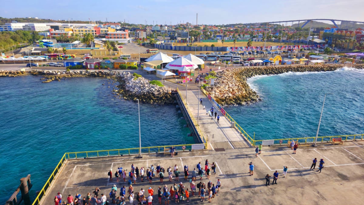
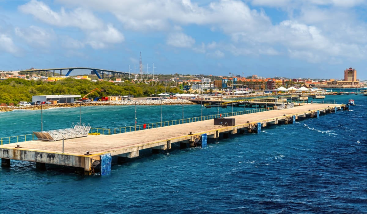
- Mega Pier Cruise Terminal (Mega Cruise Dock): Opened in November 2017, the Mega Pier extends directly from the coast of Otrobanda into the open waters of the Caribbean Sea, just west of the St. Anna Bay entrance. Featuring two simultaneous berths—Mega Pier 1 (150 meters, accommodating vessels up to 150,000 gross tons) and Mega Pier 2 (200 meters, engineered for mega-ships up to 225,000 gross tons, including Royal Caribbean’s massive Oasis-class ships)—this terminal is the primary arrival point for modern cruise fleets.
- Mathey Wharf Cruise Terminal: Unlike the projecting jetties of the Mega Pier, Mathey Wharf allows ships to berth directly along the western channel wall of St. Anna Bay, near the landmark Koningin Julianabrug (Queen Juliana Bridge). While structurally smaller, Mathey Wharf routinely hosts full-sized cruise ships that navigate northward up the St. Anna Bay channel to turn around in the expansive Schottegat Bay before heading back out to open water.
Terminal Facilities and Passenger Services
While the Mega Pier Terminal is the larger and more heavily trafficked facility, both locations offer essential amenities designed to facilitate a smooth transition from ship to shore:

- Security and Customs: Fast-track security and customs desks are operational during all ship calls.
- Information Booths: Multi-lingual tourist information booths distribute complimentary city maps and transit guides.
- Retail and Refreshments: Tented zones near the piers house local souvenir stands, craft vendors, and food-and-beverage kiosks.
- Connectivity: Both terminals provide 30 minutes of complimentary Wi-Fi access. Beyond this window, credit card authentication is required for continued usage, though travelers can bypass fees by visiting nearby establishments such as the Starbucks located 0.2 miles away on Baden Powellweg, or utilizing Willemstad’s municipal public Wi-Fi hotspots.
- Accessibility: Clean, well-maintained, and fully accessible washroom facilities are located within walking distance of all berths.
Logistics, Ground Transportation, and Parking
Arriving from Hato International Airport (CUR)
For fly-cruise passengers or those meeting a vessel mid-voyage, Curaçao’s Hato International Airport (CUR) is located approximately 7.5 miles northwest of the cruise terminals.

- Transit Time: Average driving time is 20 minutes, though peak traffic hours can extend this duration.
- Taxis: Official airport taxis operate on fixed zones, charging between $25 and $35 for a one-way trip to the port.
- Shuttles: Pre-booked private transfers via services like the Curaçao Airport Shuttle average roughly $15 per person.
Driving Directions from the Airport
Travelers who rent a vehicle at Hato International Airport can easily navigate to the cruise port via straightforward arterial roads:

- Exit the airport onto F.D. Rooseveltweg.
- Follow signs toward Willemstad/Otrobanda, merging onto Autobusweg or Schottegatweg.
- Follow coastal and port signage guiding vehicles toward the Otrobanda waterfront and the Mega Pier service roads.
Parking Regulations at the Terminals
Neither the Mega Pier nor Mathey Wharf offers long-term parking for personal or rental vehicles. However, both terminals feature clearly marked drop-off, pickup, and designated taxi loading zones.

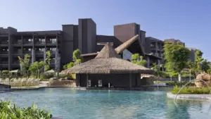
For visitors renting a vehicle to explore the city, secure parking is available in the large outdoor lot adjacent to the Renaissance Wind Creek Resort and Mall, located just 0.2 miles from the Mega Pier and 0.5 miles from Mathey Wharf. Single-day parking is often complimentary for patrons, while overnight and extended tourist rates range from $10 to $30 depending on seasonal demand.

Ground Transportation Options Available at the Piers
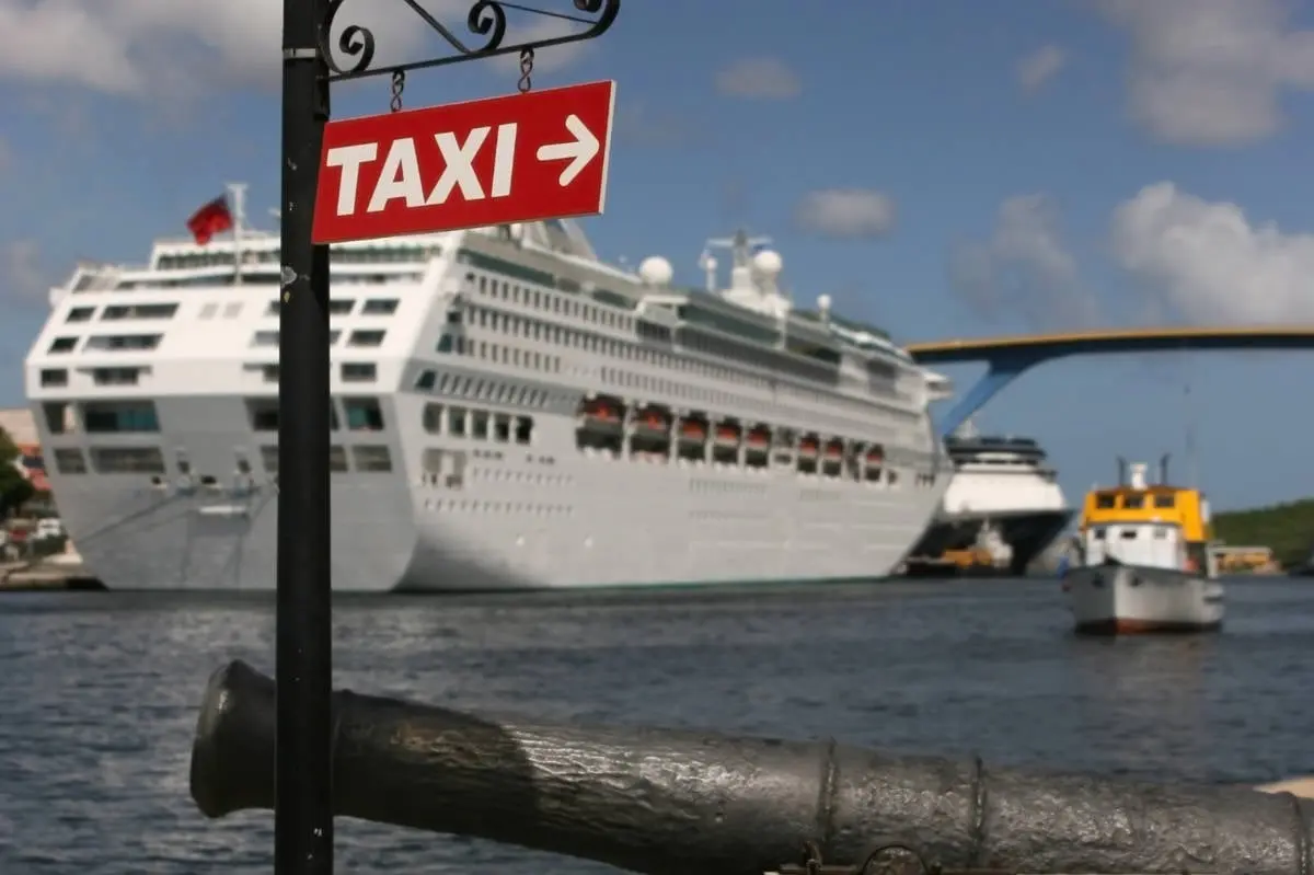
- Taxis: Taxis operate on a first-come, first-served basis from dedicated stands at each terminal. Fares are regulated and charged per vehicle rather than per passenger, with typical city or beach fares ranging from $10 to $35. Popular operators include Friendly Taxi Curaçao and Dushi Taxi. Note: Rideshare applications like Uber and Lyft do not operate on the island.
- Private and Tour Shuttles: Reserved shore excursion shuttles pick up passengers directly outside the terminal gates. Independent shuttle services to major Willemstad destinations generally cost around $20 per person.
- Public Buses (Konvoiis): While there are no bus stops directly on port property, local minibuses operate routes from central city hubs to outlying towns like Sint Michiel and Tera Kora. Fares are approximately $2 USD equivalent, payable exclusively in the local currency, the Antillean Guilder (ANG).
Major Cruise Lines Calling at Curaçao
The island’s robust maritime infrastructure routinely attracts the world’s leading cruise brands. Major lines featuring regular or seasonal calls at Willemstad include:

- Royal Caribbean International (frequently deploying Oasis and Quantum-class vessels to the Mega Pier)
- Carnival Cruise Line
- Celebrity Cruises
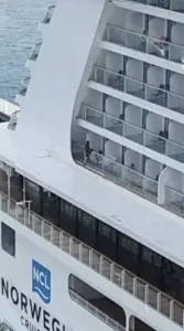
- Norwegian Cruise Line
- Princess Cruises
- Disney Cruise Line
- MSC Cruises
- Holland America Line
- Luxury and Expedition Lines such as Silversea, Seabourn, Regent Seven Seas, and Oceania Cruises.
Weather Patterns and the Best Time to Visit
Curaçao enjoys a warm, semi-arid tropical climate year-round, making it a dependable port of call in any season.

- Dry Season (January to April): Characterized by minimal rainfall and steady trade winds, this period marks the peak tourism season. Temperatures hover comfortably in the mid-80s°F (29°C).
- shoulder and Wet Seasons (May to December): Brief tropical showers can occur, though total precipitation remains lower than in other parts of the Caribbean.
Hurricane Season Context: Official Atlantic hurricane season runs from June 1 to November 30. However, Curaçao’s geographic location well south of the primary Caribbean hurricane belt makes direct tropical storm strikes historically rare, ensuring high itinerary reliability for cruise lines.

Shore Excursions and Nearby Attractions
Beaches Within Easy Reach
- Mambo Beach (3 miles from port): Also known as Aquarium Beach, this family-friendly, man-made destination features a protective offshore breakwater creating calm swimming conditions. Amenities include beach volleyball courts, public restrooms, and the vibrant Mambo Beach Boulevard boardwalk filled with restaurants and boutiques. (Admission fee: ~$3.50; lounger rentals: ~$4).
- Kokomo Beach (3.5 miles from port): A popular free-access beach featuring daybed rentals, on-site dining, a dive shop, and the iconic Instagram-worthy submerged swing set.
- Blue Bay Beach / Blauwbaai (10 miles from port): Famed for crystal-clear waters, prime snorkeling, and palm-shaded sands. Non-resort guests pay an entrance fee of approximately $12.
Within Walking Distance of the Port
- Queen Emma Bridge: Known affectionately by locals as the "Swinging Old Lady," this historic pontoon bridge built in 1888 links Otrobanda and Punda across St. Anna Bay. Operational Note: Travelers should verify bridge status prior to visiting, as the structure undergoes periodic scheduled maintenance and refitting.
- Rif Fort: Located 0.3 miles from the Mega Pier, this 1828 fortification was originally built to protect the Dutch colony from pirates and hostile fleets. Today, it houses restaurants, cafes, and open-air shopping plazas integrated into the Renaissance Mall.
- Kura Hulanda Museum: Situated less than a mile from the terminals, this world-class cultural center features provocative exhibits documenting the trans-Atlantic slave trade and African heritage in the Dutch Caribbean.
Island-Wide Highlights (Short Taxi or Excursion Required)
- Curaçao Sea Aquarium (3 miles): A unique open-water marine park connected directly to the Caribbean Sea, offering interactive stingray encounters and flamingo feeding stations.
- Hato Caves (7 miles): Ancient limestone caverns featuring dramatic stalactites, stalagmites, and preserved indigenous petroglyphs dating back 1,500 years.
- Christoffel National Park (18 miles): The island’s largest national park, offering rugged hiking trails, biodiversity, and open-air Jeep safari tours up Mount Christoffel.
Culinary Scene and Duty-Free Shopping
Dining Near the Port
Willemstad’s culinary landscape mirrors its multicultural history, blending Dutch, African, and Caribbean influences:

- Gouverneur de Rouville: Situated 0.5 miles from the port, offering traditional Dutch-Caribbean fusion dishes and panoramic outdoor views of St. Anna Bay.
- The Pen: Located 0.7 miles away at the Avila Beach Hotel, specializing in fresh local seafood served in an open-air, beachside setting.
- The Pancake Sensation: Located less than a 10-minute walk from either terminal, serving authentic Dutch pannenkoeken, waffles, and casual daytime fare.
Shopping Destinations
- Renaissance Mall: Located adjacent to Rif Fort, offering high-end designer labels, local artisan boutiques, and luxury goods in a historic setting.
- Punda Historic District: Accessible via the Queen Emma Bridge, Punda serves as the island’s primary duty-free shopping sector. Historic storefronts house international jewelers, watchmakers, and the legendary Penha Duty-Free department store, operating continuously since 1708.
Frequently Asked Questions (FAQs)
Is Curaçao walkable from the cruise port?
Yes. Both the Mega Pier and Mathey Wharf terminals sit on the immediate perimeter of Willemstad’s Otrobanda district, allowing visitors to easily walk to downtown shops, historic forts, and pedestrian bridges.

Where exactly do cruise ships dock in Curaçao?
Ships dock in Willemstad at one of two main terminal complexes: the Mega Pier Cruise Terminal (handling the largest vessels in the Caribbean) or the Mathey Wharf Cruise Terminal located within the St. Anna Bay inlet.

What is the closest beach to the Curaçao cruise port?
Mambo Beach is the closest major beach destination, located approximately 3 miles southeast of the cruise terminals and easily accessible via a 10-minute taxi ride.