





Executive Overview
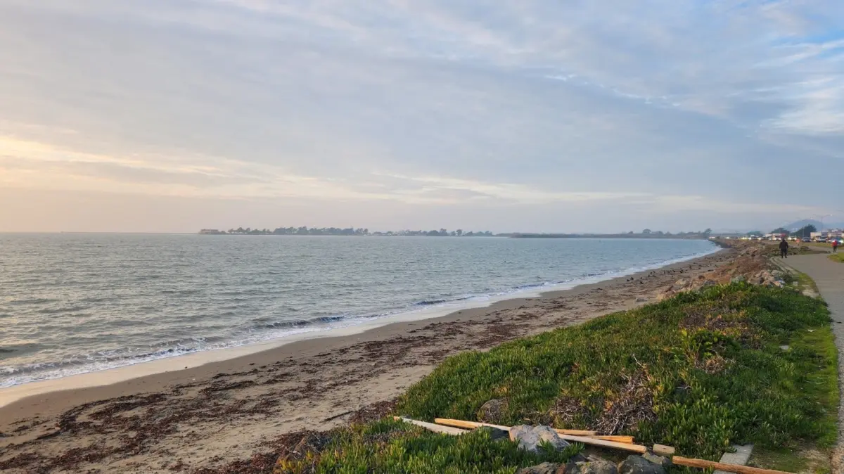
Nestled along the dynamic edge of the San Francisco Bay, just a 30-minute commute from downtown San Francisco, lies a triumphant testament to grassroots environmental activism and urban ecological restoration: McLaughlin Eastshore State Park (officially designated as McLaughlin Eastshore State Park State Seashore). Spanning an impressive 8.5 miles of prime waterfront real estate from Richmond down to the Bay Bridge in Oakland, this protected coastal green space offers sweeping, unobstructed vistas of the Golden Gate Bridge, the San Francisco-Oakland Bay Bridge, the Richmond-San Rafael Bridge, and the iconic San Francisco skyline.
Today, the park serves as a vital recreational hub and a flourishing wildlife refuge where tidal marshes, restored meadows, and wetlands echo with the calls of blackbirds, plovers, and finches. However, the serene landscape experienced by modern visitors—who utilize the area for walking, running, cycling, and bird-watching—belies a tumultuous, nearly century-long history.
For decades, this stretch of the East Bay shoreline was not a sanctuary, but a dumping ground. Often referred to historically as "The Berkeley Flats," the land was an unappealing, foul-smelling expanse composed of construction debris, discarded automobiles, tires, and sprawling municipal landfills like the infamous Berkeley Dump. Between the 1960s and 1980s, millions of tons of waste were systematically dumped directly into the bay.
Despite its degraded condition, developers eyed the prime bayfront acreage in the 1980s with lucrative commercial ambitions, proposing massive real estate developments including twin 18-story hotels. Had it not been for a relentless, five-decade campaign spearheaded by visionary local conservationists—most notably the late Sylvia McLaughlin—this critical shoreline would have been paved over and privatized. Formally designated as a state park in 2002, McLaughlin Eastshore now stands as a premier example of industrial land reclamation, proving that even the most severely blighted urban coastlines can be successfully healed and returned to the public trust.
Detailed Chronology: From Industrial Dump to Protected State Seashore
The evolution of McLaughlin Eastshore State Park is a masterclass in civic perseverance. Understanding how a toxic industrial wasteland became a treasured state park requires tracing a timeline defined by heavy industry, unchecked urban expansion, relentless grassroots opposition, and ultimate legislative victory.
Pre-Development and the Era of Bay Fill (Early to Mid-20th Century)
For generations, the shallow waters and mudflats of the East Bay shoreline were viewed by local municipalities and commercial interests not as a fragile ecosystem, but as an expendable resource. As the surrounding populations in Alameda and Contra Costa counties boomed following the Second World War, the bayfront became a convenient receptacle for the region’s refuse.
Between the 1960s and the 1980s, the practice of bay filling reached a frantic pace. Millions of cubic yards of construction debris, soil, rubble, and domestic garbage were pushed into the shallows to artificially expand the shoreline. Landfills, most notably the expansive Berkeley Dump, operated with few environmental constraints, transforming the muddy fringes of the bay into unstable, toxic plateaus. By the height of this era, the area was a wasteland of protruding rebar, rusting automotive chassis, shattered glass, and decomposing waste that emitted a persistent, noxious odor across neighboring communities.
The Rise of Commercial Threats (1970s–1980s)
As the region entered the late 20th century, the economic value of waterfront property skyrocketed. Real estate developers recognized that despite the poor soil composition and historical use as a dump, the location’s proximity to San Francisco made it prime territory for high-density commercial ventures.
During the 1980s, development pressure peaked when corporate proposals emerged to construct two massive 18-story hotels directly on the bayfront. Proponents argued that the blighted shoreline was otherwise useless and that commercial development would generate vital municipal tax revenue and jobs. Had these plans materialized, the public would have been permanently walled off from miles of the San Francisco Bay, trading a potential ecological commons for private economic gain.
The Grassroots Resistance and Sylvia McLaughlin (1960s–2000)
Fortunately, a formidable counter-movement was already taking shape. In the early 1960s, a dedicated coalition of local environmentalists—alarmed by plans to fill in vast portions of the San Francisco Bay for real estate—formed the Save San Francisco Bay Association (now known as Save The Bay). Among its foundational leaders was Sylvia McLaughlin, alongside her co-founders Kay Kerr and Esther Gulick.
McLaughlin and her peers recognized that saving the bay required not just halting new fill projects, but actively reclaiming the degraded edges of the shoreline. For nearly five decades, McLaughlin spearheaded relentless campaigns, organizing neighborhood rallies, lobbying state legislators, and legally challenging commercial development proposals.
The conservationists argued that the East Bay shoreline belonged to the public and possessed inherent ecological value that far outweighed short-term commercial profits. Their dogged persistence gradually shifted public opinion, turning the defense of the East Bay shoreline into a mainstream political cause.
Legislative Triumph and State Park Designation (2002)
Decades of activism finally bore fruit at the turn of the millennium. Recognizing the historic importance of the corridor and the overwhelming public desire for open space, state and local agencies intervened. In 2002, the property was officially designated as the McLaughlin Eastshore State Park, permanently cementing its status as a protected public resource.
Management of the expansive park was entrusted to a collaborative framework, primarily involving the California Department of Parks and Recreation and the East Bay Regional Park District (EBRPD). This designation initiated a massive, multi-million-dollar ecological healing process, transforming what was once "The Berkeley Flats" into an interconnected network of restored tidal marshes, coastal meadows, and recreational pathways.
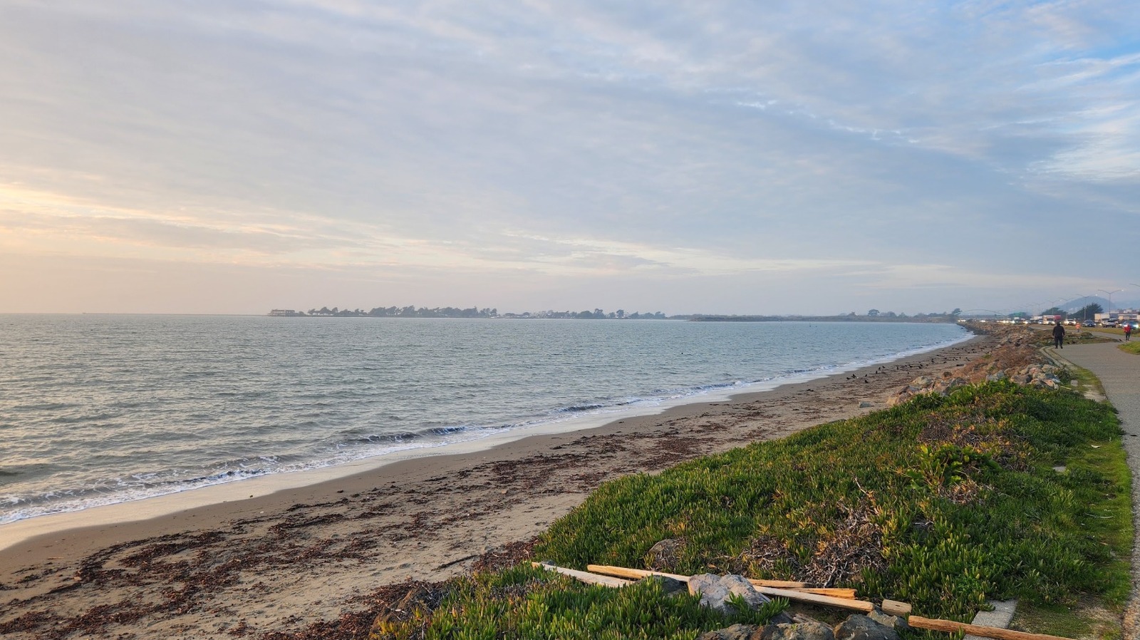
Supporting Context & Metrics: Navigating McLaughlin Eastshore Today
Spanning 8.5 miles of urban coastline, McLaughlin Eastshore State Park is designed primarily for passive recreation, offering visitors a tranquil escape from the dense concrete of the surrounding Bay Area metropolis.
Geography, Trails, and the San Francisco Bay Trail
The park’s infrastructure is anchored by a premier segment of the San Francisco Bay Trail. While the broader Bay Trail project envisions a continuous 500-mile walking and cycling path around the entire perimeter of the bay—with over 350 miles currently completed—the section running through McLaughlin Eastshore serves as one of its most scenic and heavily utilized arteries.
- Length: 8.5 continuous miles between Richmond and the Bay Bridge in Oakland.
- Commute Time: Less than 30 minutes from downtown San Francisco (traffic permitting).
- Key Interconnected Parks: The park’s trail system seamlessly links McLaughlin Eastshore with several adjacent shoreline preserves, including:
- Point Isabel Regional Shoreline (renowned for its expansive off-leash dog areas)
- Cesar E. Chavez Park (featuring sweeping hilltop views and kite-flying traditions)
- Emeryville Marina Park
- Shorter Coastal Paths: In addition to the main arterial Bay Trail, visitors can explore intimate walking routes that wind through the Berkeley Meadow and the specialized bird sanctuary adjacent to Albany Beach.
Recreational Activities and Wildlife Recovery
While swimming in the bay along this stretch is not a primary activity due to currents and historical water quality concerns, visitors engage in a wide array of outdoor pursuits:
- Cycling and Running: The paved, multi-use trails accommodate thousands of commuters and recreational athletes weekly.
- Birding and Wildlife Viewing: Thanks to aggressive restoration of native tidal marshes and grasslands, avian populations have made a dramatic comeback. Bird-watchers frequently spot blackbirds, plovers, finches, egrets, and shorebirds foraging in the restored wetlands.
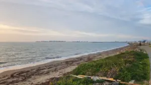
- Beach Access: The park features distinct, named sandy access points. Albany Beach, a prominent 1,800-foot-long stretch, is exceptionally popular among local dog owners and casual beachgoers.
Visitor Logistics and Best Practices
- Operating Hours: The park is open daily from 5:00 AM to 10:00 PM.
- Scenic Peaks: Park administrators and frequent visitors note that the park is at its most visually striking during sunset, when the golden light reflects off the open waters of the bay and illuminates the San Francisco skyline.
- Parking and Access: While there are six official access points along the 8.5-mile stretch, local visitors frequently recommend the parking lot situated at the western terminus of University Avenue. This entry point places visitors immediately adjacent to the Berkeley Yacht Harbor and steps away from Seabreeze, a beloved local culinary landmark famous for its fried catfish sandwiches.
- Pet Regulations: Dogs are permitted within the park but must remain strictly under voice command, and leashes are required on all multi-use trails, near beach entry points, and within designated parking lots.
Official Statements and Conservation Warnings
While the transformation of McLaughlin Eastshore State Park is a celebrated success story, managing a former municipal landfill requires ongoing vigilance from park authorities. The East Bay Regional Park District issues explicit guidelines to ensure public safety and protect fragile, ongoing restoration zones.
Staying on Designated Paths
Park rangers and environmental scientists emphasize the absolute necessity for visitors to remain strictly on established trails and boardwalks. Venturing off-trail into areas currently undergoing ecological restoration can severely damage nascent native plant colonies and disrupt nesting shorebirds.
The Hidden Hazards of Industrial Reclamation
More critically, staying on marked paths is a vital safety measure. Because the park was constructed on top of historical landfills and construction debris, the land occasionally reveals its industrial past.
Exposed Rebar Warning: Visitors—particularly those with children or pets—are frequently warned about the potential presence of jagged pieces of rusted metal and protruding rebar that can occasionally surface through the soil due to erosion or ground shifting. These sharp metallic remnants are a stark, hazardous reminder of the park’s landfill origins and pose a genuine risk of severe lacerations or puncture wounds.
The East Bay Regional Park District continually monitors and remediates these hazards, but park officials rely heavily on visitor compliance—urging the public to respect all signage and barrier fencing designed to keep recreationists safely separated from un-remediated or sensitive ecological zones.
Future Outlook: Preservation, Climate Resilience, and Urban Integration
As McLaughlin Eastshore State Park enters its third decade as an officially designated state seashore, management agencies and environmental advocates are shifting their focus toward long-term sustainability and climate change resilience.
Combating Sea-Level Rise
Located directly on the margin of the San Francisco Bay, the park faces existential challenges from accelerating sea-level rise and increasingly severe storm surges driven by climate change. Future planning by the California Department of Parks and Recreation and local stakeholders heavily incorporates "living shoreline" strategies. Rather than relying solely on hard, concrete sea walls—which can destroy intertidal habitats—planners are utilizing restored tidal marshes, oyster reefs, and graded mudflats to naturally absorb wave energy and protect both the park’s ecosystems and the inland urban infrastructure.
Completing the Regional Trail Network
Efforts are also underway to fully complete the remaining gaps in the regional San Francisco Bay Trail network. As neighboring municipalities continue to densify and urban infill projects progress, McLaughlin Eastshore acts as a vital, non-motorized transportation corridor linking Contra Costa and Alameda counties. Maintaining the ecological integrity of this green buffer while expanding commuter and recreational access remains a delicate, ongoing balancing act.
Honoring a Legacy of Advocacy
The enduring success of McLaughlin Eastshore State Park ultimately serves as a blueprint for post-industrial ecological recovery worldwide. It demonstrates that with visionary leadership, inter-agency cooperation, and decades of relentless grassroots advocacy, blighted urban coastlines can be redeemed.
The park stands today not merely as a scenic backdrop for the San Francisco skyline, but as a living monument to Sylvia McLaughlin and the citizens who refused to let concrete replace the coast—ensuring that generations to come can witness the sun set over a living, breathing San Francisco Bay.