







Executive Overview
Along the sweeping, mist-veiled coast of southern Louisiana, land and water merge into a mosaic of habitats that define the Pelican State’s ecological identity. While the world-famous bayous of the Mississippi Delta often steal the spotlight with their moss-draped cypress trees and deep-rooted folklore, another landscape lies further west, offering a starkly different yet equally mesmerizing coastal experience. Nestled between the bustling cultural hub of Lafayette and the Texas border, the Cameron Prairie National Wildlife Refuge spans nearly 25,000 acres of protected coastal prairie, freshwater marshes, and dynamic wetlands.
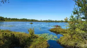
Far removed from the dense, heavily canopied swamps of eastern Louisiana, Cameron Prairie presents a horizon of wide-open spaces, flooded grasslands, and reflective waters. Established primarily as a sanctuary for migrating waterfowl navigating the Central and Mississippi flyways, the refuge has evolved into a haven for outdoor enthusiasts, wildlife photographers, and conservationists alike. Visitors who make the journey—roughly an hour and forty-five minutes west of Lafayette or less than an hour south of Lake Charles—are rewarded with a pristine sanctuary where feathered populations vastly outnumber human crowds. With an array of modern visitor facilities, expansive boardwalks, scenic driving loops, and remote boating channels, Cameron Prairie stands as a premier destination for those seeking an authentic, unvarnished encounter with the American wetlands.
Detailed Chronology: Evolution of a Coastal Sanctuary
To fully understand the ecological significance of the Cameron Prairie National Wildlife Refuge, one must trace its transformation from a manipulated agricultural landscape into a fiercely protected federal sanctuary.
Pre-Settlement and Early Agricultural Era
Before European settlement, the region that now comprises the refuge was a vast, unbroken expanse of coastal prairie and tidal marsh, shaped by the natural flooding cycles of the Gulf of Mexico and local river systems. Indigenous peoples utilized the rich biological bounty of the wetlands for seasonal hunting and gathering.
By the late 19th and early 20th centuries, as European-American settlers moved into southwestern Louisiana, the landscape underwent a profound alteration. The introduction of commercial rice farming converted large swaths of natural prairie into flooded paddies. Canals, levees, and dikes were constructed to control water flow, transforming the native hydrology to support agriculture and cattle grazing. While these changes significantly impacted native flora and fauna, the abandoned rice fields eventually took on a new life, inadvertently creating prime foraging and resting grounds for migrating waterfowl.
Establishment and Federal Protection
Recognizing the critical importance of these coastal marshes to North America’s migratory bird populations, the United States Fish and Wildlife Service (USFWS) moved to establish formal protection in the late 20th century. The acquisition and designation of the Cameron Prairie National Wildlife Refuge marked a vital step in preserving the Chenier Plain ecosystem.
Management objectives shifted from agricultural production to wetland restoration and habitat enhancement. Dikes and water control structures—once used to flood rice crops—were repurposed to manage water levels precisely, promoting the growth of native aquatic plants and providing ideal over-wintering conditions for millions of ducks, geese, and wading birds.

Modern Development and Access
In the decades following its establishment, the refuge expanded its recreational and educational infrastructure without compromising its core conservation mission. The development of the northern Gibbstown unit introduced a state-of-the-art visitor center, educational exhibits, and elevated boardwalks designed to give the public access to sensitive marsh environments. Simultaneously, the southern East Cove unit was preserved in a largely primitive, boat-in-only state, ensuring that wilderness qualities remained intact. Today, Cameron Prairie serves as a cornerstone of the Creole Nature Trail All-American Road, bridging local conservation efforts with regional eco-tourism.
Supporting Context & Metrics: The Ecology of Cameron Prairie
Spanning approximately 25,000 acres, the refuge is ecologically divided into two distinct operating units: the 9,621-acre Gibbstown Unit to the north and the 14,927-acre East Cove Unit to the south. Each section plays a vital role in maintaining the biological health of Louisiana’s Chenier Plain.
Geographic and Ecological Profile
- Total Acreage: ~25,000 acres of protected wetlands, marshes, prairies, and open water.
- Location: Cameron Parish, western Louisiana, situated approximately 50 miles south of Lake Charles and 105 miles west of Lafayette.
- Ecosystem Type: Coastal prairie, brackish and freshwater marshes, abandoned agricultural rice fields, and shallow canals.
- Flyway Significance: Positioned at the intersection of the Mississippi and Central migratory flyways, serving as a critical bottleneck and wintering ground for millions of birds.
Biodiversity Metrics
Cameron Prairie is recognized as a biodiversity hotspot, recording over 200 distinct bird species throughout the year.
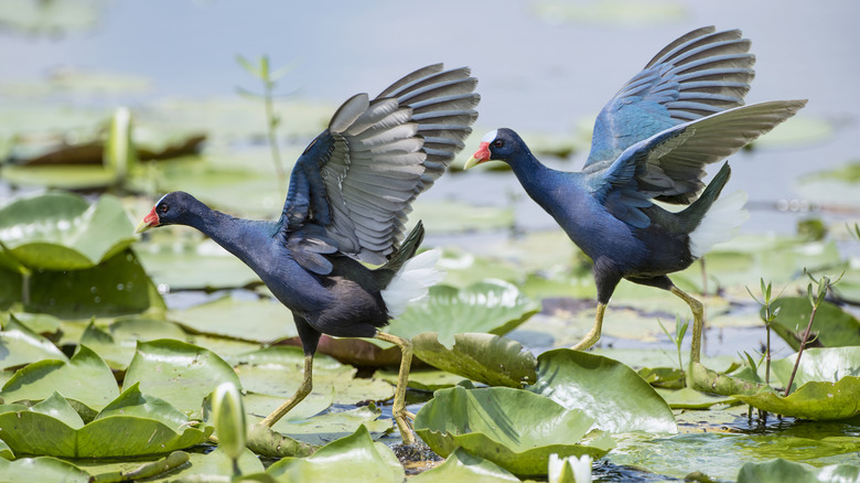
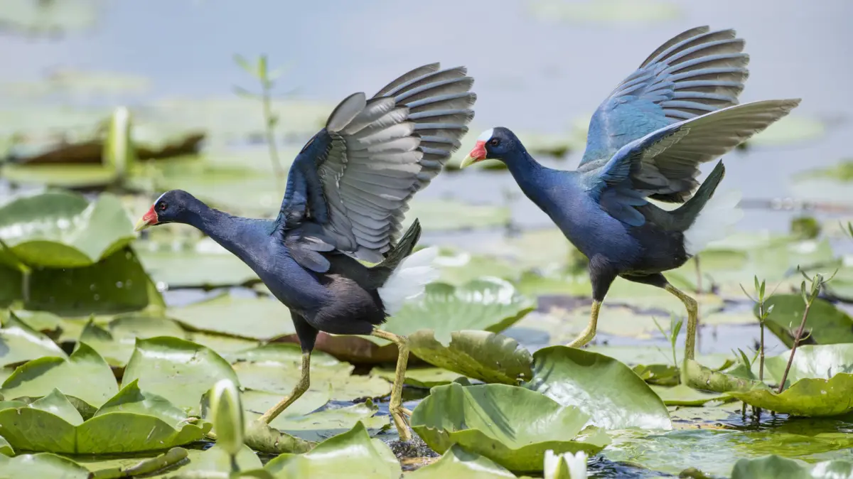
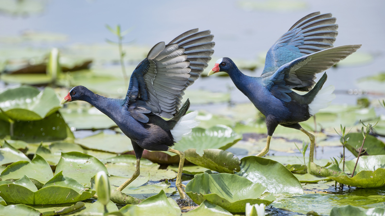
- Waterfowl & Wading Birds: Winter months see massive arrivals of snow geese, green-winged teals, mallards, and northern pintails. Year-round residents and seasonal visitors include great blue herons, snowy egrets, roseate spoonbills, and the vibrant purple gallinule.
- Raptors: The open vistas provide exceptional viewing for predatory birds, including bald eagles, ospreys, northern harriers, and Cooper’s hawks.
- Mammalian Wildlife: Beyond avian life, the refuge supports healthy populations of river otters, bobcats, coyotes, raccoons, opossums, and white-tailed deer.
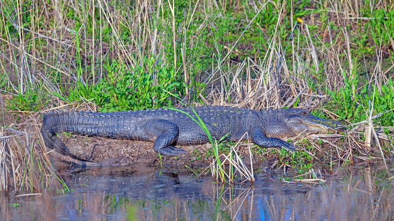
- Reptilian Life: The American alligator (Alligator mississippiensis) is the apex reptile of the refuge, frequently sighted basking on sun-drenched mud banks or gliding silently through narrow canals.
Official Statements and Conservation Perspectives
Wildlife management and habitat preservation in southwestern Louisiana require a delicate balance between public recreational access and strict environmental stewardship. Federal officials and local conservationists emphasize the multifaceted role that refuges like Cameron Prairie play in modern environmental policy.
"Cameron Prairie is not merely a scenic backdrop for birdwatchers and photographers; it is a critical ecological buffer along a rapidly changing Gulf Coast," noted a regional wildlife biologist for the U.S. Fish and Wildlife Service. "By managing water levels across our impoundments, we mimic natural hydrological pulses that sustain native vegetation, which in turn supports everything from microscopic aquatic organisms to apex predators like the American alligator."
Conservation stakeholders also highlight the economic and educational value of the refuge. As eco-tourism grows along the Gulf Coast, destinations that offer low-impact recreation—such as wildlife photography, kayaking, and catch-and-release fishing—prove that economic vitality and environmental preservation can coexist.
Furthermore, local tourism boards emphasize the integration of Cameron Prairie into larger scenic byways. By anchoring the western leg of the Creole Nature Trail All-American Road, the refuge draws visitors deep into "Louisiana’s Outback," fostering a deeper appreciation for coastal marsh preservation in the face of rising sea levels and coastal erosion.
Exploring the Refuge: Trails, Waterways, and Visitor Amenities
For travelers looking to experience Cameron Prairie firsthand, the refuge offers a variety of well-maintained access points tailored to different modes of exploration.
The Gibbstown Unit: Visitor Center and Boardwalks
The northern Gibbstown unit serves as the primary gateway to the refuge. It houses the administrative offices, an informative visitor center featuring interactive exhibits on local ecology, and essential public restrooms.
- Alan C. Bonsack Observation Tower: Accessible via a short, 0.6-mile boardwalk starting near the visitor center, this tower provides panoramic views of the surrounding marshes, making it an ideal spot for spotting distant raptors and wading birds.
- Pintail Wildlife Drive: A premier three-mile scenic driving loop that allows visitors to tour the heart of the freshwater marshes from the comfort of their vehicles. Strategically placed pull-offs and interpretive signage invite guests to pause, scan the grasslands, and set up spotting scopes.
- Pintail Boardwalk: Stretching just over half a mile, this flat, accessible loop takes hikers directly over flooded wetland terrain, offering intimate glimpses of aquatic flora, insects, and amphibians. Additional walking access is permitted along designated levees and dikes unless posted otherwise.
The East Cove Unit: A Primitive Aquatic Wilderness
For those seeking a more remote adventure, the southern East Cove unit offers an entirely different experience. Accessible exclusively by boat, this 14,927-acre expanse is defined by pristine waterways, grassy islets, and absolute solitude.
- Boating & Paddling: A public boat launch located near the Pintail Wildlife Drive provides direct access to the Intracoastal Waterway. From there, motorized boats and paddlecraft can navigate toward Calcasieu Lake and push south into the undeveloped reaches of East Cove.
- Fishing and Hunting: Subject to strict federal regulations, seasonal permits, and designated zones, the refuge permits recreational fishing and waterfowl hunting, contributing to traditional local outdoor practices while funding ongoing conservation initiatives.
Future Outlook: Challenges and Conservation Strategies Ahead
As the 21st century progresses, wildlife refuges along the Gulf Coast face unprecedented environmental pressures. Rising sea levels, saltwater intrusion, subsidence, and the increasing frequency of high-intensity hurricanes pose severe threats to freshwater marsh habitats.
To combat these vulnerabilities, the U.S. Fish and Wildlife Service, in partnership with state agencies and non-profit conservation groups, is continuously refining adaptive management strategies for Cameron Prairie. Key future initiatives include:
- Hydrological Restoration: Upgrading water control infrastructure—such as culverts, spillways, and levees—to better manage salinity levels and prevent saltwater from overwhelming delicate freshwater plant communities.
- Marsh Terracing: Constructing earthen terraces within shallow open-water areas to reduce wave energy, capture suspended sediments, and promote the re-vegetation of emergent marsh grasses.
- Climate Resiliency Monitoring: Ongoing scientific studies to track shifts in avian migration patterns, invasive species proliferation (such as nutria), and vegetative health across the Chenier Plain.
Despite these environmental headwinds, Cameron Prairie National Wildlife Refuge remains an enduring testament to the resilience of Louisiana’s wetlands. By offering a sanctuary where nature dictates the rhythm of daily life, the refuge ensures that future generations will continue to experience the wild, untamed beauty of America’s southern coast—a landscape where earth and water eternally intertwine.