



By Jeff Watters, Vice President of External Affairs, Ocean Conservancy
Published: August 2026 | 7-Minute Read
Executive Overview
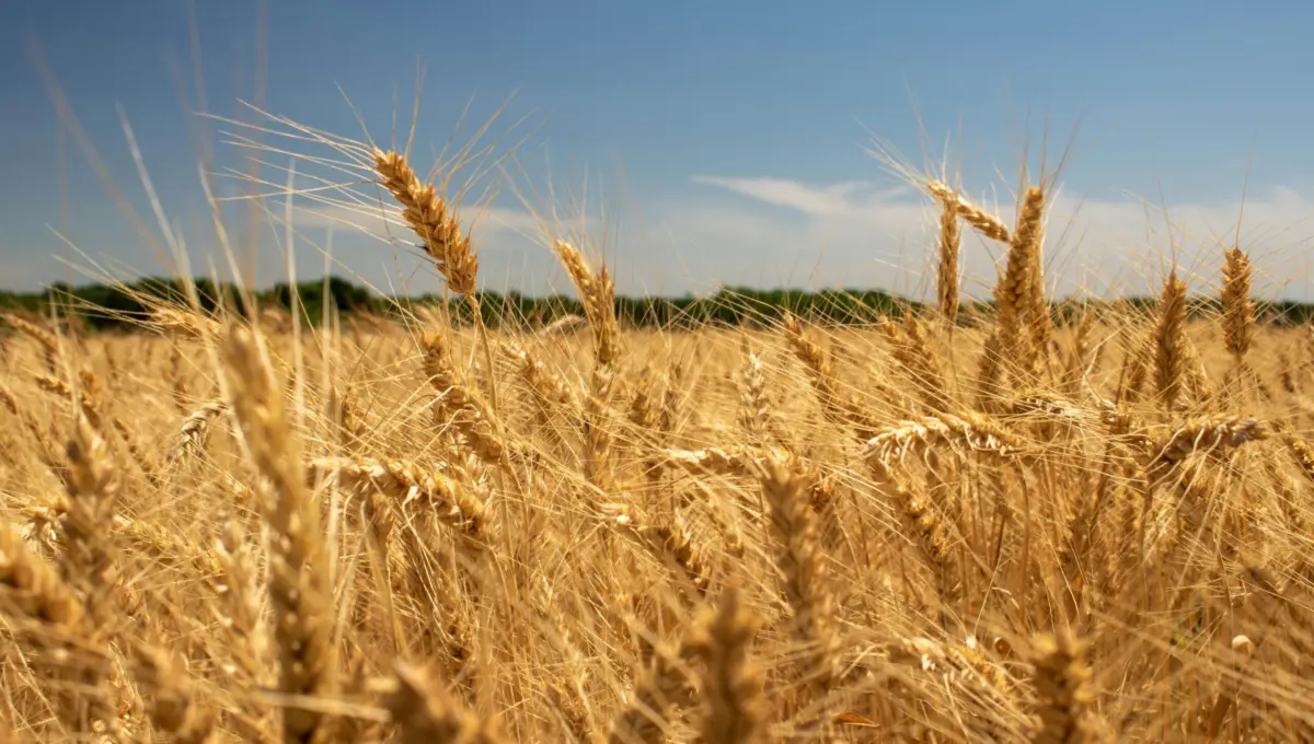
If you were to ask the average American to name the states most economically and environmentally tethered to the world’s oceans, the answers would predictably lean coastal. The mind automatically drifts to the sun-bleached boardwalks of California, the commercial fisheries of Maine, the bustling shipping lanes of the Gulf of Mexico, or the fragile barrier islands of the Carolinas. Rarely would a respondent picture the endless golden wheat fields of Kansas.
Boasting no crashing surf, no commercial saltwater ports, and no briny sea air, the landlocked "Sunflower State" is conventionally viewed as the absolute geographic antithesis of a maritime region. Yet, a landmark report released by the Ocean Conservancy upends this conventional wisdom. Kansas serves as a vivid, unmistakable proof point for a reality that atmospheric scientists, ecologists, and policy experts have long understood: the influence of the ocean does not stop at the shoreline.
From the severe spring tornado warnings that send families rushing to storm cellars in Wichita, to the long-range drought outlooks guiding agricultural decisions in the high plains, life in Kansas is inexorably linked to marine and atmospheric dynamics happening thousands of miles away. At the center of this invisible lifeline is the National Oceanic and Atmospheric Administration (NOAA). Frequently pigeonholed as a coastal-centric or fisheries-focused entity, NOAA functions as an indispensable national security and public safety infrastructure provider for the American interior.
As Congress routinely debates federal environmental budgets, treating agencies like NOAA through a narrow, localized lens fails to capture the true breadth of their societal footprint. Weakening NOAA’s upstream capabilities—its satellites, deep-ocean buoys, and global supercomputing models—does not merely impact coastal fishermen; it strips vital weather forecasting lead times away from landlocked farmers, emergency managers, and inland communities. This report examines how ocean data powers Kansas decisions, why the ocean-atmosphere continuum cannot be compartmentalized, and why protecting federal science is a bipartisan imperative for the entire nation.
Detailed Chronology: The Invisible Chain From Deep Ocean to the Great Plains
To understand how the ocean dictates daily life in Kansas, one must trace the invisible, unbroken chain of atmospheric and marine data that connects the Pacific and Atlantic basins to the rolling plains of the Midwest. This interconnected system operates continuously, bridging thousands of miles through advanced technology and federal meteorology.
Phase One: Oceanic Generators (Months to Weeks Prior)
Long before a drop of rain falls on a Kansas cornfield, the foundational ingredients of that weather system are being forged over distant bodies of water.

- The Gulf Conveyor: Warm, moisture-laden air masses evaporate continuously from the Gulf of Mexico. These thermodynamic currents act as the primary engine for precipitation across the central United States. When prevailing winds sweep this moisture northward across the Mississippi and Missouri river basins, it collides with dry continental air masses over the Great Plains, creating the volatile atmospheric setup characteristic of Tornado Alley.
- Pacific Teleconnections: Simultaneously, sea-surface temperature anomalies in the equatorial Pacific (such as El Niño and La Niña cycles) dictate long-range climate oscillations. These temperature shifts alter jet stream trajectories, directly signaling to Kansas ranchers and grain producers whether the upcoming season will bring crippling droughts or historic flood-producing rainfall.
Phase Two: Global Observation Networks (Days to Hours Prior)
Capturing these vast atmospheric shifts requires an unyielding, high-tech observation network managed primarily by NOAA:
- Offshore and Orbital Sentinels: High-orbiting NOAA geostationary satellites (GOES series) gaze continuously down at the Earth, tracking cloud formations, moisture tracks, and jet stream velocities over both the open ocean and the continental interior. Meanwhile, a web of ocean buoys, profiling floats (Argo arrays), and marine radar systems measure sea-surface temperatures, salinity, and pressure gradients.
- Data Synthesis: This massive influx of raw data—terabytes of marine and atmospheric metrics—is channeled into advanced numerical weather prediction models powered by some of the world’s most powerful supercomputers.
Phase Three: Local Execution (Minutes to Seconds Prior)
The culmination of this global, ocean-centric observation network materializes locally when severe weather threatens Kansas:
- The Lead-Time Window: When a supercell thunderstorm spawns a tornado near Dodge City, local meteorologists at National Weather Service forecast offices rely entirely on the high-resolution data streams fed by NOAA’s upstream infrastructure.
- Public Alerts: The resulting lead time—often measured in critical minutes—determines whether families can reach storm shelters, hospitals can safeguard vulnerable patients, and logistics hubs can reroute transport vehicles. When a severe weather warning lights up a smartphone screen in Topeka or Wichita, the end-user is experiencing the direct downstream benefit of an integrated federal ocean-and-atmosphere monitoring system.
Supporting Context & Metrics: The Real-World Stakes in Kansas
The integration of marine science into landlocked economies is not an abstract academic theory; it is a matter of economic survival and public safety. Kansas possesses a multi-billion-dollar agricultural sector uniquely vulnerable to meteorological volatility.
+-------------------------------------------------------------------------+
                    THE OCEAN-TO-PLAINS DATA PIPELINE
+-------------------------------------------------------------------------+

  [ GLOBAL OCEAN ]         [ NOAA INFRASTRUCTURE ]         [ KANSAS PLAINS ]
  • Gulf Moisture   -----> • GOES Satellites     -----> • Tornado Warnings
  • Pacific El Niño -----> • Ocean Buoys & Radar -----> • Drought Forecasts
  • Thermal Shifts  -----> • Supercomputing Models --> • Agricultural Planning

+-------------------------------------------------------------------------+
Agriculture and the Hydrological Cycle
Kansas routinely ranks among the top wheat-producing states in the United States, alongside significant yields in corn, sorghum, and cattle. Agricultural viability relies on precision planning.
- Drought Preparedness: Ranchers and farmers utilize seasonal outlooks derived from Pacific and Atlantic ocean temperature indicators to make multi-month decisions regarding herd sizes, crop rotations, and irrigation management.
- Infrastructure Engineering: State civil engineers and Department of Transportation planners rely on historical rainfall distribution data—anchored in NOAA precipitation frequency atlases—to design drainage systems, highways, bridges, and municipal stormwater facilities capable of withstanding extreme flash floods.
The Cost of Premature Budget Cuts
Conversations regarding federal science funding often get bogged down in bureaucratic silos. Critics unfamiliar with the interdisciplinary nature of Earth sciences may argue that an agency housing "Oceanic" in its title should have its budget trimmed if coastal programs are deemed over-resourced.
However, pulling threads out of this integrated system causes the entire tapestry to unravel. If upstream ocean observation networks—such as satellite maintenance, deep-water buoy replacements, and core research programs—are defunded or weakened, the degradation does not stay isolated to coastal marine biology laboratories. It directly degrades the accuracy of inland weather models.
When forecasts become less reliable, the margin of error in severe weather prediction widens. Communities lose crucial minutes of warning lead time, leaving agricultural markets flying blind into seasonal shifts and robbing emergency management teams of the predictive tools needed to protect lives and property.
Official Statements and Expert Perspectives
The Ocean Conservancy’s report underscores the urgency of viewing federal environmental and meteorological science as critical national infrastructure rather than discretionary line items.
"The ocean does not stop mattering at the shoreline," emphasizes Jeff Watters, Vice President of External Affairs at Ocean Conservancy. "In landlocked states like Kansas, the ocean shows up as a spring tornado warning, a summer drought outlook, and a pilot’s weather briefing before takeoff. NOAA is not a nice-to-have for Kansas; it is essential infrastructure."
The report notes that public perception of NOAA is frequently skewed by its visible coastal portfolio—such as marine mammal protection, coral reef restoration, and coastal zone management. Yet, the engine driving the agency’s value proposition is its unified approach to Earth systems science.
- The Continuum Principle: Atmospheric scientists emphasize that the Earth’s fluid envelope—the interconnected atmosphere and oceans—operates as a single thermodynamic machine. Energy absorbed by tropical oceans powers atmospheric rivers and frontal systems that drive weather deep into continental interiors.
- The Non-Partisan Mandate: Protecting coastal and atmospheric observation networks transcends traditional political divisions. Safeguarding the tools that predict droughts in the Great Plains and hurricanes in the Gulf of Mexico is fundamentally about protecting American lives, supply chains, and food security.
Future Outlook: Protecting the Science That Protects Us
As climate volatility accelerates globally, the frequency and intensity of extreme weather events are projected to rise. For inland states like Kansas, this means confronting more erratic precipitation patterns, intensified severe storm systems, and heightened risks of flash flooding and prolonged dry spells.
Navigating this uncertain horizon requires doubling down on our observational and predictive capabilities, not scaling them back.
- Modernizing Federal Infrastructure: Continued investment in next-generation satellite technology, high-performance computing, and resilient ocean-atmosphere monitoring networks is non-negotiable if the United States is to maintain its gold standard in meteorological forecasting.
- Bridging the Urban-Rural Divide in Conservation: Environmental advocacy must increasingly bridge the gap between coastal protection and inland resilience. Campaigns to fund and protect NOAA must resonate just as powerfully with lawmakers representing the Great Plains and the Midwest as they do with coastal delegations.
- Public Awareness and Action: Citizens across the country—whether they reside in Miami, Topeka, or Seattle—must recognize that their daily safety and economic stability are underwritten by comprehensive Earth science.
Kansas may be miles away from the nearest ocean beach, but it remains inextricably bound to the sea. By recognizing that ocean health, meteorological precision, and community resilience are cut from the same cloth, policymakers can ensure that the vital data pipeline protecting the American heartland remains strong, funded, and operational for generations to come.
Take Action
Safeguarding our ocean and atmospheric infrastructure is not a partisan issue—it is about delivering real, actionable solutions for the future of our planet and our communities.
- Read the Full Report: Explore the complete data and case studies in the Ocean Conservancy’s NOAA-Kansas Report (PDF).
- Make Your Voice Heard: Add your name to support critical federal science funding and protect NOAA’s vital mission by visiting the Ocean Conservancy Action Center.