




The protection of marine mammals—specifically the critically endangered North Atlantic right whale (Eubalaena glacialis)—has long been a contentious battleground between environmental conservationists, federal regulators, and the commercial and recreational marine industries. For decades, the primary regulatory instrument employed by the National Oceanic and Atmospheric Administration (NOAA) has been the implementation of blanket seasonal speed restrictions across vast swaths of the Eastern Seaboard. While well-intentioned, these broad-brush mandates have drawn fierce opposition from boating advocacy groups and manufacturers who argue that blanket rules impose an existential economic threat to recreational boating without effectively addressing the dynamic, highly mobile nature of marine wildlife distribution.
Enter the Whale and Vessel Safety (WAVS) Taskforce. Formed in late 2022 by the Viking Marine Group in direct response to proposed expansions of NOAA’s vessel speed restriction rules, the WAVS Taskforce represents a paradigm shift. Rather than fighting conservation efforts, the 501(c)(3) nonprofit organization is pioneering a technological, data-driven approach designed to protect whales through precision rather than prohibition. By harnessing existing onboard marine electronics, leveraging artificial intelligence (AI) for automated classification, and integrating standardized messaging protocols like NMEA 2000, WAVS is spearheading an ecosystem of real-time alerts. This initiative aims to warn mariners of localized marine mammal presence precisely when and where it matters, allowing boaters to maintain safe navigation and throttle control without enduring cumbersome, sweeping speed limits.
Detailed Chronology of the North Atlantic Right Whale Protection Battle
1970–2008: The Regulatory Baseline and Early Interventions
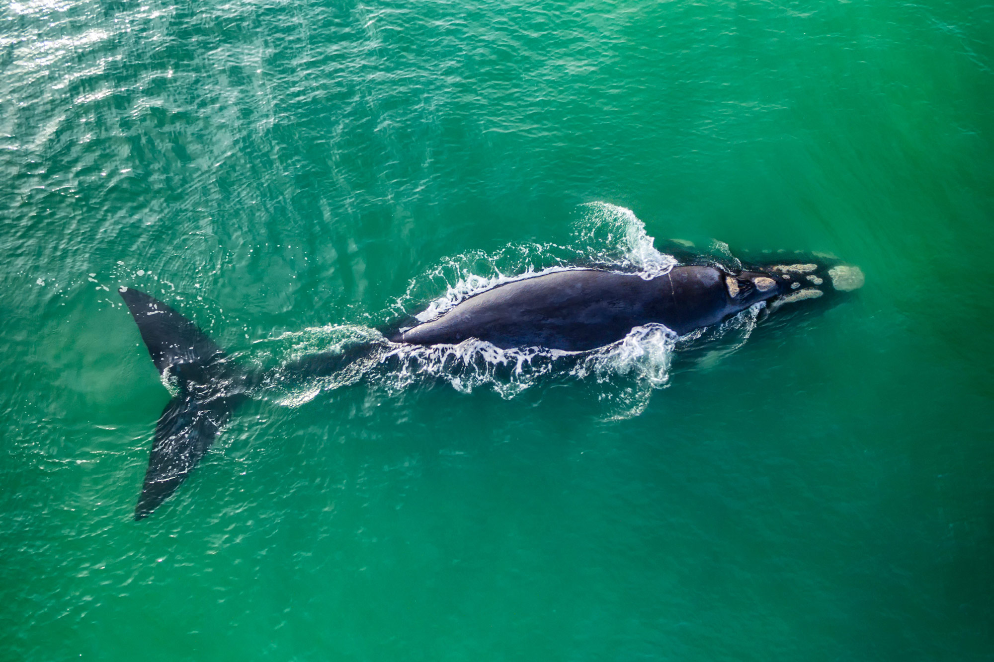
The plight of the North Atlantic right whale is well-documented. Having been decimated by commercial whaling in previous centuries, the population lingers at dangerously low levels. NOAA estimates that roughly 380 individuals remain today, with a precarious core of only about 70 breeding females.
Recognizing their desperate status, the species was officially listed under the United States Endangered Species Act (ESA) in 1970. Decades later, in 2008, NOAA enacted the North Atlantic Right Whale Vessel Strike Reduction Rule. This landmark regulation imposed mandatory 10-knot speed limits along specific migratory corridors and seasonal management areas along the East Coast. Crucially, the 2008 rule applied primarily to commercial vessels measuring 65 feet and larger, leaving smaller recreational vessels largely exempt from federal speed mandates during their seasonal windows.
Late 2022: The Regulatory Flashpoint and the Birth of WAVS
The fragile detente between recreational boaters and federal regulators shattered in 2022 when NOAA Fisheries proposed sweeping amendments to the 2008 rule. The proposed changes sought to dramatically expand both the geographic boundaries and temporal duration of seasonal speed zones. Most alarmingly for the recreational sector, the proposed rules lowered the vessel size threshold from 65 feet down to 35 feet, effectively pulling thousands of sportfishing yachts, cruisers, and large recreational boats into strict regulatory nets.
Industry trade groups, including the National Marine Manufacturers Association (NMMA) and the Viking Marine Group, immediately sounded the alarm, characterizing the expansion as an existential blow to coastal economies, marine tourism, and recreational freedom. Recognizing that adversarial resistance alone would not satisfy conservation mandates, marine industry leaders pivoted toward proactive problem-solving. In late 2022, the Viking Marine Group spearheaded the creation of the WAVS Taskforce—a volunteer-driven nonprofit dedicated to proving that advanced technology could achieve NOAA’s conservation goals far more efficiently than broad regulatory mandates.
2023–Present: Shifting Tides and Technological Prototyping
Although NOAA Fisheries has since moderated its regulatory stance—easing off the immediate threat of the expanded 35-foot rule—the WAVS Taskforce has pressed forward with its mission. The organization realized that the core vulnerability in protecting whales was not a lack of concern from mariners, but a systemic friction in data collection, verification, and dissemination.
Over the past few years, WAVS has transitioned from a defensive lobbying coalition into an active research and development collective. By outfitting a testbed vessel—a Contender 24S integrated with equipment from 13 competing marine electronics manufacturers—the taskforce has methodically tackled the hardware and software hurdles required to build a seamless, interoperable whale-alert network.
Supporting Context & Metrics: The Scale of the Challenge
To understand the urgency driving the WAVS Taskforce, one must examine the intersection of marine biology, navigation physics, and data architecture.
The Biological Reality
With an estimated population of approximately 380 individuals, every single North Atlantic right whale loss represents a devastating blow to the species’ recovery trajectory. Vessel strikes and entanglement in fishing gear remain the two leading anthropogenic causes of serious injury and mortality for the species. Because right whales frequently spend time near the surface—feeding, resting, or socializing—and possess dark coloration that blends into the ocean swell, they are notoriously difficult for mariners to spot visually, particularly in low-light conditions, choppy seas, or at cruising speeds.
The Data Gap
Historically, marine mammal conservation has suffered from a critical latency problem in data flow. While federal agencies, state wildlife observers, and research institutions routinely log whale sightings, this information is often siloed or slow to reach the mariners who need it most. Official agency sightings are logged in near real-time, but crowd-sourced reports from civilian boaters via platforms like the WhaleAlert app (maintained by conserve.io) frequently require 24 to 48 hours for verification before being cleared for public distribution.
For a high-speed sportfishing vessel traveling at 25 knots, a verified whale sighting reported 48 hours later is entirely useless. The WAVS Taskforce recognized that closing this chronological gap requires a combination of automated metadata verification, artificial intelligence, and instantaneous communication pipelines.
Official Statements and Industry Perspectives
The success of the WAVS initiative hinges on unprecedented collaboration across a notoriously competitive marine electronics landscape. Industry leaders have stepped forward to champion the cause.
"We want to bring together the marine industry, the experts in the field and the manufacturers, and have a venue where we can discuss how we move forward, and address this issue from a technology perspective. The main goal is to leverage innovation and technology to help mitigate the risk of vessel strikes."
— John DePersenaire, Director of Government Affairs and Sustainability at Viking Marine Group and Chairman of the WAVS Taskforce
DePersenaire emphasizes that the taskforce is laser-focused on avoiding "alert fatigue" among boaters. Rather than forcing captains to constantly monitor third-party mobile applications while navigating complex coastal waters, WAVS aims to integrate data directly into existing onboard multifunction displays (MFDs) in a clean, non-intrusive manner.
Matthew Zimmerman, CEO of FarSounder and an active WAVS Taskforce member, highlights the necessity of automation in managing data streams:
"We need to have automated systems to help manage the amount of data that will be needed. I don’t think that unleashing the AI will just take care of all of it, but I think it could be a really useful tool. It’s harnessing what’s already out there and making them connect together."
This sentiment is echoed by major hardware manufacturers who have temporarily set aside market competition to tackle a shared environmental challenge. Shaun Ruge, Director of Marine Business Development at Garmin, notes:
"On the WAVS vessel, we have multiple manufacturers’ multifunction displays and cameras. Garmin believes, and I don’t think we’re alone here, that reducing strike risk is a cause worth advocating for alongside our competition."
Future Outlook: The Technology Pipeline and Scalability
Looking ahead, the WAVS Taskforce’s blueprint for whale protection rests on three core technological pillars: interoperability standards, automated AI classification, and bidirectional data distribution.
Standardizing Marine Electronics via NMEA
One of the most significant technical hurdles facing marine electronics is proprietary data formatting. Different brands of MFDs, radar systems, and sonars rarely speak the same native language out of the box. To solve this, WAVS is actively collaborating with the National Marine Electronics Association (NMEA) to establish standardized whale-related sentences for NMEA 0183 and Parameter Group Numbers (PGNs) for NMEA 2000.
Once finalized, these universal standards will provide boaters with intuitive virtual buttons on their chartplotters. A captain who sights a whale can press a button that instantly packages GPS coordinates, time stamps, and vessel metadata, transmitting it upstream to data repositories. Conversely, once that data is vetted, automated alerts can be pushed downstream to other geo-relevant vessels.
AI and Sensor Integration
Rather than inventing costly new proprietary hardware sensors, WAVS is focusing on maximizing the utility of sensors already installed on modern vessels. Advances in artificial intelligence and optical machine-learning classification are opening new frontiers for automated collision avoidance. High-resolution marine cameras equipped with AI models can theoretically detect surface disturbances, blows, or flukes, classifying them as marine mammals and triggering immediate bridge alarms before a human eye registers the danger.
Furthermore, through bidirectional data flow, the technological burden is decentralized. A sensor-rich research vessel or commercial craft equipped with advanced sonar and optical gear can log and transmit a hazard warning, protecting dozens of smaller vessels traversing the same area without requiring every single boat to carry expensive, specialized equipment.
Expanding the Research Fleet
The physical manifestation of this philosophy is the WAVS testbed vessel—the Contender 24S—which successfully integrates competing hardware from 13 distinct marine brands. Beyond the testbed, the initiative is expanding through partnerships with private yacht owners who volunteer their vessels for field testing, supported by grants from organizations like the National Fish and Wildlife Foundation.
As these technologies mature and regulatory bodies observe the efficacy of precision-based, real-time alerts over blunt regulatory instruments, the marine industry is inching closer to a sustainable future. It is a future where recreational boating and marine conservation are no longer locked in a regulatory tug-of-war, but are instead harmonized through the quiet, efficient power of connected technology.