








Executive Overview
Casco Bay Lines (CBL), an indispensable lifeline for Maine’s island communities and a beloved fixture of the greater Portland waterfront, is bridging its storied maritime heritage with cutting-edge digital innovation. This month, the transit authority formally unveiled the CBL Live Map, a robust, real-time tracking tool designed to fundamentally transform how daily commuters, seasonal residents, and tourists navigate Casco Bay.
Following a quiet beta launch earlier this fall, the tool has already garnered enthusiastic reviews from regular riders. One commuter wrote in via the transit authority’s online feedback portal to praise the rollout: "Your new live map is absolutely awesome and works with ease. Good job."
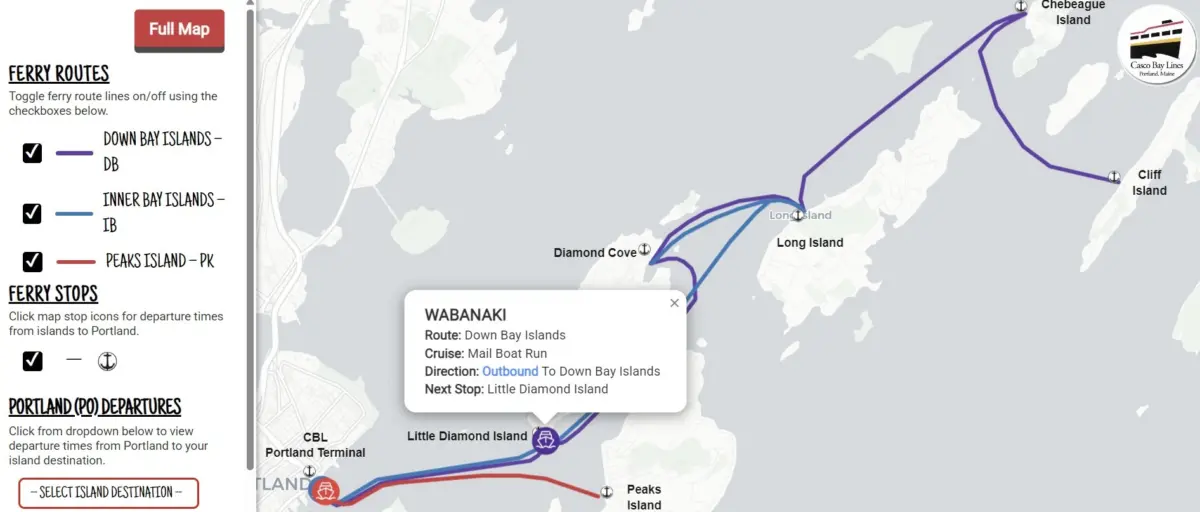
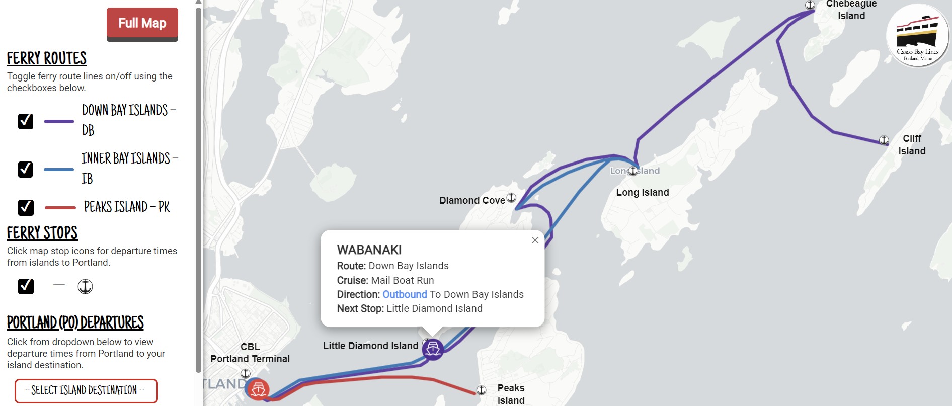
Powered by advanced cloud platforms and precise onboard GPS data, the CBL Live Map updates every 15 to 30 seconds. It provides an immediate, interactive window into ferry movements across the bay, allowing users to track vessels, check schedules, monitor service alerts, and plan their journeys with unprecedented precision. Funded in large part by federal transit grants and brought to life through strategic regional partnerships, this rollout represents a monumental leap forward for regional Intelligent Transportation Systems (ITS). Beyond offering a slick user-facing map, the underlying technology modernizes Casco Bay Lines’ entire data infrastructure—integrating seamlessly with popular navigation suites like Google Maps, Apple Maps, and the Transit app, while streamlining internal communications and significantly reducing routine customer service inquiries.

Detailed Chronology: From Concept to Launch
The realization of the CBL Live Map was not an overnight endeavor. It was the culmination of meticulous planning, regional collaboration, and technical execution that began in earnest during the summer of 2024.
July 2024: Project Kickoff and Strategic Partnerships
The initiative moved into high gear in July 2024, when Casco Bay Lines formally partnered with Pine Tree Project Management Pros, LLC, a Maine-based project management firm, to oversee the complex integration process. To build a reliable, scalable foundation for real-time tracking, CBL procured two industry-standard cloud platforms:
- Remix by Via: This platform was implemented to format Casco Bay Lines’ intricate seasonal and year-round sailing schedules into the General Transit Feed Specification (GTFS) format—the open-source standard for public transportation schedules worldwide.
- Swiftly, Inc.: This platform was integrated to convert raw onboard GPS data streams from the active ferry fleet into GTFS-Realtime feeds, capturing vessel velocity, positioning, and schedule adherence in milliseconds.
Fall 2024: The Quiet Beta Launch
With the back-end infrastructure established and rigorously tested, CBL rolled out the CBL Live Map in a quiet beta phase during the fall of 2024. Rather than a massive marketing blitz, the organization chose to let daily commuters discover the tool organically. This soft launch provided invaluable real-world data, allowing engineers and operations staff to fine-tune update frequencies, verify GPS signal reliability across the varied topography of Casco Bay, and optimize the user interface for mobile devices. The feedback collected during this phase confirmed that the map was not only functionally sound but deeply appreciated by the riding public.
The Official Unveiling
Building on months of successful operational testing and glowing user reviews, Casco Bay Lines officially introduced the tool to the broader public this month. Alongside the direct web link (https://livemap.cascobaylines.com/), CBL launched a dedicated onboarding page on its main website. This portal features a concise instructional video and a straightforward, four-step guide enabling users—whether on Apple iOS or Android devices—to pin the live map directly to their smartphone home screens for instant access.

Supporting Context & Metrics: Funding, Technology, and Infrastructure
To fully appreciate the significance of the CBL Live Map, one must examine the financial architecture, technical plumbing, and logistical challenges that shaped its development.
Financial Backing and Federal Investment
The deployment of the CBL Live Map was made possible through a strategic allocation of federal resources. The project was funded via Federal Transit Administration (FTA) Section 5307 Urbanized Area Formula funds designated for the Portland region. These funds were suballocated specifically to Casco Bay Lines for Intelligent Transportation Systems (ITS) upgrades. To secure the federal investment, CBL provided a required 20% local matching fund, demonstrating a strong institutional commitment to modernizing local infrastructure without placing an undue burden on passenger fares.
The Engine Under the Hood: GTFS and Open Standards
To the casual observer, the CBL Live Map is simply an intuitive graphic interface showing little icons of ferries moving gracefully across a map of Casco Bay. However, the architecture driving the interface is remarkably sophisticated.
By leveraging Remix by Via and Swiftly, Inc., Casco Bay Lines transitioned from legacy scheduling systems to a fully modernized, open-data ecosystem. The integration of GTFS and GTFS-Realtime standards means the benefits extend far beyond the proprietary CBL Live Map. The exact same data feeds power:
- On-site terminal gate displays for waiting passengers.
- Global mapping platforms including Google Maps and Apple Maps.
- Dedicated multi-modal transit applications like the Transit app.
This interoperability ensures that whether a traveler is planning a trip weeks in advance from out of state or checking a departure time while standing on the Portland pier, they receive accurate, synchronized information.
Operational Relief and Efficiency Metrics
Prior to the rollout of real-time tracking, Casco Bay Lines’ ticket office and customer service representatives handled a high volume of routine phone inquiries. Passengers frequently called to ask whether a specific vessel was running on time, where a ferry was located along its route, or if weather-related delays were in effect.
By putting this data directly into the hands of passengers via their smartphones and web browsers, CBL has engineered a profound drop in routine informational calls. Ticket agents and terminal staff are now freed up to focus on complex travel arrangements, passenger safety, ticketing logistics, and on-site customer service. Furthermore, because GTFS is an open standard, Casco Bay Lines has future-proofed its digital infrastructure. The organization can now readily build out additional operational tools, internal reports, and passenger-facing features as maritime technology continues to evolve.
Official Statements and Community Reception
The reception to the CBL Live Map underscores a broader industry truth: modern transit riders demand transparency, predictability, and ease of use.
Voices from the Commuter Community
Island commuters—who rely on Casco Bay Lines for everything from daily employment in Portland to grocery runs, medical appointments, and schooling—have been among the most vocal advocates for the new tool. The digital divide that historically separated land-based public transit (like subways and city buses) from marine transit is rapidly closing.
One regular commuter’s testimonial, submitted via the transit authority’s online feedback portal, encapsulates the sentiment of many:
"Your new live map is absolutely awesome and works with ease. Good job."
Such praise highlights the meticulous attention paid to user experience (UX) design during the development phase. The map was engineered to load rapidly, function seamlessly on both high-end and budget smartphones, and present real-time data without clutter or confusing navigation menus.
Leadership Perspective
Casco Bay Lines leadership views the live map not merely as a tech upgrade, but as a reaffirmation of the agency’s core mission. While the organization proudly honors a long and storied maritime history in Casco Bay—serving peaks of tourist traffic in the summer and anchoring the year-round economy of islands like Peaks, Chebeague, Cliff, Long, and Great Diamond—it recognizes that keeping pace with modern expectations requires continuous forward momentum.
In public communications releasing the tool, transit executives emphasized that technological evolution is essential to maintaining the trust and loyalty of the communities they serve. By investing in modern ITS infrastructure, CBL is ensuring that its operations remain resilient, transparent, and user-centric for generations to come.
Future Outlook: What’s Next for Casco Bay Lines?
The launch of the CBL Live Map marks a transformative milestone, but transit authorities and industry experts agree that it is just the beginning of a larger digital evolution for Casco Bay Lines.
Expanding the Digital Ecosystem
Now that the back-end GTFS and GTFS-Realtime architecture is fully operational, Casco Bay Lines possesses a flexible framework upon which future innovations can be built. Open standards allow for easy integration with emerging mobility-as-a-service (MaaS) platforms, potentially opening doors for integrated ticketing, multimodal journey planning (pairing ferries with local bus and rideshare networks), and advanced passenger notification systems via SMS or push notifications.
Enhanced Weather and Operational Alerting
Casco Bay is renowned for its stunning beauty, but it is also subject to rapidly changing Maine weather conditions—including dense winter fog, high winds, Nor’easters, and icy conditions. Future iterations of data-driven tools like the Live Map hold the potential to integrate hyper-local meteorological data directly into the passenger tracking interface, giving riders instant visual confirmation of how weather patterns are impacting specific vessel runs across the bay.
Community-Driven Iteration
Casco Bay Lines has made it clear that the journey doesn’t end with this release. Recognizing that the best transit tools are shaped by the people who use them every day, transit leadership continues to actively solicit feedback from the community. Riders are encouraged to test out the map at https://livemap.cascobaylines.com/, review the step-by-step home-screen installation guide on the CBL website, and submit their thoughts, critiques, and feature requests through the official CBL Feedback and Report Form.
As Casco Bay Lines looks toward the horizon, the successful deployment of the CBL Live Map proves that even historic maritime institutions can embrace modern technological innovation to deliver exceptional, transparent, and reliable public transit for all.