




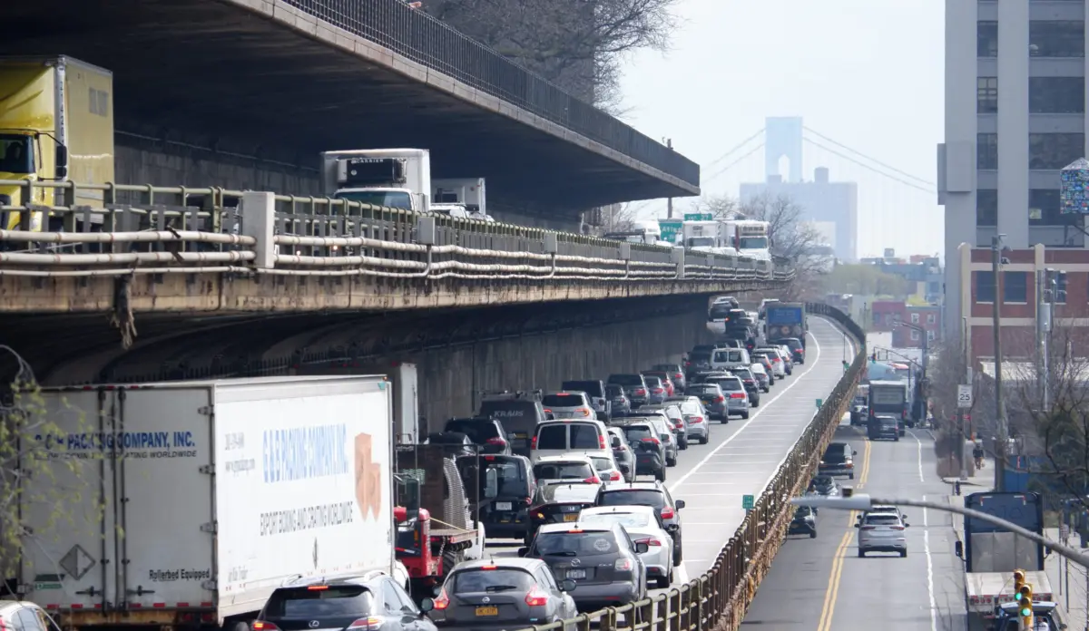
Mayor Mamdani has officially abandoned proposals to tear down or fundamentally reimagine the deteriorating, triple-cantilevered stretch of the Brooklyn-Queens Expressway (BQE Central). Instead, the administration will pursue a $4 billion, decade-long reconstruction project anchored by a temporary two-tiered bypass structure. Scheduled to begin construction in 2030 and wrap up by 2040, the plan aims to extend the lifespan of the critical urban corridor through 2080.
Unlike previous iterations floated by past administrations, Mamdani’s blueprint promises not to expand the highway’s physical footprint, capping capacity at two lanes in each direction along the 0.4-mile historic cantilever stretch between Atlantic Avenue and Columbia Heights. City officials, speaking at a closed briefing, defended the decision as an urgent, pragmatic intervention. They warned that total removal or prolonged inaction would trigger catastrophic traffic diversions onto local residential streets and paralyze key regional freight networks.
Yet, the announcement sets the stage for renewed friction with civic groups, environmental advocates, and Brooklyn residents who have long championed a forward-looking vision: dismantling the highway entirely to heal the scars carved by mid-century urban planner Robert Moses. With the administration locking the highway in place for another half-century, the city faces a contentious path forward balancing structural survival against modern urban planning paradigms.
Detailed Chronology of the BQE Central Impasse
The saga of BQE Central—the city-owned, 1.5-mile segment running between Atlantic Avenue and Sands Street—is a masterclass in bureaucratic delay, political hesitation, and the immense complexities of managing aging 20th-century infrastructure.
Origins and Early Failures (2006–2021)
Planning for the overhaul of the deteriorating cantilever structure dates back to 2006, when municipal engineers first raised alarms over corrosion, cracked concrete, and failing structural ties. Under the de Blasio administration, the city took over ownership and operational oversight of the central segment from New York State. However, efforts to address the crisis repeatedly stalled.
In 2018, the de Blasio administration floated a controversial plan to construct a six-lane replacement highway directly atop the iconic Brooklyn Heights Promenade. The proposal sparked immediate, fierce community pushback. Fearing political fallout and intense local resistance, the city shelved the major overhaul. Instead, de Blasio opted for a costly "long punt"—implementing patchwork structural repairs and narrowing the roadway from three lanes to two to reduce the deadweight load on the aging cantilever. Currently, the city drains roughly $160 million annually just to maintain the deteriorating structure in lieu of a permanent fix.
The Adams Administration and Federal Ambitions (2021–2025)
When Eric Adams assumed office, the BQE headache persisted. Adams’s team flirted heavily with car-first Brooklyn Democratic Party power brokers who advocated for restoring the corridor to a full six lanes of traffic. Concurrently, the administration lobbied the federal government for massive grants, pitching a reconstruction project intended to last an entire century.
However, these plans failed to secure the necessary federal sign-offs or funding. As political paralysis deepened, a coalition of civic, environmental, and transit advocacy groups coalesced in 2024 to demand a radical pivot: entirely removing BQE Central and rethinking the corridor from the Verrazzano to the Kosciuszko bridges.
The Mamdani Pivot (2025–Present)
Upon taking office, Mayor Mamdani evaluated the gridlocked landscape. Rejecting both the highway-removal movement and the expansive, footprint-widening proposals of his predecessor, Mamdani opted for a middle-ground compromise.
The administration’s timeline outlines the following phases:
- Mid-2028: Formal initiation of the state and federal environmental review processes.
- 2029: Groundbreaking and commencement of preliminary construction activities.
- 2030: Traffic is diverted onto the temporary two-tiered bypass structure running along Furman Street.
- 2040: Project completion, removal of the temporary bypass, and restoration of impacted park spaces, pushing the corridor’s structural lifespan to 2080.
Supporting Context, Metrics, and Logistics
The engineering and logistical scope of the Mamdani administration’s temporary bypass plan is immense, carrying sweeping implications for traffic flow, public parks, and neighborhood livability.
Engineering the Bypass
The Department of Transportation (DOT) plans to construct a temporary, two-tiered bypass highway directly adjacent to the 0.4-mile cantilever along Furman Street, nestled between Atlantic Avenue and Columbia Heights. To seamlessly re-integrate traffic, the detour road will extend over the Brooklyn Bridge approach at Vine Street, reconnecting with the wider expressway network. While the exact alignment near the bridge remains under engineering review, officials have stressed that the temporary structure will be built at a lower elevation than the Brooklyn Heights Promenade—roughly matching the height of the northbound upper roadway of the existing cantilever.
Traffic Realities and the "Local Street" Fear
A central pillar of the city’s defense for retaining the highway is the sheer volume of daily commuters. City transportation analysts insist that any total closure or unmitigated shutdown risks diverting a "significant portion" of the roughly 130,000 daily car and truck trips directly onto local municipal streets.
Critics, however, point out a persistent irony: motorist cut-through traffic is already a daily reality. Drivers routinely exit the BQE early to bypass the trenched sections in Carroll Gardens and Cobble Hill, squeezing through residential corridors before re-entering at Atlantic Avenue. Urban planners and traffic experts have argued for years that closing the chaotic Atlantic Avenue on-ramps near Brooklyn Bridge Park would effectively eliminate this cut-through behavior and calm local traffic. While the DOT has studied closing these ramps as part of the broader redevelopment of the adjacent Brooklyn Marine Terminal, officials note that any such modifications would trigger complex, time-consuming federal highway reviews.
Environmental and Park Impacts
Because the temporary bypass will occupy space within the Furman Street right-of-way, the project will unavoidably intersect with numerous beloved public green spaces along the Brooklyn waterfront. According to City Hall briefings, the construction footprint will directly impact:
- Squibb Park
- Hillside Dog Park
- Anchorage Plaza
- Clumber Corner
- Bar and Grill Park
- Adam Yauch Park
- Portions of the Harry Chapin Playground
Furthermore, portions of the scenic Brooklyn Heights Promenade will experience intermittent closures, though officials have promised that the walkway will remain partially open to the public at all times. The adjacent Columbia Heights overpass will also undergo complete reconstruction during the decade-long timeline. To legally execute the project, the DOT intends to formally request that the state alienate parkland. In exchange, city officials have made a binding commitment to tear down the temporary roadway entirely and fully restore all disrupted green spaces once the primary reconstruction concludes in 2040.
Official Statements and Political Rationales
Faced with inevitable political friction, the administration and its agency heads have launched a coordinated messaging campaign emphasizing pragmatism, public safety, and the unacceptable costs of continued inaction.
In his official statement, Mayor Mamdani framed the project as a decisive break from decades of political indecision:
"For decades, prior administrations have failed to deliver urgent long-term repairs to BQE Central — but we can no longer afford to wait for the perfect solution. This plan allows us to safely fix the BQE without slowing our city down or wasting decades more on magical thinking. The cost of inaction is too high, and the risks to New Yorkers are too important to delay any longer."
DOT Commissioner Mike Flynn echoed these sentiments, directly addressing the physical decay of the infrastructure while nodding to the historical context of mid-century urban planning:
"While the city and the state must right the wrongs of Robert Moses with the BQE and other infrastructure plowed through urban communities, decades of political paralysis have left us out of options. Confronting the reality of cracked concrete, exposed steel and extensive rust damage simply cannot wait for another blue-ribbon commission."
Highlighting the logistical nightmare of a sudden structural failure, Deputy Mayor for Operations Julia Kerson underscored the multi-layered impacts on daily commerce:
"A catastrophic failure of the corridor would force cars and heavy trucks onto local streets, severely disrupting key freight transportation networks. We must and will act now."
Future Outlook: Precedents, Partnerships, and Local Resistance
The Global and National Highway Removal Debate
Mamdani’s decision to preserve the highway places New York City at odds with a growing global and domestic movement favoring urban highway removal. Across the world, cities have successfully dismantled aging elevated expressways to reclaim waterfronts, stitch neighborhoods back together, and spur economic revitalization.
Notable case studies often cited by transit advocates include:
- Seoul, South Korea: The demolition of the Cheonggyecheon motorway, which successfully transformed a congested elevated highway into a vibrant, pedestrian-friendly urban river walk.
- Seattle, Washington: The removal of the Alaska Way Viaduct, where transit planners watched traffic "just disappear" as motorists organically adjusted their commuting habits.
- San Francisco, California: The teardown of the Embarcadero Freeway, which revitalized the city’s waterfront corridor.
- New York State Precedent: Governor Kathy Hochul recently canceled an expansive modernization project on the Cross-Bronx Expressway following fierce community pushback and sustained local reporting, demonstrating that highway expansions are increasingly politically toxic.
Despite these precedents, municipal officials maintain that replicating such models in Brooklyn is structurally impossible without active, cooperative intervention from state and federal partners. Because the BQE is integrated into the interstate highway system—with the vast majority of the wider corridor owned and operated by New York State—the city possesses jurisdiction over only a 1.5-mile slice. To date, officials in Albany have shown zero institutional appetite for completely decommissioning their portions of the expressway.
The Road Ahead: Anticipating Community Pushback
As the Mamdani administration prepares to roll out its finalized blueprint, local resistance is all but guaranteed. Brooklyn Heights residents, civic associations, and environmental watchdogs—who mobilized heavily against previous iterations of BQE construction—are expected to scrutinize the environmental review process slated for mid-2028.
While the administration has intentionally lowered the profile of the temporary bypass to protect views and reduce neighborhood intrusion, the prospect of a decade of heavy construction, parkland disruption, and locked-in highway infrastructure for the next fifty years ensures that the BQE will remain one of New York City’s most polarizing political and urban planning battlegrounds.