







Executive Overview
While Arizona’s arid reputation often evokes images of sun-baked expanses and sparse landscapes, the Grand Canyon State is home to a remarkable network of aquatic retreats. Featuring only two natural lakes that are prone to seasonal dry cycles, Arizona’s aquatic identity is instead defined by a vast engineering network of sun-dappled reservoirs. Maintained as critical sources of municipal drinking water, these man-made bodies of water are subjected to rigorous water quality monitoring by agencies such as the Arizona Department of Environmental Quality (ADEQ).
Surrounded by diverse topography—ranging from marshy avian sanctuaries and jagged canyon walls to the alpine, tree-lined shores of higher-elevation impoundments—these aquatic destinations serve as premier havens for outdoor recreation, kayaking, hiking, and angling. However, shifting regional climates, sustained droughts, and regional water-sharing compacts have introduced significant volatility to the region. Major impoundments like Lake Powell face unprecedented hydrological pressures, forcing infrastructure managers, marinas, and recreation areas to constantly adapt.
To help travelers navigate this vibrant landscape, this comprehensive report examines 12 top-rated lake destinations across Arizona. Selected through a rigorous cross-referencing of average visitor ratings on Google (maintaining a minimum threshold of 4.6 stars), TripAdvisor, and official assessments from Arizona State Parks, Visit Arizona, and Visit USA Parks, this guide provides an authoritative roadmap to the state’s most pristine aquatic getaways.
Detailed Chronology & Geographic Distribution
The evolution of Arizona’s lake system spans decades of water infrastructure development, beginning with early 20th-century irrigation projects along the Salt and Colorado rivers and continuing through the mid-century construction of monumental dams. Today, these reservoirs span the state’s varied geography, creating microclimates that transition from the Lower Colorado River basin to the high-desert mountain transition zones of central Arizona.
The Western Borders and the Lower Colorado River
1. Lake Havasu
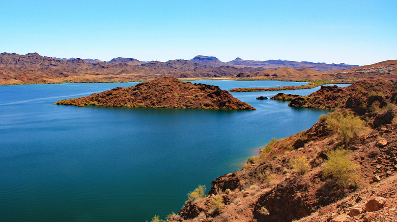
Created along the Colorado River to form part of the boundary between Arizona and California, Lake Havasu boasts a surface area exceeding 30 square miles. Lake Havasu State Park maintains a stellar 4.7-star rating on Google, drawing approximately 2.5 million annual visitors to its resorts, recreation areas, and Lake Havasu City—home to the historic London Bridge. Beyond the urbanized bustle, explorers can navigate by boat to picturesque southern inlets like Sadie’s Cove or hike the elevated loop trails at SARA Park. Further south, Cattail Cove State Park offers white-sand beaches and campsites, while the Bill Williams River National Wildlife Refuge and the expansive Havasu National Wildlife Refuge protect critical habitats for hundreds of migratory and nesting bird species.
2. Lake Mead and Lake Mohave
Extending north from the Arizona-Nevada border, Lake Mead offers roughly 750 miles of shoreline. Managed under the 1.5-million-acre Lake Mead National Recreation Area, the region includes Lake Mohave to the south, stretching from the Hoover Dam down to the Davis Dam near Laughlin, Nevada. Visitors frequently praise the striking visual contrast of deep blue water against rugged desert topography, contributing to its robust 4.6-star Google rating. For lakeside camping, Kingman Wash Beach offers immediate water access, while Temple Bar Marina serves as a premier hub for water-skiers and boaters seeking access to secluded retreats like Gregg’s Hideout.
3. Alamo Lake
Located within Alamo Lake State Park in western Arizona, this 3,500-acre desert oasis is renowned for its remote mountain views and exceptional sportfishing. Anglers flock to its waters each spring for the largemouth bass spawn. Because the nearest urban centers are roughly a 2.5-hour drive away (with Prescott to the northeast and Lake Havasu City to the northwest), Alamo Lake offers premier stargazing opportunities and a profound sense of solitude.
Central Arizona’s Mountain and High-Desert Jewels
4. Watson Lake
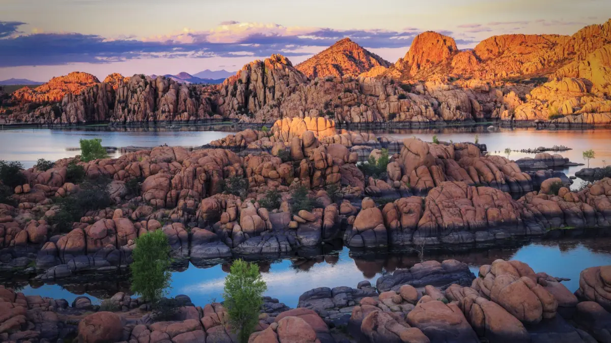
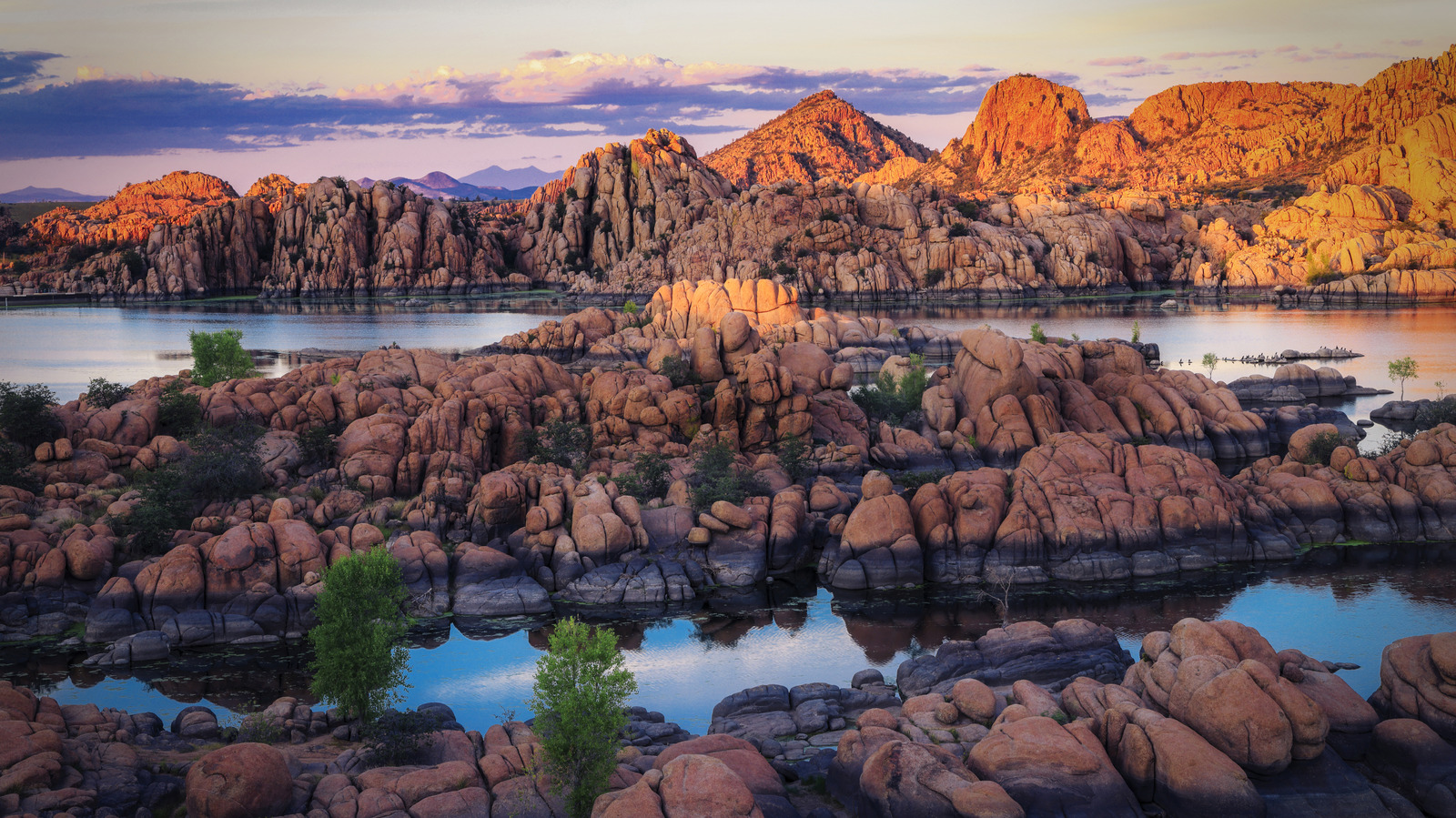
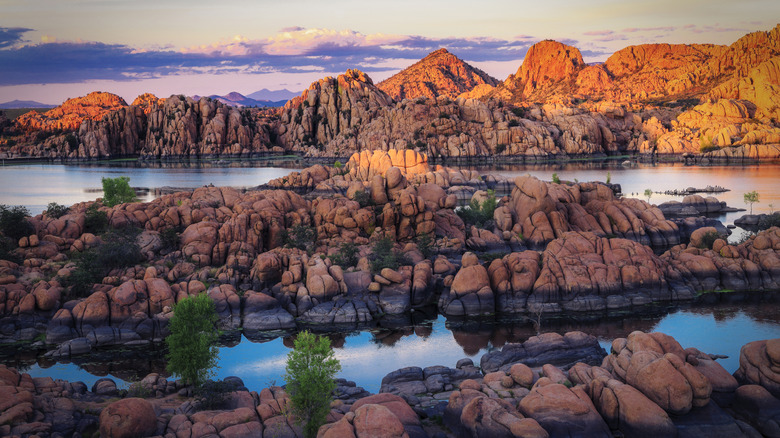
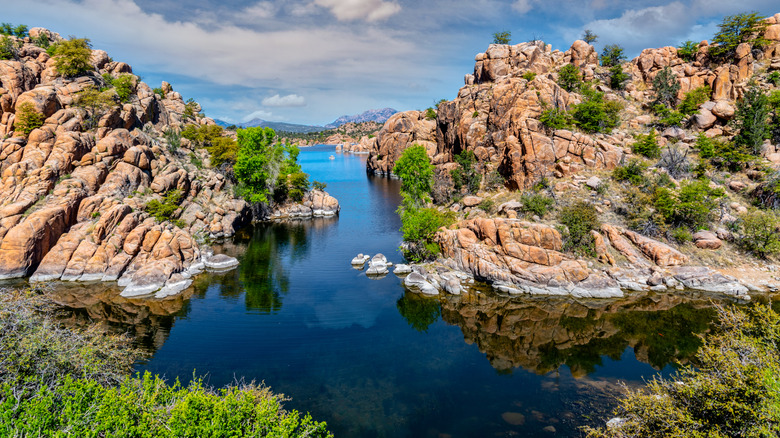
Situated in central Arizona’s transitional mountain zone—where the Colorado Plateau gives way to the Sonoran Desert—Watson Lake lies just 5.5 miles northeast of downtown Prescott. Surrounded by the Bradshaw Mountains and Black Hills, this mile-high desert reservoir is famous for its unique granite islands formed by the 1.4-million-year-old Granite Dells. Averaging an impressive 4.8 stars on Google, the lake offers exceptional kayaking, rainbow trout and largemouth bass fishing, an 18-hole disc golf course, and nearby seasonal camping facilities managed by the City of Prescott.
5. Lynx Lake
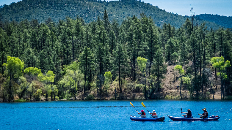
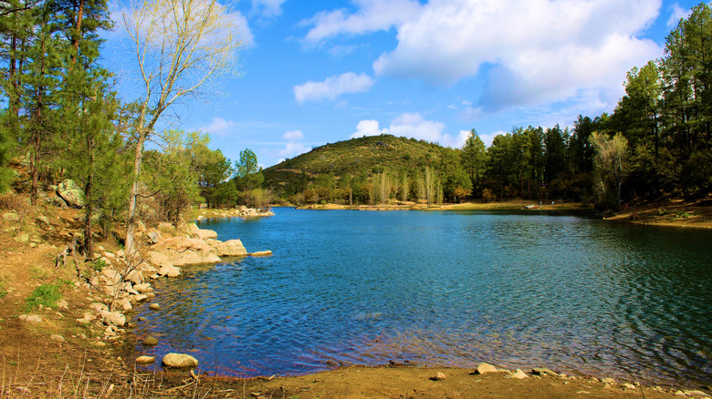
Located just seven miles east of downtown Prescott within the Prescott National Forest, Lynx Lake sits at an elevation of 5,800 feet. Encompassing a 55-acre reservoir, the Lynx Lake Recreation Area features tree-lined shores, peaceful trails, and two campgrounds. Averaging 4.7 stars on Google, the lake is celebrated for trout and bass fishing, as well as the easy 2.5-mile Lynx Lake Recreation Loop Trail, making it an ideal alpine-style escape from lower-elevation summer heat.
6. Goldwater Lake
Just four miles south of Prescott, Goldwater Lake comprises Upper and Lower Goldwater Lakes, spanning a modest 15 acres. Restricted to electric-powered watercraft, this intimate mountain destination is a favorite among paddlers seeking tranquil views of ponderosa pine-lined shores. Holding a 4.7-star rating on Google, the area features the 2.4-mile Goldwater Lakes Loop trail and seamless access to the expansive 56-mile Prescott Circle Trail.
The Salt River Reservoir System & Eastern Wilderness
7. Canyon Lake
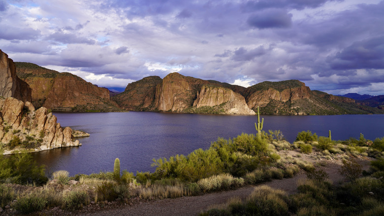
Located 50 miles east of downtown Phoenix within the Tonto National Forest, Canyon Lake is one of four reservoirs engineered along the Salt River. Averaging 4.7 stars on Google, it is celebrated for its crystal-clear water and dramatic canyon views. Visitors can explore the narrow eastern inlets via kayak, camp at the Canyon Lake Marina, or take a leisurely excursion aboard the historic Dolly Steamboat. Hikers can also access elevated vistas of the water via the Boulder Canyon Trailhead in the Superstition Wilderness.
8. Saguaro Lake
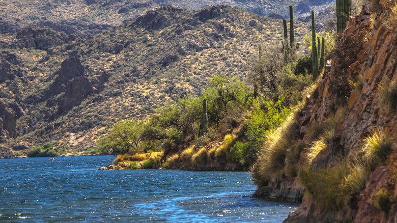
Positioned just over 40 miles east of downtown Phoenix, Saguaro Lake offers 22 miles of shoreline framed by the Salt River’s dramatic canyon walls. Boasting a 4.7-star Google rating, the lake features Butcher Jones Beach for swimming and narrated tours via Desert Belle Cruises. Visitors can also experience the historic Saguaro Lake Guest Ranch—family-run since 1948—which offers rustic-luxe cabin accommodations, horseback riding, and prime angling for catfish, bass, and bluegill.
9. Theodore Roosevelt Lake
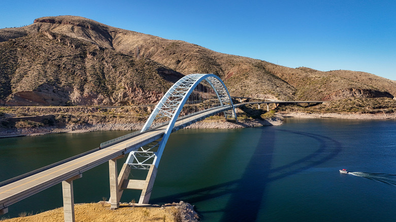
As the largest lake contained entirely within Arizona’s borders, Theodore Roosevelt Lake spans the Tonto National Forest as part of the Salt River system. Maintained with popular facilities like the seasonal Cholla Campground and the Roosevelt Lake Marina, the reservoir holds a 4.7-star Google rating. It serves as a premier destination for family recreation, trophy bass fishing, and historical exploration, given its proximity to the Ancestral Puebloan cliff dwellings at Tonto National Monument.
10. Apache Lake
Separated from Roosevelt Lake by the Theodore Roosevelt Dam, Apache Lake is another scenic Salt River impoundment within the Tonto National Forest. Accessible via a rugged, gravel stretch of State Route 88, Apache Lake rewards travelers with a 4.7-star overall Google rating, offering boat rentals, resort accommodations at Apache Lake Marina, and secluded shorelines like Chunk Beach and the Burnt Corral Campground.
The Borderlands and Northern Canyons
11. Lake Powell
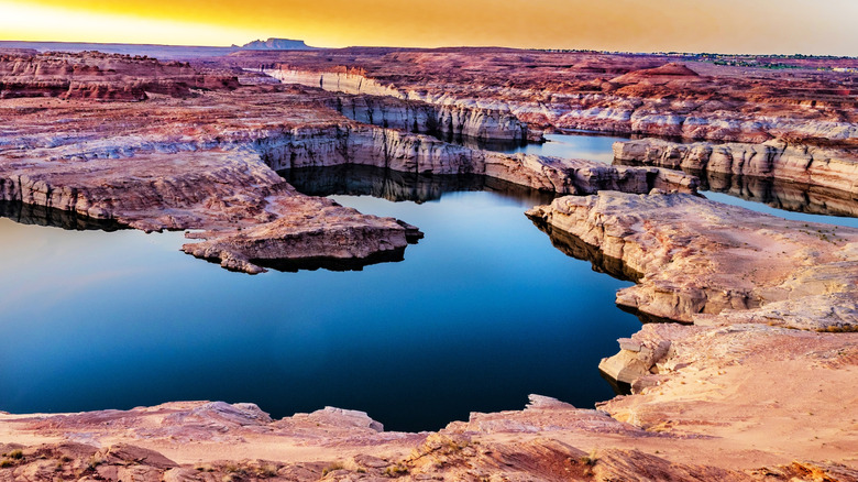
Spanning the border of Arizona and Utah, Lake Powell was created by the construction of the Glen Canyon Dam on the Colorado River. Famous for its towering red rock cliffs, hidden canyons, and winding waterways, the reservoir maintains a 4.7-star Google rating. Major hubs like Wahweap Marina and Antelope Point Marina provide houseboat rentals, lodging, and access to narrow slot canyons ideal for kayaking. However, the lake has faced historically low water levels, prompting ongoing infrastructural adaptations by the National Park Service.
12. Patagonia Lake
Positioned approximately 75 miles south of Tucson within Patagonia Lake State Park, this southern desert oasis provides sandy beaches, wooded campsites, and a designated quiet zone for birdwatching alongside a high-energy water recreation zone. Holding a 4.6-star Google rating, the park features the 1.9-mile Patagonia Lake Birding Loop and the 2.7-mile Sonoita Creek Trail, offering visitors a vibrant blend of aquatic recreation and rich riparian biodiversity.
Supporting Context & Metrics
Managing Arizona’s aquatic infrastructure requires a delicate balance between recreation, environmental conservation, and municipal water security.
- Water Quality Monitoring: Because these reservoirs serve as primary drinking water sources for major metropolitan areas, the Arizona Department of Environmental Quality (ADEQ) enforces strict testing protocols. Nutrient levels, dissolved oxygen, and microbial indicators are continuously assessed to ensure safe public use.
- Hydrological Volatility: Reservoirs within the Southwest are uniquely vulnerable to inter-annual climate fluctuations. Sustained regional droughts, shifting snowpacks in the Rocky Mountains, and rising ambient temperatures have caused significant fluctuations in storage capacities—most notably at Lake Powell and Lake Mead.
- Visitation Metrics: High-profile recreation areas experience intense seasonal compression. For instance, Lake Havasu draws roughly 2.5 million visitors annually, while northern hubs like Wahweap at Lake Powell exceed one million visitors per year. This heavy traffic has necessitated real-time capacity management by state and federal park rangers.
Official Statements & Regulatory Guidance
State and federal land management agencies frequently update access guidelines to protect both ecological resources and public safety during extreme weather or maintenance cycles.
"Many reservoirs in the Southwest have seen substantial changes over the past decade or two… The levels in these impoundments can vary based on infrastructural and political agreements, but also on natural factors like sustained drought and rising temperatures. A combination of these variables can affect access to boat landings and marinas, which have to adapt to the changes, so check current conditions in advance if you’re concerned about accessing ramps or certain areas."
— Resource Management Advisory, Arizona State Parks and National Park Service
Furthermore, agencies emphasize visitor preparedness regarding parking fees, daily vehicle permits, and temporary park closures:
- Day-Use Fees: State parks such as Patagonia Lake and Alamo Lake implement vehicle entrance fees (typically ranging from $15 to $20), while national recreation areas like Glen Canyon and Lake Mead utilize federal recreation passes.
- Capacity Closures: Popular beaches and boat ramps—particularly at Patagonia Lake and Lake Havasu—frequently reach maximum parking capacity during summer weekends, leading to temporary temporary closures until departing visitors free up space.
Future Outlook
The long-term outlook for Arizona’s premier lake getaways hinges on adaptive infrastructure management and regional water conservation agreements. As climate models project continued thermal stress across the Southwest, federal authorities, state regulators, and municipal water districts are actively negotiating long-term operating guidelines for the Colorado River basin.
For outdoor enthusiasts and travelers, these environmental shifts underscore the importance of pre-trip planning. While receding water lines at major reservoirs like Lake Powell have occasionally limited motorized boat ramp access, they have simultaneously unveiled hidden canyons and geological formations not seen in decades. By respecting park capacity limits, monitoring official updates from the National Park Service and Arizona State Parks, and practicing Leave No Trace principles, visitors can continue to enjoy the pristine beauty, ecological diversity, and recreational vitality of Arizona’s high-desert oases for generations to come.