






Executive Overview
When most people envision the state of Oklahoma, images of flat, sun-baked plains, rolling tumbleweeds, and arid ranchlands immediately spring to mind. Yet, this central American state possesses a vastly diverse topography that shatters these conventional stereotypes. Far from being a uniform desert or prairie, Oklahoma features a rich landscape of rolling hills, ancient mountain ranges, and dense river valleys.
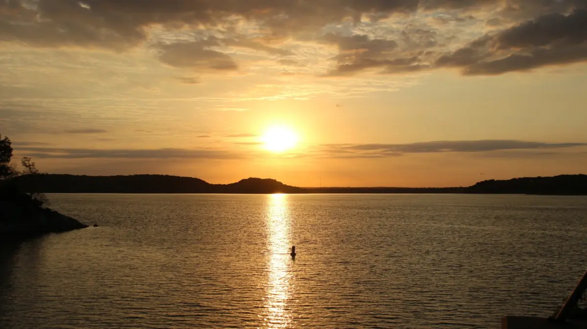
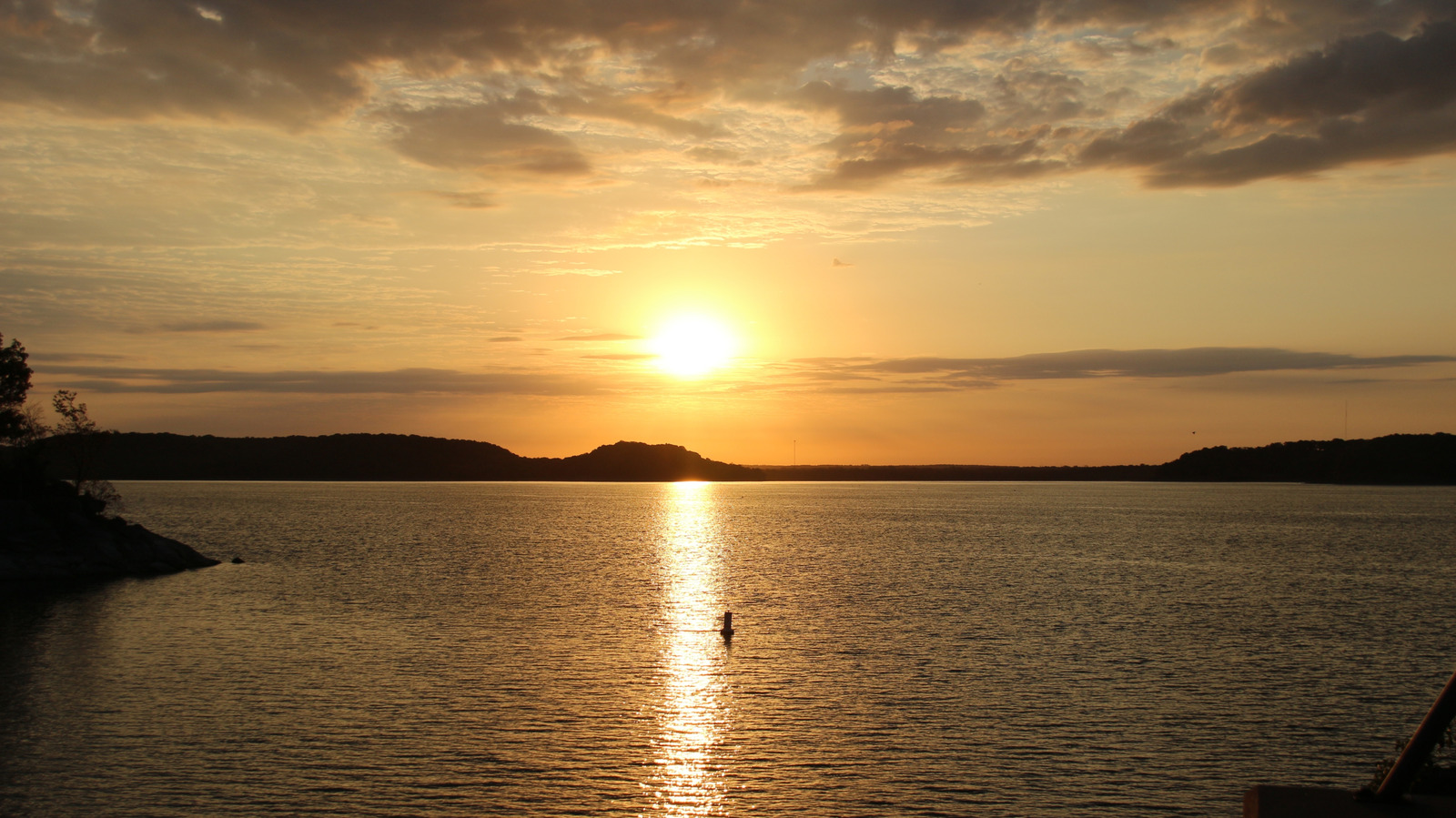
Among its most prized natural assets is a vast network of waterways, featuring 15 major rivers and eight expansive reservoirs. Nestled within the lush, verdant region known locally as "Green Country"—roughly an hour’s drive north of Tulsa—lies Oologah Lake. Spanning nearly 217 miles of picturesque shoreline, this expansive body of water was originally engineered and completed by the U.S. Army Corps of Engineers in the mid-20th century.
Today, Oologah Lake has evolved from a utilitarian flood-control project into a premier recreational haven. Surrounded by wooded hills and rolling meadows, the destination offers an impressive array of outdoor pursuits, including world-class sportfishing, competitive sailing, swimming at sandy beaches, horseback riding, mountain biking, and extensive camping facilities. Stretching gracefully between the small, historic towns of Oologah and Nowata, this waterfront gem serves as an accessible, multi-faceted escape for nature enthusiasts, families, and weekend adventurers alike.
Detailed Chronology and Development of the Reservoir
The Mid-Century Engineering Genesis
The story of Oologah Lake is deeply intertwined with the broader history of American water management and flood control following the devastating floods of the mid-20th century. Recognizing the volatile nature of the Verdigris River basin, federal authorities sought a comprehensive engineering solution to tame the rushing waters, protect downstream agrarian communities, and provide reliable water reserves.
- 1950s Construction Phase: The U.S. Army Corps of Engineers spearheaded the development of the Oologah Dam and the subsequent creation of the reservoir. Completed in 1950, the massive infrastructure project permanently altered the landscape, flooding low-lying river valleys while carving out a pristine, deep-water lake bordered by steep, forested bluffs and fertile bottomlands.
- Evolution of Public Access: Following its initial decades as primarily a flood-control and agricultural resource, local and federal authorities recognized its latent tourism and recreational potential. Over subsequent decades, the Corps of Engineers—in cooperation with state wildlife and parks departments—systematically developed 11 distinct public use areas around the shoreline.
- Modern Recreational Integration: By the late 20th and early 21st centuries, Oologah Lake had transitioned into a fully integrated recreation destination. The establishment of dedicated equestrian trails, paved access roads, modern campgrounds, and specialized clubs transformed the shoreline into a thriving hub for regional tourism.
Supporting Context, Metrics, and Recreational Infrastructure
Angling Paradise: A Fishery of Distinction
Oologah Lake is widely celebrated by regional anglers for its diverse and abundant aquatic ecosystem. The reservoir’s varied structural topography—featuring submerged creek channels, rocky points, and timbered coves—provides an ideal habitat for a wide variety of sportfish.
- Stocking Programs: The lake is regularly stocked by wildlife conservation agencies, ensuring robust populations of hybrid striped bass and walleye.
- Native and Trophy Species: Beyond the stocked varieties, blue catfish and paddlefish have historically thrived in the fertile waters. Anglers frequently target largemouth bass along the submerged weed lines and rocky banks.
- Access Points: Whether casting from the shoreline or navigating the open water via boat, fishers have access to numerous strategically placed launch sites. Essential regional infrastructure includes specialized bait and tackle shops—such as The Tackle Box, JD’s TackleBox, and Nabatak Outdoors—which supply local expertise, live bait, and gear tailored to the lake’s unique conditions.
+-----------------------------------------------------------------+
|               OOLOGAH LAKE FISHERY METRICS AT A GLANCE          |
+--------------------------+--------------------------------------+
| Total Shoreline          | Nearly 217 miles                     |
| Primary Sportfish        | Hybrid Striped Bass, Walleye, Bass   |
| Trophy Species           | Blue Catfish, Paddlefish             |
| Governing Federal Agency | U.S. Army Corps of Engineers         |
+--------------------------+--------------------------------------+
Boating, Sailing, and Marina Operations
Navigating the expansive waters of Oologah Lake is facilitated by a robust network of marinas, boat ramps, and aquatic clubs.
- Redbud Marina: Situated roughly a 15-minute drive north of Claremore—a charming, historic Route 66 retirement hub—Redbud Marina stands as the focal point for aquatic recreation on the lake. Boasting over 200 operational boat slips, the marina provides comprehensive services, including the rental of pontoon boats, sailboats, and various paddlecraft.
- The Spindrift Sailing Club: Catering to enthusiasts of wind-powered watercraft, the active club welcomes both novice and experienced sailors. Offering structured skill-building programs and organized community races, the club maintains remarkably accessible family membership rates (averaging around $100 annually), fostering a vibrant community of water sports hobbyists.
Comprehensive Campground Infrastructure
For visitors wishing to extend their stay, Oologah Lake features four meticulously maintained public campgrounds managed via federal recreation portals:
- Blue Creek Campground: Tucked along the southeastern shore, this site offers standard electric and non-electric campsites, each equipped with dedicated picnic tables. Amenities include modern shower facilities, a children’s playground, direct boat ramp access, and immediate entry points for equestrian trail systems.
- Hawthorn Bluff: Located on the southwestern tip of the lake, Hawthorn Bluff features a balanced mix of electric, non-electric, and tent-only sites. Beyond standard camping infrastructure, it boasts a fishing dock, boat ramp, playground equipment, volleyball courts, and horseshoe pits.
- Redbud Bay Campground & Spencer Creek: Both locations provide modern conveniences, including electrical hookups, flush toilets, hot showers, and functional waste dump stations, making them ideal for RV travelers and extended family getaways.
Official Guidelines, Directives, and Environmental Metrics
Visitor Protocols and Mandatory Compliance
To ensure environmental preservation, public safety, and sustainable wildlife management, governing agencies enforce specific protocols for all incoming visitors.
- Online Check-In Requirements: Per updated state wildlife regulations, visitors are strictly required to complete an online check-in procedure via official state wildlife department portals prior to accessing specific recreational and hunting zones around the lake.
- Water Safety Initiatives: In cooperation with local safety officials, the U.S. Army Corps of Engineers sponsors widespread life jacket loaner stations situated near major swimming beaches—such as those at Hawthorne Bluff and Spencer Creek Cove. Visitors are encouraged to borrow coast-guard-approved flotation devices free of charge and return them following use.
Terrestrial Trails and Biodiversity
Oologah Lake is not merely an aquatic playground; its surrounding perimeter hosts miles of diverse terrestrial trails traversing rich ecological biomes.
- Skull Hollow Nature Trail: An accessible 1.2-mile loop trail winding through forested terrain along the southwestern shore. This path serves as a prime location for observing native flora and localized fauna, including waterfowl and white-tailed deer.
- Will Rogers Centennial Trail: Spanning a continuous 12 miles, this extensive trail was originally engineered for horseback riders but has gained immense popularity among hikers and mountain bikers. Traversing the eastern shore, the trail guides trekkers through dense canopies of oak and hickory trees interspersed with open prairie fields.
- Avian Biodiversity: Positioned squarely within Oklahoma’s lush "Green Country," the lake acts as a vital stopover and habitat for regional birdlife. Observers equipped with binoculars frequently sight Canada geese, common terns, great egrets, dark-eyed juncos, savannah sparrows, and brilliant Northern cardinals.
Future Outlook and Regional Tourism Integration
Expanding Green Country’s Ecological Footprint
As regional tourism initiatives continue to elevate the profile of northeastern Oklahoma, Oologah Lake is poised for sustained economic and ecological development. Local chambers of commerce and state tourism boards are increasingly marketing Green Country as an affordable, amenity-rich alternative to more congested national vacation destinations.
- Inter-Lake Synergy: Oologah Lake benefits significantly from its geographic proximity to other regional jewels. Travelers frequently combine an excursion to Oologah with visits to nearby aquatic attractions, such as Greenleaf Lake (located roughly a two-hour drive southeast) or Hulah Lake, which offers comparable boating, fishing, and swimming infrastructure nestled within the northern hills.
- Sustainable Conservation: Future infrastructure plans emphasize sustainable tourism, ensuring that increased visitor volume does not compromise the delicate balance of the lake’s aquatic ecosystems or the natural integrity of its surrounding forests and trails. By balancing modern recreational amenities with stringent wildlife management and habitat protection, Oologah Lake remains a shining example of mid-century federal engineering harmonizing with Oklahoma’s enduring natural beauty.