








By Hilary Aylesworth, PTV Group | September 2026
Executive Overview
Train stations stand among the most complex and heavily trafficked public environments in the modern world. Major global hubs like Shinjuku Station in Tokyo process millions of travelers annually, while even modest, medium-sized commuter terminals must safely and efficiently channel thousands of daily commuters through their concourses. As municipal governments and transit agencies worldwide double down on public transport as the fundamental backbone of sustainable urban mobility, these terminals are evolving into much more than mere boarding zones.
Today’s transit hubs are dynamic, multi-modal ecosystems. They seamlessly integrate commuter rail, rapid transit metros, bus loops, light rail, bicycle infrastructure, ride-hailing staging areas, and dense pedestrian networks. Furthermore, modern stations frequently double as commercial destinations, embedding retail centers, dining spaces, and public plazas directly into the traveler’s journey.
This multi-dimensional operational complexity presents unprecedented challenges for transit planners and engineers. Passenger movement is governed by a delicate interplay of physical bottlenecks: platform capacity constraints, mechanical performance limits of escalators, stairways and elevators, the placement of fare-control gates, and the complex fluid dynamics of intersecting human streams. During peak commuting hours, even negligible fluctuations in travel demand can trigger severe cascading bottlenecks, inflate transfer times, degrade passenger comfort, and cripple network-wide operational resilience.
To conquer these systemic hurdles, the industry is increasingly turning to an indispensable engineering technology: pedestrian microsimulation. By digitally mapping stations and treating every traveler as an autonomous agent with distinct behavioral patterns, planners can test, stress-test, and optimize facility designs long before the first shovel breaks ground. This article explores how pedestrian microsimulation is transforming transit planning globally, featuring insights from real-world implementations in California and Tel Aviv.
Detailed Chronology: The Evolution of Transit Hub Complexity and Simulation
The integration of advanced modeling tools into civil engineering did not happen overnight. It represents a steady, decades-long technological evolution born out of necessity as cities densified and transit networks expanded.
- The Mid-to-Late 20th Century (The Era of Static Metrics): For decades, station design relied primarily on static, macro-level guidelines. Planners consulted legacy manuals—such as early iterations of the Transit Capacity and Quality of Service Manual (TCQSM)—to calculate simplistic floor-space-to-passenger ratios and theoretical corridor capacities. These calculations treated passenger crowds like water flowing through static pipes, ignoring human behavioral variables, walking speeds, and directional conflicts.
- The Turn of the 21st Century (The Rise of Multimodal Hubs): As urban centers expanded, rail stations transitioned from simple boarding platforms into sprawling multimodal interchanges. The incorporation of retail spaces, mixed-use zoning, and rapid transfers between diverse transit modes introduced unpredictable pedestrian traffic patterns that legacy calculations simply could not capture.
- The 2010s (Adoption of Behavioral Modeling): High-powered computing enabled the transition from macro-level approximations to micro-level behavioral modeling. Utilizing mathematical frameworks like the Social Force Model, engineers began simulating individual pedestrian interactions, such as obstacle avoidance, group cohesion, and reaction to localized congestion.
- The 2020s and Beyond (Predictive Prototyping & Digital Twins): Today, pedestrian microsimulation serves as the cornerstone of predictive infrastructure planning. Agencies no longer view simulation as an optional visualization tool, but as a mandatory risk-mitigation phase. Modern digital twins allow engineers to test multi-level station architectures against decades-out ridership projections, transforming raw conceptual designs into highly optimized, resilient public spaces.
Supporting Context & Metrics: Decoding the Mechanics of Microsimulation
Unlike rail rolling stock, which operates strictly on rigid timetables, pedestrian flows are inherently organic and erratic. Passengers walk at wildly varying speeds, navigate via different cognitive pathways, pause to orient themselves, travel in packs, lug heavy baggage, and react dynamically to congestion building up around them. The collective output of these thousands of independent, micro-level decisions dictates the macroscopic operational efficiency of the entire station.

The Power of Behavioral Algorithms
Modern simulation software relies heavily on advanced behavioral modeling frameworks, most notably the Social Force Model. This mathematical approach operationalizes human movement by treating pedestrians as particles influenced by "forces"—such as the internal desire to reach a destination, an attractive pull toward a specific exit, and a repulsive force that drives people away from obstacles, walls, and other commuters.
Rather than working with aggregate averages, these simulations display how individual travelers interact with station infrastructure in hyper-realistic operating conditions. Planners can track every stage of the passenger journey:
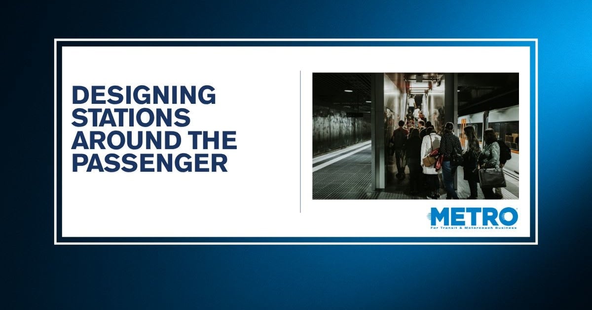
- Waiting dynamics and dwell times on platforms.
- Boarding and alighting friction points.
- Concourse navigation and wayfinding friction.
- Inter-modal transfer efficiency.
- Emergency evacuation dynamics.
Quantifying Operational Resilience
Crucially, modern pedestrian simulation does not operate in a vacuum; it is deeply intertwined with rail operations modeling. When a train experiences a delay, the simulation immediately mirrors how disrupted passenger discharges ripple through concourses, bottleneck stairwells, and alter vertical circulation. Conversely, it quantifies how prolonged passenger boarding times can compromise train dwell times and degrade overall rail corridor performance.
Engineers extract quantifiable metrics from these models, including:
- Precise walking and transfer times.
- Identification of micro-bottlenecks and localized friction zones.
- Pedestrian density metrics and Levels of Service (LOS).
- Queue length development and dissipation rates.
Official Statements & Case Studies: Real-World Applications
To understand the profound impact of pedestrian microsimulation, one must examine how major transit authorities utilize the technology to navigate multi-billion-dollar infrastructure challenges.
San José Diridon Station: Preparing for Silicon Valley’s Future
San José Diridon Station in California stands as a prime example of a historic transit hub preparing for monumental growth. Currently serving roughly 16,000 daily passengers, the station is projected to see ridership skyrocket to 100,000 passengers per day by 2050, propelled by regional rail expansions and the rollout of California’s High-Speed Rail initiative.
Ahead of construction, planners deployed pedestrian microsimulation during early design phases to map out passenger movement. The digital model quickly exposed critical operational vulnerabilities. Under projected 2050 demand levels, pedestrian flows converged hazardously inside the station’s legacy tunnel. This caused sustained queues, zero operational resilience during demand surges, and immense pressure on aging stairwells and escalators.
By testing various layout alternatives within the simulation environment, planners demonstrated that a complete architectural redesign—featuring a three-level station layout, significantly expanded concourses, a widened pedestrian underpass, and additional high-capacity vertical circulation—was vital.
“By comparing alternative layouts, planners found that a three-level station design featuring larger concourses, a wider tunnel, and additional escalators significantly improved circulation throughout the station.”
The projected return on investment for this simulation-backed redesign is staggering: the optimized layout is expected to save approximately 404,000 passenger-hours annually through mitigated walking delays, shorter queues, and drastically improved transfer reliability.
Tel Aviv Metro: Optimizing Multimodal Interchanges
While San José focused on retrofitting an existing regional hub, emerging transit systems face the challenge of designing completely new networks from scratch. In Israel, the development of an extensive underground metro system—encompassing three new lines and over 100 stations—demands flawless spatial planning.
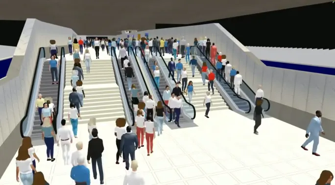
Several of these new stations will function as massive multimodal interchange hubs, managing immense passenger volumes transitioning simultaneously between underground metro lines, regional rail links, surface bus routes, and pedestrian thoroughfares. Planners deployed detailed pedestrian models to optimize peak-hour circulation.
The modeling pinpointed precise behavioral friction points across multi-level concourses. For instance, testing different staircase configurations revealed that a group of three parallel stairs operates at peak efficiency when two stairs are designated for ascending traffic and one for descending traffic. Furthermore, where staircases connected floors at awkward angles, simulations identified vectors where opposing passenger streams collided. Minor architectural and directional adjustments—such as strategic wayfinding placements and modified barrier layouts—eradicated these bottlenecks prior to ground-breaking.
Future Outlook: Moving From Infrastructure Capacity to Holistic Passenger Experience
Historically, transit station planning has been dictated by purely mechanical metrics: raw physical capacity and theoretical throughput limits. Planners asked a simple question: How many bodies can theoretically fit on this platform or pass through this corridor within a given hour?
As we move deeper into the 21st century, the industry paradigm is shifting decisively toward passenger experience, equity, and safety.
A station may technically clear every statutory capacity requirement on paper, yet still fail in practice if its layout feels confusing, overly congested, anxiety-inducing, or hostile to wayfinding. Conversely, targeted enhancements to pedestrian circulation can exponentially elevate operational efficiency without requiring multi-million-dollar structural expansions or concrete pours.
Pedestrian microsimulation grants transit agencies the predictive foresight required to master this delicate balance. By visualizing how thousands of autonomous human agents navigate complex physical spaces, planners can craft modern transit hubs that do more than simply survive future ridership surges. They build environments that are fundamentally safer, inherently intuitive, resilient against disruptions, and deeply integrated into the fabric of sustainable urban life. As global rail networks continue their historic expansion, designing around the nuances of human movement—rather than just the mechanics of train schedules—will remain the definitive hallmark of world-class transit planning.
About the Author
Hilary Aylesworth is the Chief Product & Technology Officer at PTV Group, part of Umovity. She leads the global product and technology strategy for the company’s elite mobility planning and simulation solutions, including PTV Vissim, empowering planners and civil engineers worldwide to model complex traffic, public transit, and pedestrian dynamics for major infrastructure projects.