



By Rachel Brittin, Founder of Vireo Communications and former NOAA Deputy Director of External Affairs
Enriched Journalistic Special Report
Executive Overview
To the millions of Americans who visit its shores each year, the ocean is a place of recreation, relaxation, and scenic beauty. To the global economy, it is a vast maritime superhighway carrying billions of dollars in essential goods. Yet beneath the crashing waves and rolling swells lies an invisible, high-tech safety net that most citizens do not even know exists: the United States Integrated Ocean Observing System (IOOS).
Operated under the umbrella of the National Oceanic and Atmospheric Administration (NOAA), IOOS is a complex web of buoys, underwater gliders, high-frequency coastal radars, and water-level stations. It forms the backbone of America’s marine intelligence. From the logistics manager tracking a cargo ship entering a major port to the everyday consumer buying imported electronics, and from the local fisherman navigating changing tides to the emergency rescue team searching for a missing swimmer, the entire nation relies on the continuous data stream provided by this public infrastructure.
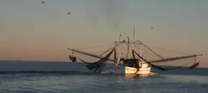
However, this critical national security and economic asset is facing an unprecedented threat. Current federal budget negotiations place vital investments in NOAA and its subsidiary observation programs at severe risk. Cutting funding for ocean observation does not neutralize environmental hazards—it merely blinds us to them. As the planet faces increasingly volatile weather patterns, including a rapidly strengthening El Niño cycle projected for the 2026–2027 season, dismantling or underfunding America’s ocean observing network is a gamble the nation cannot afford to take.
Detailed Chronology: The Evolution and Current Crisis of American Oceanography
The Genesis of Integrated Ocean Observation
The formal establishment of IOOS was not born overnight. For decades, federal agencies, academic institutions, and state governments gathered marine data in isolated silos. Fishermen collected localized temperature data, the U.S. Navy mapped bathymetry for defense purposes, and academic researchers studied long-term climate shifts independently.
Recognizing the need for a unified, standardized national approach, Congress and federal scientists spearheaded the integration of these disparate efforts into a cohesive framework. By the early 2000s, IOOS was formally codified to bridge the gap between raw scientific data and practical, real-world application. Partnering with 11 regional associations spanning the U.S. Atlantic, Pacific, Gulf coasts, and the Great Lakes, IOOS evolved into a synchronized network capable of capturing real-time changes across vast marine ecosystems.
The Modern Operational Era (2015–Present)
Over the past decade, technological leaps have transformed IOOS from a basic monitoring project into a sophisticated predictive machine. The deployment of autonomous underwater gliders—torpedo-shaped drones capable of diving deep into the water column for months at a time—has revolutionized how scientists measure subsurface temperatures, salinity, and acidification.
Concurrently, high-frequency radar networks were expanded along the coastline, allowing meteorologists and Coast Guard personnel to map surface currents in near-real-time. These advancements proved critical during major historical weather events, such as Hurricane Sandy and subsequent catastrophic storm seasons, where precise water-level telemetry spared billions in infrastructure damage and countless lives.
The 2026 Funding Threshold and the El Niño Convergence
Today, IOOS stands at a historic crossroads. As the federal government navigates the Fiscal Year 2027 appropriations process, proposed funding cuts threaten to dismantle decades of accumulated baseline data.
This funding crunch coincides dangerously with natural meteorological cycles. Meteorological models indicate a greater than 90% probability that a robust El Niño event will dominate the tropical Pacific during the fall and winter of 2026–2027. Historically, strong El Niño events fundamentally alter weather patterns, exacerbating coastal erosion along the West Coast, supercharging storm surges, and triggering devastating marine heatwaves and harmful algal blooms (HABs). Without the granular, localized data captured by regional IOOS networks, coastal communities will be left flying blind as these massive climate phenomena collide with unprecedented baseline ocean warming.
Supporting Context & Metrics: Why Ocean Data is Public Infrastructure
We frequently think of infrastructure in terms of tangible, terrestrial assets: interstate highways, electrical power grids, and municipal water purification plants. Yet, in the twenty-first century, information infrastructure is just as vital. IOOS is, fundamentally, an information utility.
The Economic Engine of the Maritime Sector
The United States is a maritime trading nation. According to federal trade data, over 90% of all global trade moves by water. America’s deep-water ports handle trillions of dollars in cargo annually, keeping retail shelves stocked from coast to coast.
- Safe Navigation: Modern container ships operate on razor-thin margins. Draft depths, shifting sandbars, and unpredictable local currents can cause groundings that halt port operations entirely, sending shockwaves through national supply chains. IOOS data streams feed directly into navigation systems, allowing harbor pilots to guide mega-vessels safely through treacherous channels.
- Commercial Fisheries: The U.S. commercial fishing industry generates tens of billions of dollars annually and supports hundreds of thousands of jobs. Fishermen depend on accurate sea surface temperature and current data to locate sustainable stocks, avoid hazardous sea states, and navigate around toxic algal blooms that can contaminate shellfish and devastate local economies.
Emergency Response and Search-and-Rescue Operations
When a vessel capsizes or a swimmer is swept out to sea by a rip current, every second counts. The U.S. Coast Guard does not guess where a drifting target might be; they utilize complex trajectory models built on real-time surface-current data provided by NOAA and IOOS.
High-frequency radar systems map surface currents across miles of open water, allowing search-and-rescue commanders to narrow search zones exponentially. In high-stress marine environments, reducing a search grid from fifty square miles to five square miles is often the difference between a successful rescue and a tragedy.
Official Statements and Expert Perspectives
The threat facing America’s ocean observing infrastructure has mobilized scientists, conservationists, and former government officials who understand the catastrophic cost of data blackouts.
"America has spent decades building an extraordinary capacity to observe and understand our ocean. Walking away from that capacity would not make us safer or save us from the changes already underway. It would simply leave the people making important decisions with less information when they may need it most."
— Rachel Brittin, former NOAA Deputy Director of External Affairs and Founder of Vireo Communications.
Conservation organizations echo these warnings, emphasizing that environmental hazards cannot be wished away by ignoring them.
"Cutting ocean observations does not make the hazards disappear. Hurricanes will still cross the ocean. Coastal waters will still flood. Harmful algal blooms will still occur. We will simply know less about what is happening and have less information to prepare us," noted representatives from the Ocean Conservancy in recent policy briefings.
Experts stress that unlike a physical machine that can be turned off and back on at will, environmental data collection relies on continuity. A broken time-series—where observations are halted for several years due to budget lapses—destroys decades of baseline trends. Without continuous, unbroken records, scientists lose the ability to differentiate between short-term weather anomalies and long-term climate trajectories, crippling the predictive models that urban planners and emergency managers rely upon.
Future Outlook: The Imperative for Sustained Investment
As we look toward the remainder of the decade and beyond, the challenges facing our marine environments will only intensify. Sea-level rise, shifting fish migrations, intensifying hurricane seasons, and recurring marine heatwaves represent systemic risks to the American homeland.
Mitigating these risks requires a proactive, forward-looking commitment to Earth system science. The upcoming Fiscal Year 2027 federal appropriations cycle represents a critical test of political will. Lawmakers must decide whether to fortify the scientific foundations that protect our coastal populations or allow budgetary neglect to erode our national resilience.
How Citizens Can Take Action
The ocean never stops changing, and the systems monitoring it cannot afford to pause either. Protecting NOAA and America’s Integrated Ocean Observing System requires active civic engagement.
Advocacy groups, including the Ocean Conservancy, are mobilizing citizens to contact their federal representatives. By demanding that Congress prioritize robust funding for NOAA and its regional observing partners in the FY 2027 budget, everyday Americans can help ensure that our coastal communities, maritime industries, and emergency responders retain the vital intelligence they need to keep the nation safe.
The ocean is watching over us through science and technology. Now, it is our turn to watch over it.