




By Jeff Watters, Vice President of External Affairs
Published by Ocean Conservancy
Executive Overview
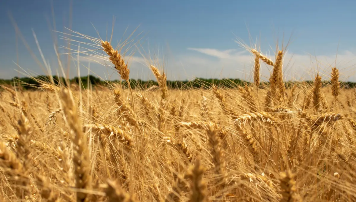
If you were to ask the average American to identify the states most dependent on the health and study of the world’s oceans, the landlocked expanses of the Great Plains would likely sit at the very bottom of the list. With no crashing waves, no sprawling maritime shipping ports, and no salty ocean breezes sweeping across its rolling golden wheat fields, Kansas seems about as far removed from marine ecosystems as a place can possibly get.
Yet, this very geographical detachment makes the Sunflower State a profound case study in a foundational ecological and meteorological truth: the ocean does not stop mattering at the shoreline.
Far inland, the health of the global ocean and the continuous atmospheric telemetry managed by the National Oceanic and Atmospheric Administration (NOAA) dictate daily life in ways most citizens never realize. From the spring tornado warnings that send families scrambling into storm cellars in Wichita, to the drought models that guide ranchers through bone-dry summer months, and the precise rainfall calculations civil engineers rely upon to design flood-resistant infrastructure, NOAA is an invisible, indispensable pillar of continental survival.
A newly released report by Ocean Conservancy, titled “NOAA in Kansas,” aims to bridge the perceptual gap between the coastline and the heartland. By detailing how ocean-derived data powers inland decision-making, the report sounds an urgent alarm: federal underfunding or dismantling of NOAA is not merely a coastal policy issue. It is a direct threat to the safety, economic stability, and resilience of communities thousands of miles away from the nearest beach.
Detailed Chronology: The Journey of an Inland Forecast
To truly understand how a drop of seawater off the coast of the Gulf of Mexico translates into a weather alert on a smartphone in Dodge City, one must trace the intricate, high-tech chronology of modern meteorological forecasting.
Phase 1: Global Data Collection (Months to Days Prior)
The process begins far beyond Kansas borders. In the tropical waters of the Pacific and Atlantic Oceans, thousands of autonomous marine sensors—ranging from deep-sea Argo floats to moored buoys—measure ocean temperature, salinity, and heat content. Simultaneously, a fleet of specialized environmental satellites operated by NOAA orbits hundreds of miles above the Earth, scanning cloud formations, tracking moisture plumes, and monitoring global atmospheric pressure systems.
Phase 2: Atmospheric Teleconnections (Days to Hours Prior)
Weather does not respect state lines, nor does it originate exclusively over land. Warm, moisture-laden air evaporating from the Gulf of Mexico is pulled northward by prevailing jet stream dynamics, which are themselves heavily influenced by Pacific Ocean temperature oscillations like El Niño and La Niña. This invisible conveyor belt of marine energy moves straight up the Mississippi River Valley and collides with cold, dry air sweeping down from the Rocky Mountains right over the Great Plains.
Phase 3: High-Performance Modeling and Local Synthesis (Hours Prior)
All raw observational data—collected from ocean depths, upper-atmosphere radiosondes, and space-based satellites—is funneled into NOAA’s massive supercomputing networks. These models simulate complex fluid dynamics to predict where volatile atmospheric collisions will occur. Local National Weather Service (NWS) forecasters in offices across Kansas analyze these models to pinpoint severe thunderstorm trajectories, hail potential, and tornado touch-down vectors.
Phase 4: Public Dissemination and Community Action (Minutes Prior)
When a supercell thunderstorm begins rotating near the Kansas-Oklahoma border, forecasters issue emergency alerts. The precious minutes of lead time gained through NOAA’s integrated observational network allow schools to shelter children, hospitals to secure emergency power, and farmers to move livestock to safety. Without the upstream ocean data, that critical warning window shrinks dramatically, transforming a manageable severe weather event into a catastrophic tragedy.
Supporting Context & Metrics: The Undeniable Data Link
The connection between oceanography and Great Plains survival is supported by decades of atmospheric science and economic data.
The Great Plains Moisture Engine
Meteorological studies confirm that a staggering percentage of summertime precipitation in the central United States originates as evaporation from the Gulf of Mexico. When ocean surface temperatures in the Gulf rise above historical averages, atmospheric humidity increases exponentially. While this fuels agricultural growth during favorable years, it also supercharges convective storm systems, turning routine spring showers into catastrophic flash floods and violent tornado outbreaks.
[Pacific/Atlantic Oceans]
       │ (Temperature Patterns & Evaporation)
       ▼
[Atmospheric Conveyor Belt]
       │ (Moisture Transport via Gulf of Mexico)
       ▼
[Great Plains Collision Zone]
       │ (Interaction with Rocky Mountain Dry Air)
       ▼
[Kansas Impact: Tornadoes, Droughts, & Floods]
Economic Stakes for Agriculture and Infrastructure
Kansas is an agricultural powerhouse, consistently ranking among the top U.S. states in the production of wheat, sorghum, and cattle. According to state economic data, agriculture contributes billions of dollars annually to the Kansas economy and supports tens of thousands of jobs.
- Drought Mitigation: Long-range precipitation outlooks—derived from oceanic climate indices—allow cattle ranchers to make critical herd-sizing decisions months in advance of a dry season, preventing catastrophic overgrazing and financial ruin.
- Infrastructure Resilience: Civil engineers utilize intensity-duration-frequency (IDF) curves generated from historical NOAA rainfall data to design municipal stormwater systems, culverts, and highway bridges. Outdated or underfunded climate data leads to improperly sized infrastructure, resulting in million-dollar washout damages during extreme weather events.
Official Statements & Expert Perspectives
The disconnect between public perception of NOAA and its actual footprint across the American interior has long frustrated federal scientists, emergency managers, and conservation advocates.
In the Ocean Conservancy report, Jeff Watters emphasizes that political debates surrounding federal environmental budgets frequently miss the broader systemic reality:
"Conversations about NOAA funding can be misleading—this agency isn’t just a coastal concern, or just a weather app with a federal logo. NOAA is much bigger than the forecast people see on their phones. The visible part of NOAA’s work is the downstream result. Upstream are the satellites, ocean observations, research programs, data systems, and modeling capabilities that make accurate forecasts and useful warnings possible in the first place."
Emergency management officials in the Midwest frequently echo these sentiments. During congressional briefings on disaster preparedness, local responders routinely stress that degrading federal Earth-observation infrastructure directly compromises local public safety.
Furthermore, scientific coalitions point out that cutting oceanographic research under the false assumption that it only benefits coastal fishermen or marine biologists is akin to removing the engine from an airplane because you are sitting in the passenger cabin. Every component of the global climate and weather observation network is mutually dependent.
Future Outlook: Protecting Our Shared Lifeline
As global climate patterns shift and extreme weather events become increasingly frequent and severe, the reliance of inland states on robust ocean and atmospheric science will only intensify.
The challenges facing Kansas—ranging from historic multi-year megadroughts in the west to destructive flash floods and violent tornado swarms in the east—cannot be effectively managed with localized data alone. Understanding tomorrow’s weather in the Sunflower State requires monitoring today’s oceans across the globe.
A Call to Action
Safeguarding NOAA and securing its long-term federal funding must transcend partisan divides. It is an investment in national security, public safety, and economic resilience. Whether living in a high-rise condominium in Miami or managing a multi-generational cattle ranch in Meade County, every American relies on the continuous, unbroken chain of environmental intelligence forged by ocean science.
As Ocean Conservancy’s report powerfully demonstrates, the ocean touches us all. To protect our inland communities, we must first protect the oceans and the scientific institutions that watch over them.
Take Action Today
- Read the Full Report: Explore the complete data and findings in Ocean Conservancy’s official publication, NOAA in Kansas.
- Make Your Voice Heard: Add your name to the advocacy campaign urging federal lawmakers to recognize that our ocean and atmosphere are not partisan issues, but essential foundations for the future of our planet. Visit Ocean Conservancy’s Action Center to get involved.