








Executive Overview
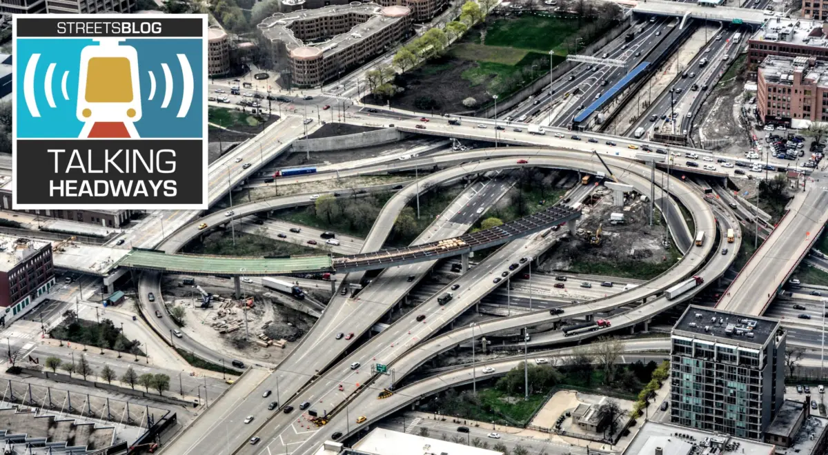
For decades, the physical layout of the American metropolis has been defined by the concrete ribbon of the urban highway. Bisecting vibrant neighborhoods, displacing historic communities, and carving deep trenches through downtown economic centers, the Interstate Highway System fundamentally reshaped the nation’s urban geography. While mid-century planners promised reduced congestion, streamlined commerce, and unmatched mobility, a growing body of data reveals a starkly different ledger: trillions in lost property values, eviscerated municipal tax bases, and a staggering misallocation of national wealth.
In a recent comprehensive data-driven publication titled An Atlas of Intercity Highway Impacts, Dallas-based urban designer, developer, and DART (Dallas Area Rapid Transit) board member Patrick Kennedy maps out the devastating economic fallout of these decisions. Moving away from traditional historical narratives, Kennedy’s work dives deep into empirical geographic data to quantify what American cities lost when federal bulldozers cleared space for inner-city freeways.
This deep dive explores the mechanics of Kennedy’s research, the historical counterfactuals of mid-century infrastructure policy, and the stark economic realities of what American cities could have been had alternative transportation futures been realized. By examining the true cost of property acquisition, construction overruns, and the long-term devaluation of urban cores, urban planners and policymakers are forced to confront a foundational question: What is the long-term value of a highway when compared to the vibrant, walkable neighborhoods it replaced?
Detailed Chronology: From Eisenhower’s Vision to the Modern Data Atlas
To understand how American cities arrived at their current configuration, one must trace the historical trajectory of the Federal-Aid Highway Act and the competing visions that shaped its implementation.
The Misunderstood Origins of the Interstate System
The popular narrative attributes the Interstate Highway System entirely to national defense and post-war economic expansion under President Dwight D. Eisenhower. However, historical archives reveal internal friction over how these massive financial resources should be deployed. Eisenhower appointed General David Bragdon to keep the burgeoning interstate initiative on time and under budget. Bragdon, an administrative figure largely forgotten by mainstream history, functioned as an institutional Cassandra.
In his 1960 interim report, Bragdon sounded the alarm: the interstate highway system was explicitly intended to facilitate interstate commerce, not to serve as a high-capacity collector for local urban traffic. Bragdon argued that attempting to accommodate projected 1980 local traffic volumes through downtown cores via freeways would require preposterous engineering feats, such as highways spanning 40 lanes or more. He advocated instead for the deployment of federal funds toward high-capacity public transit.
The Bureaucratic Defeat and Cost Escalations
Bragdon’s warnings went unheeded as he clashed repeatedly with the Bureau of Public Roads and the acolytes of master builder Robert Moses. While Bragdon’s mandate was to maintain fiscal discipline, the system ultimately ballooned to five to six times its original projections. Adjusted for modern inflation, the total cost of the Interstate Highway System soared to roughly $750 billion.
Crucially, the inner-city segments of this system—representing a mere one-tenth of the total lane mileage—accounted for a disproportionate share of the price tag. Property acquisition and urban construction ran ten times more expensive per mile than rural extensions. Consequently, roughly half of the entire interstate budget—approximately $375 billion—was funneled directly into acquiring urban right-of-ways and building freeways through the hearts of American downtowns.
The Pivot to Empirical Data
Recognizing that the standard historical narrative of the highway era had been thoroughly told, Patrick Kennedy shifted his focus from narrative history to hard spatial data. Initially drawing inspiration from the federal government’s historical Yellow Book—which cataloged early urban routing plans for roughly 90 cities—Kennedy realized the dataset was geographically incomplete, lacking representations for major hubs like San Diego and entire states like North Carolina.
Expanding his scope to 142 cities, Kennedy began assembling a massive relational database tracking population density shifts since 1960. He identified a critical demographic inflection point: the turn of the millennium, marked by the entry of the millennial generation into the workforce and their subsequent demand for walkable, urban environments. This data collection set the stage for an investigative breakthrough during the COVID-19 pandemic, when a landmark study by the Philadelphia Federal Reserve quantified the localized economic damage inflicted by urban freeways.
Supporting Context & Metrics: The Anatomy of Urban Devaluation
The empirical backbone of An Atlas of Intercity Highway Impacts relies on spatial geography, property assessment rolls, and econometric studies to calculate the exact financial drain caused by urban highways.
The Federal Reserve Discovery and the Three-Mile Radius
The Philadelphia Federal Reserve report provided Kennedy with the theoretical framework needed to measure urban property devaluation. The study demonstrated that within a three-mile radius of a downtown core, urban highways frequently function as severe "disamenities," actively devaluing adjacent real estate up to a half-mile away.
Prompted by this finding, Kennedy constructed precise geographic buffers—focusing on one-mile and three-mile radii—around the downtown cores of his 142 study cities. By pulling recent real-estate development data from municipal tax rolls, he measured the total acreage consumed by highway right-of-ways within these vital urban zones.
Calculating the Lost Tax Base
To determine the theoretical tax base stripped from American municipalities, Kennedy applied a standardized land-use efficiency model to every acre of highway right-of-way:
- Infrastructure Allocation: Accounting for necessary tax-exempt surface roads, schools, and civic infrastructure, Kennedy modeled a conservative 50 to 55 percent efficiency rate for private development.
- Valuation Multiplier: By multiplying the remaining developable acreage by prevailing urban real estate values within those specific one-mile and three-mile geographies, he arrived at a staggering figure for every city evaluated.
This methodology mirrors historical warnings, such as those documented in the early 1990s California transportation study The Elephant in the Bedroom, which noted that the construction of the 210 freeway through Pasadena instantly wiped 10 percent of the city’s property tax rolls off the map. Kennedy’s atlas scales this localized devastation across the entire United States, offering a standardized metric for the economic development potential stolen from cities by mid-century highway design.
The Counterfactual: "Earth 2" and the Paris Metro Comparison
To grasp the magnitude of the $375 billion spent exclusively on urban highway construction and land acquisition, Kennedy constructs a compelling historical counterfactual.
During the 1960s, cities like Montreal were actively constructing the foundational legs of their heavy rail subway systems at known, fixed costs. Had the United States chosen to allocate its urban highway expenditures toward heavy rail transit, the financial equivalent would have funded roughly 36 complete Paris Metro-style networks spread across mid-sized and major American cities.
Under this alternate timeline—an "Earth 2" scenario—metropolitan areas like Cincinnati, Kansas City, and Dallas would feature world-class underground transit networks capable of moving millions of passengers efficiently, preserving the structural integrity of their downtown tax bases rather than bulldozing them for asphalt.
Official Statements and Expert Perspectives
The discourse surrounding urban infrastructure policy increasingly bridges the gap between historical retrospective and modern economic pragmatism. Urban planning professionals and transit advocates are actively reassessing the dogma of car-centric development.
"Nobody cares about history. Focus on the actual data. What was the impact? And focus on the future."
— Scott Polikov, Urban Planner and Strategist (as recounted by Patrick Kennedy)
While industry advisors like Polikov pushed researchers to bypass well-trodden historical narratives in favor of raw economic metrics, modern urbanists emphasize that understanding the past is essential to correcting contemporary policy errors.
"We could have built the equivalent of 36 Paris Metros for that $375 billion at the cost that Montreal was building its subway. What if we had gotten it right? We could have a Paris Metro system in Cincinnati and in Kansas City serving local traffic and not devaluing the downtowns."
— Patrick Kennedy, Urban Designer and DART Board Member
Kennedy’s analysis underscores a recurring theme in modern transportation debates: infrastructure is not a neutral engineering tool, but a value-laden mechanism that either enhances or destroys civic wealth. The institutional insistence on pushing high-speed automotive sewers through dense neighborhoods represents one of the most costly policy miscalculations in American history.
Future Outlook: Remediation, Removal, and Rebuilding Urban Economies
As American cities grapple with aging highway infrastructure, soaring housing costs, and climate imperatives, the findings compiled in An Atlas of Intercity Highway Impacts offer more than just an academic post-mortem—they provide a strategic roadmap for the future.
The Rise of the Highway Removal Movement
For decades, the idea of removing an urban interstate was considered politically impossible. However, successful projects across the country—such as the removal of the Embarcadero Freeway in San Francisco, the Central Freeway, and the Inner Loop in Rochester, New York—have demonstrated that reclaiming highway right-of-ways generates immediate economic dividends.
By utilizing data models similar to Kennedy’s, city planners can now demonstrate to skeptical taxpayers and municipal leaders that replacing trenches of concrete with mixed-use development, public parks, and grid-connected street networks can rapidly regenerate depleted property tax bases.
Policy Implications for the 21st Century
As cities face modern economic shocks—ranging from energy volatility reminiscent of the 1970s oil crises to post-pandemic shifts in downtown commercial real estate—the pressure to find alternative off-ramps from car dependency has never been higher. Federal programs like the "Reconnecting Communities Pilot Program" signal a nascent policy shift, though current funding allocations remain a fraction of the trillions historically poured into highway expansion.
Ultimately, Patrick Kennedy’s Atlas serves as both an indictment of past administrative failures and a quantitative call to action. By visualizing the massive wealth extracted from American cities by mid-century highway planning, the atlas equips urban designers, economists, and everyday citizens with the empirical ammunition required to heal urban cores, restore municipal tax health, and reimagine the American metropolis for a post-highway era.